Arizona
Travels & Tours
Pictures, Photos, Images, & Reviews.
Alamo Lake & Alamo Dam.
George & Eve DeLange
Google Map To Alamo Lake & Alamo Dam
View Larger Map

Click On Any Of The Following Links By Amazon.Com
For Books, Videos, & Lures For Bass Fishing. No Obligation!
 |
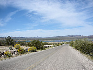
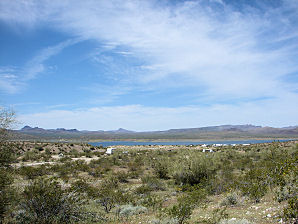
| Alamo Lake, Arizona. Photo Taken: March 21, 2009. First View Of The Lake From Alamo Lake Road |
|---|
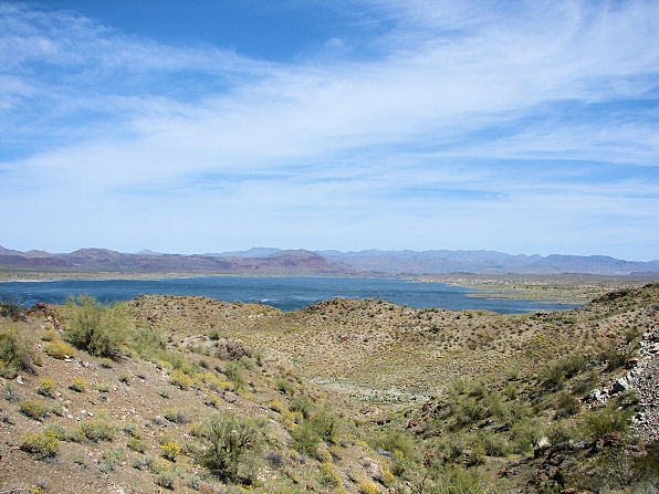 |
| Alamo Lake, Arizona. Photo Taken: March 21, 2009. At The Alamo Dam Overview Point. |
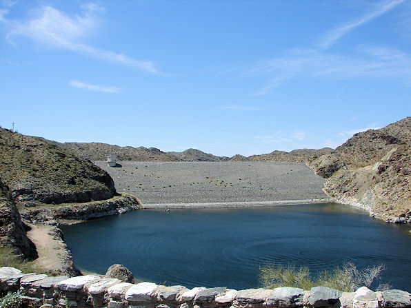 |
| Alamo Dam, Arizona. Photo Taken: March 21, 2009. At The Alamo Dam Overview Point. |
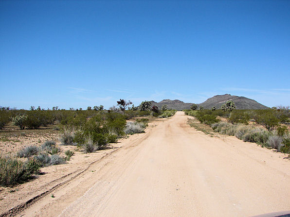 |
| The Primitive Road To Alamo Dam And Lake, Arizona. Drives Into A Joshua Tree Forest. The Other Road, Called; "Alamo Lake Road" Is An Easier Way To The Lake. |
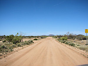 | 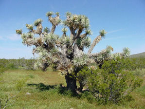 |
| The Primitive Road To Alamo Dam And Lake. Turn At U.S. Route 93 Between Mile 177 and 178. | The Primitive Road To Alamo Dam And Lake. Drives Through One Of Arizona's Three Joshua Tree Forests. |
|---|---|
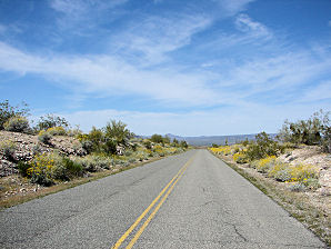 | 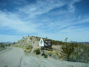 |
| Turn Right From Primitive Road Onto Alamo Lake Road | Entering Alamo Lake State Park, Arizona. |
 |  |
| Cholla Road Camp Area | Cholla Road Camp Area |
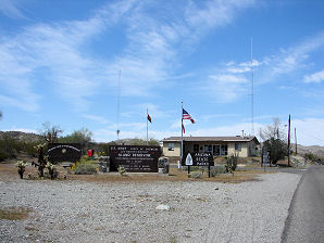 | 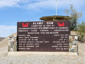 |
| Ranger Station | Bill Williams Alamo Dam Overlook Sign |
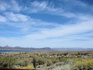 | 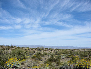 |
| Camping Area | East Of Alamo Lake |
Alamo Lake, Arizona.
The earthen dam is 970 feet long, 283 feet high, creating a permanent lake area of about 500 acres. A Google Earth Map search marks the center of the Alamo Lake Dam at 34o 13' 54.74" N 113o 36' 05.55" W. The Big Sandy River is located in northwestern Arizona in Mohave County. Its length is about 80 miles. It begins where the Cottonwood Wash and Trout Creek converge in the Hualapai Indian Reservation near Hualapai Peak. The river then flows past Wikieup south of Kingman. The Santa Maria River is an intermittent stream formed by the confluence of the Sycamore and Kirkland Creeks. They are located about 10 miles east of the mining community of Bagdad, Arizona. From this confluence, the Santa Maria River flows in a southwestern direction through the rugged Arrastra Mountain Wilderness area. The river also is part of the boundary line between Mohave and La Paz counties. The Bill Williams River begins at the lower end of the Alamo Dam and flows from Alamo Reservoir through the wild Buckskin Mountains in the west central part of the state and joins the Colorado River at Lake Havasu, just above Parker Dam. Because of the many species of birds found there, the lower area is designated as a National Wildlife Refuge where the Bill Williams River meanders across the tree-lined valley below the dam. You may ask, "who was Bill Williams?" William Sherley Williams was born in June 1787, as the fourth of nine children to parents of Welsh ancestry in a remote area of North Carolina. In about 1793, the Williams family joined the flight of pioneeers going to the west, settling in Missouri, before it was a state. It was there that he perfected the woodland skills that would later on rank him as one of the finest of the Mountain Men. When Bill was only sixteen years old on a hunting trip he arrived at a village of the Osage Indians. Captivated by their ways, he chose to live as an Osage. Will learned their language, and married into their tribe, and became respected by them. He had two daughters, Sarah and Mary, and he married two more wives. He lived with the Osage for almost 25 years. Will continued to earn a reputation among the people moving west to know more about the territory and the indians than any other man. Thus, he was known to be one of the most skillful guides in the West. From this beginning he became a hero of American Adventure. In November of 1848, Captain John C. Fremont, of the United States Topographical Engineers, was searching for a railroad route to California, and finally convinced Bill to guide his fourth expedition. This expedition, became a disaster, resulting in the death of at least ten men and 120 mules. Twenty-three men were crippled (never to recover completely), and nearly all of their equipment was lost. Then in March of 1849, Bill and a small group left Taos, heading back to recover any salvageable equipment. Then in mid March, stories got back to Taos that on March 21, 1849, they were all shot and killed. No evidence has ever been found to indicate that their bodies were ever recovered. Therefor in his honor, the Bill Williams Mountain Range was named after him. As well as the town beneath the Bill Williams Mountain Range, Williams, Arizona. Therefor it was only fitting that the river below Alamo Dam should be called the "Bill Williams River" with the completion of Alamo Dam in 1968 by the Army Corps of Engineers. Alamo Lake, is one of Arizona's Largemouth Bass fishing hot spots. It yields plenty of bass, black crappie and channel catfish. It also is one of Arizona's State Parks. Its waters attract a variety of Arizona wildlife, including wild burros, fox, mule deer, and many species of birds including the bald and golden eagles. In the spring it produces an abundance of colorful wild flowers, and cactus blooms. Yet, with all of these excellent features Alamo Lake is one of Arizona's best kept secrets! When you get there you will notice that there are about 80 campgrounds within the park and surrounding the lake. Several are fully developed with full hookups, dump stations, restrooms, showers, electricity, and fish cleaning stations. There are two multi-lane boat launching ramps and the park sells fishing licenses, bait, ice, and firewood. The park and lake are open year around. There are two ways to get to Alamo Lake: From the Phoenix Area, take I 60 (Grand Avenue) to Wickenburg which is about 55 miles northwest of Phoenix. Then from Wickenburg continue west on I 60 to Wenden. From Wenden, take the Alamo Lake Road turnoff north about 37 miles to Alamo Lake. This is the easy way!! It is called the Alamo Lake Road. On the way, you will begin climbing gradually into the Harcuvar Mountain range, and you will then enter a region of unspoiled desert habitat. Look toward the hills and you will see a few mines and side tracks, but once you pass them, you will enter into the wide Butler Valley. Here the land is completely undeveloped as nature intended it to be with many flowers and cacti including numerous saguaro. You will see more flowering plants in the spring most noticeably purple owls clover, yellow brittlebrush and orange California poppies. However, there is usually a showing of yellow bloom during the fall. Or, you can take the primitive unmaintained dirt and gravel road. A Google Earth Map search marks the turnoff at 34o 09' 45.03" N 113o 00' 28.37" W. It begins on the south side of U.S. Route 93, between mile markers 177 and 178. It is labeled on maps as Tres Alamos Road. But the 29 mile road is UNMARKED. After you turn off of U.S. Route 93, it then turns westward from U.S. Route 93 into the open desert, where you will see many Joshua trees, then mesquites, paloverdes and ocotillos. But beware, the road is a washboard, dirt, gravel, rough, road until about mile 19, where it smoothes out into a well-graded surface. About 6 miles from U.S. Route 93 you will encounter the first Y intersection, which is unsigned, turn to the left at the intersection. After another 23 miles you will see signs to the Alamo Dam on your left. Then after about 3 miles you will enter the paved Alamo Dam Road. Turn right and the lake is a short distance away. Most high profile four wheel drive vehicles can make this trip. Just be careful! This primitive road also takes you through one of Arizona's three native Joshua Tree forest's. If you go to the to the dam at the southwest corner of the reservoir, called the Dam Overlook Area, The very end of the road is private but open to foot travel, and from here begins the hike down the Bill Williams River Canyon. Remember, the desert can be harsh and dangerous, but it is also very fragile. Help to protect it, and yourself, by camping in the designated camp areas and keeping all vehicles on the maintained roadways.
|
If you are planning to visit Alamo Lake & Alamo Dam you may need to purchase some outdoor gear, boating equipment, or fishing gear. We also have links to Priceline.com if you need to book nearby hotels. We have some links to Altrec.com on this page since they are a good online source for outdoor gear. We of course, appreciate your use of the advertising on our pages, since it helps us to keep our pages active.
|

We Are Proud Of Our SafeSurf Rating!

Click On Any Of The Following Links By Amazon.Com
For Camping Gear. No Obligation!
Click On Any Of The Following Links By Amazon.Com
For Books, Videos, & Lures For Bass Fishing. No Obligation!
Back To "Valley Of The Sun" Lakes
or "Phoenix Area" Lakes Page.
Back To Arizona Tours Page
Back To DeLange Home Page
Images And Text Copyright George & Eve DeLange
| Back To "Valley Of The Sun" Lakes or "Phoenix Area" Lakes Page.
|
| Back To Arizona Tours Page
|
| Back To DeLange Home Page
Images And Text Copyright George & Eve DeLange
|
