Canyonlands National Park, Utah.
Hikes, Travels, & Tours
Pictures, Photos, Images, & Reviews.
October 12, 2015

October 12, 2015

Google Map To Canyonlands National Park, Utah.
Of Canyonlands National Park, Utah.
At Amazon.Com , No obligation !

| Green River Oxbow. Canyonlands National Park, Utah. All Photos Courtesy Of National Park Service, by Neal Herbert. |
|---|

Canyonlands National Park, Utah:
We wish to thank Wikipedia, the free encyclopedia for some of the information on this page. We share information with Wikipedia.
Canyonlands National Park is a U.S. National Park located in southeastern Utah near the town of Moab. It preserves a colorful landscape eroded into countless canyons, mesas, and buttes by the Colorado River, the Green River, and their respective tributaries. Legislation creating the park was signed into law by President Lyndon Johnson on September 12, 1964. The park is divided into four districts: the Island in the Sky, the Needles, the Maze, and the two rivers themselves. The park is mainly made up of two large river canyons; which were carved into the Colorado Plateau by both the Colorado River, and the Green River. The Island in the Sky district, with its proximity to the Moab, Utah area, attracts the majority (59 percent) of park users. The Needles district is the second most visited, drawing 35 percent of visitors. The rivers within the park and the remote Maze district each only account for 3 percent of park visitation. Several geologic actions created the current day landscape of Canyonlands National Park. Our information is from Wikipedia, the free encyclopedia; they got their information from Geology of National Parks: Fifth Edition, Ann G. Harris, Esther Tuttle, Sherwood D., Tuttle, and Furuya, M., Mueller, K., and Wahr, J., 2007, Active salt tectonics in the Needles District, Canyonlands (Utah) as detected by interferometric synthetic aperture radar and point target analysis: 1992-2002. Journal of Geophysical Research v. 112, B06418, doi:10.1029/2006JB004302. Note:There are two theories about how this could have happened, the Salt Dome Theory, & the Impact Crater Theory. Scientists seem to be preferring the Impact Crater Theory. First the Salt Dome Theory. During the Pennsylvanian Geologic Time Period; roughly 323.2 million years ago to 298.9 million years ago Ma (million years ago), a subsiding basin and nearby uplifting mountain range (the Uncompahgre) existed in the area. Seawater which was trapped in the subsiding basin created many thick evaporite deposits by the Mid Pennsylvanian Time Period. These evaporite deposits, along with eroded material from the nearby mountain range, become what is called the Paradox Formation, itself a part of what is called the Hermosa Group. The Paradox salt beds started to flow later in the Pennsylvanian Period, and probably continued to move until the end of the Jurassic Geologic Time Period (that extends from 201.3� 0.6 Ma (million years ago) to 145� 4 Ma). Some scientists believe Upheaval Dome was created from Paradox salt bed movement, creating a salt dome, but more modern studies show that the meteorite theory is more likely to be correct. Then near the end of the Pennsylvanian Period a warm shallow sea again flooded the region, fossil-rich limestones, sandstones, and shales of the gray-colored Honaker Trail Formation resulted. Then a period of erosion ensued, creating a break in the geologic record called an unconformity. Then early in the Permian Geologic Period (which extends from 298.9 � 0.15 to 252.17 � 0.06 million years ago), an advancing sea laid down the Halgaito Shale. Causing the coastal lowlands to later return to the area, creating the Elephant Canyon Formation. Then, large alluvial fans filled the basin where it met the Uncompahgre Mountains, creating the Cutler red beds of iron-rich arkose sandstone. Next, underwater sand bars and sand dunes on the coast inter-fingered with the red beds and later became the white-colored cliff-forming Cedar Mesa Sandstone. Then, brightly colored oxidized muds were then deposited, forming the Organ Rock Shale. Coastal sand dunes and marine sand bars once again became dominant, creating the White Rim Sandstone. A second unconformity was created after the Permian sea retreated. Flood plains on an expansive lowland covered the eroded surface and mud built up in tidal flats, creating the Moenkopi Formation. Erosion returned, forming a third unconformity. The Chinle Formation was then laid down on top of this eroded surface. Increasingly dry climates dominated the Triassic. Therefore, sand in the form of sand dunes invaded and became the Wingate Sandstone. For a time climatic conditions became wetter and streams cut channels through the sand dunes, forming the Kayenta Formation. Arid conditions returned to the region with a vengeance; a large desert spread over much of western North America and later became the Navajo Sandstone. A fourth unconformity was created by a period of erosion. Mud flats returned, forming the Carmel Formation and the Entrada Sandstone was laid down next. A long period of erosion stripped away most of the San Rafael Group in the area along with any formations that may have been laid down in the Cretaceous period. The Laramide orogeny started to uplift the Rocky Mountains 70 million years ago and with it the Canyonlands region. Erosion intensified and when the Colorado River Canyon reached the salt beds of the Paradox Formation the overlying strata extended toward the river canyon, forming features such as The Grabens. Increased precipitation during the ice ages of the Pleistocene quickened the rate of canyon excavation along with other erosion. Similar types of erosion are ongoing, but occur at a slower rate. Second, the Impact Crater Theory. When meteorites collide with the earth, they leave impact craters like Meteor Crater in Arizona. Some geologists estimate that roughly 60 million years ago, a meteorite with a diameter of approximately one-third of a mile hit at what is now the Upheaval Dome. The impact created a large explosion, sending dust and debris high into the atmosphere. The impact initially created an unstable crater that partially collapsed. As the area around Upheaval Dome reached an equilibrium, the rocks underground heaved upward to fill the void left by the impact. Erosion since the impact has washed away any meteorite debris, and now provides a glimpse into the interior of the impact crater, exposing rock layers once buried thousands of feet underground.
The "Island in the Sky" offers the best opportunities for sightseeing by car. Several overlooks are along the scenic drive. They are perched about 1,000 feet above the surrounding terrain, providing spectacular views of the canyons below as well as the other districts.
|
We recommend visiting Canyonlands National Park, Utah. when also traveling by car to a major city in the Southern Utah Area.
Canyonlands National Park is about 30 miles (48 km) SW of Moab, Utah. Moab has several motels.
There are many hotels and motels in Utah, and if you need a place to stay; Priceline.com can arrange that for you. We have personally, booked flights, hotels, and vacations; through Priceline.com and we can highly recommend them. Their website is also easy to use! We have some links to Priceline.com on this page since they can arrange all of your air flights, hotels and car. We of course, appreciate your use of the advertising on our pages, since it helps us to keep our pages active. Whenever you make a purchase from a link on our page we get credit for that transaction. Again, Thanks!
|
| Cataract Canyon. Canyonlands National Park, Utah. | KKearse Island. Canyonlands National Park, Utah. |
|---|---|
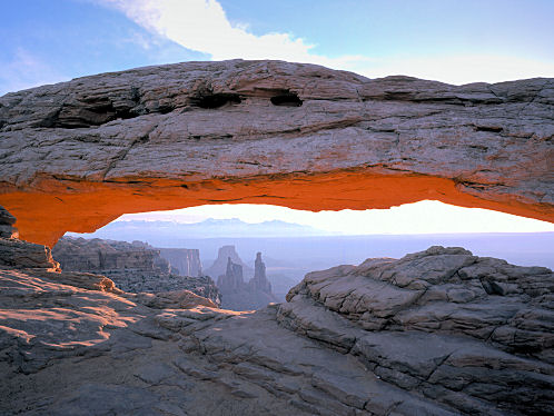 | |
| Candlestick Tower. Canyonlands National Park, Utah. | Mesa Arch, Island in the Sky. Canyonlands National Park, Utah. |
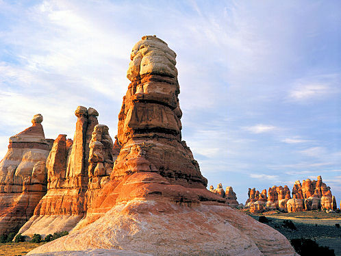 | 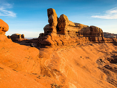 |
| Chesler Park Needles District. Canyonlands National Park, Utah. | Needles Sunrise. Canyonlands National Park, Utah. |
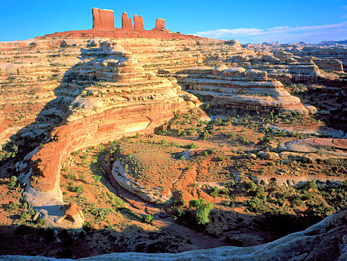 | |
| Chocolate Drops Maze District. Canyonlands National Park, Utah. | Pothole Point, Needles District. Canyonlands National Park, Utah. |
| Colorado River Meander. Canyonlands National Park, Utah. | Wingate Sandstone. Canyonlands National Park, Utah. |
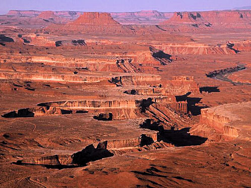 | |
| Green River, Labyrinth Canyon. Canyonlands National Park, Utah. | Green River Overlook. Canyonlands National Park, Utah. |

We Are Proud Of Our SafeSurf Rating!

At Amazon.Com , No obligation !
By Amazon.Com - No obligation!
Here Are Some Links To The Very Best & Most Popular Items Sold On Amazon.Com
To Learn More! Click The Links Below. No Obligation, Of Course!


