We Are Proud Of Our SafeSurf Rating!

Castle Hot Springs
Castle Creek, Arizona
Travels & Tours
Pictures, Photos, Images, & Reviews.
George and Eve DeLange

Google Map To Castle Hot Springs, Arizona.
View Larger Map

When we go to Castle Hot Springs by way of Castle Creek we are taking a short 1/2 day tour that can easilly be extended to a longer tour depending upon your own choosing as to how long you wish to stop and walk around the areas. It also makes for a nice picnic trip in the spring and fall
Just about any vehicle can make the trip. Be sure to carry extra food and water just in case. There are other people on the road from time to time, so if you have trouble, I suggest just waiting by your vehicle until someone comes along. Part of the trip is out of the service area for cell phones.
You will see small cattle ranches, unusual rock formations and mountains, lots of wildlife - depending upon the time of day or night, part of the old resort known as Castle Hot Springs, and some natural artesian springs or wells that feed water into Castle Creek, which is surrounded by the rocky cliffs and crags of the Bradshaw Mountains.
Some of the water that flows from these artesian wells is seasonable depending upon rainfall in the area that feeds the springs.
You will also notice that there appears to be a lot of minerals in the water probably from the multi-colored rock formations surrounding Castle Creek and some of the other creeks that supply water to the area.
You can get to this area by taking the Lake Pleasant Road off of Highway 74. This road is closest to Phoenix. Don't go into the Lake Area itself, simply keep going North until you get to the end of the pavement, keep going North and you will see signs that say Castle Hot Springs Road. Then go West toward Castle Hot Springs.
You can also get to this area by taking the Castle Hot Springs Road off of Highway 74. This road is closest to Wickenburg.
Either road you take will connect to the other, so if you want to take either one, it really does not matter. The road to Lake Pleasant Road off of Highway 74 is closer to Castle Hot Springs.
The tour on this page will start from the Castle Hot Springs Exit at Highway 74 going from the West to the East toward Lake Pleasant. We will cross a clearly marked area leaving Maricopa County and entering Yavapii County. I will start photos on the page from about two miles past that point.
Castle Hot Springs enjoys a rich and lengthy history reaching back to the pre-settlement Apaches who gave healing powers to the hot, clear water that poured out from the canyon rock.
Castle Hot Springs also served as the first territorial capital of Arizona as well as a retreat for many wealthy businessmen, politicians, and even presidents of the United States.
During its time as the territorial winter capital of the Arizona Territory, Castle Hot Springs was both the residence of the Territorial Governor and a local jail. Castle Hot Springs attracted many of America's wealthiest and most well-known families, including the Rockefellers, Carnegies, Cabots, and the Wrigleys. United States Presidents; including Theodore Roosevelt, Warren Harding, Woodrow Wilson, and Herbert Hoover also stayed there. John F. Kennedy actually spent three months at the resort in 1945, when he was recovering from wounds received during World War II as a Naval officer.
The actor, Clark Gable and actress, Carole Lombard also spent their honeymoon at the resort. The author, Zane Grey also stayed there.
President John F. Kennedy spent time his there during World War II, when Castle Hot Springs was leased to the military to house recuperating pilots. This special service earned Castle Hot Springs a special dispensation, allowing the American flag to be flown 24 hours a day on nearby Salvation Peak. Today the flag is maintained by the Boy Scouts of America.
The hot springs are actually fed by an enormous cistern created by the displacement of tertiary volcanic rock, which occurred tens of thousands of years ago. Each day, this underground reservoir produces about 200,000 gallons of water at about 122 degrees Fahrenheit�the hottest temperature known for any spring, in the world, which is not volcanically active.
The waterfall emerges from a crack in the rock wall, which supplies Castle Creek and its three deep pools with water that is very pure, odorless, and crystal clear. Its quality indicates that the source comes from a depth of about 7,000 to 10,000 feet.
Its lush native and introduced vegetation can be found growing here. You will find saguaro, hedgehog, and ocotillo blooming alongside manicured palms and fruit trees, including oranges, grapefruits, and figs. The U.S. Fish and Wildlife Service has even made attempts to reintroduce the federally endangered Gila topminnow to Castle Creek.
The hot springs and associated creek also provide critical habitat to populations of toads, and frogs. Flying insects are attracted to these waters providing food for the nearby colonies of bats, including the Myotis lucifugus occultus bat, which is the only subspecies of bat found in Arizona.
We hope that you will enjoy the area as much as we do.
If you are planning to visit Castle Hot Springs by way of Castle Creek, you may need to purchase some outdoor gear, or some fishing gear to use at nearby Lake Pleasant.
We also have some links to Priceline.com on this page since they can arrange all of your air flights, hotels and a car; if you are flying into the Phoenix area.
You may need some outdoor clothing and equipment, if you plan to visit the Castle Creek area.
We have some links to Altrec on this page since they are a good online source for outdoor gear.
We of course, appreciate your use of the advertising on our pages, since it helps us to keep our pages active.
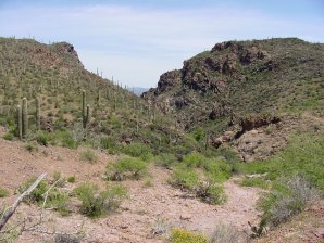
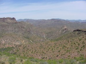
Looking East Toward
Castle Hot Springs Looking North East 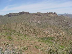
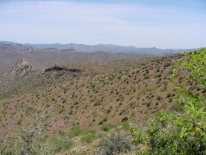
Looking North Looking North East
Bradshaw Mountains In Distance 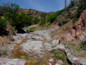
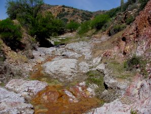
Castle Creek, Mineral Water Castle Creek, Lots Of Color! 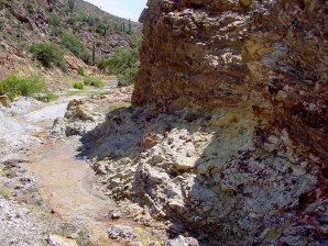
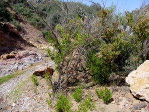
Lots Of Mineralization Many Lovely Riparian Plants 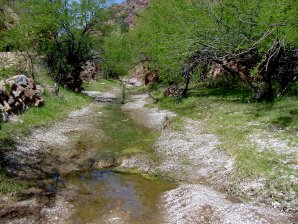
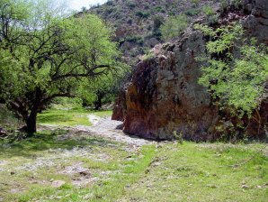
Nice Grassy Rest Areas Great For Picnics 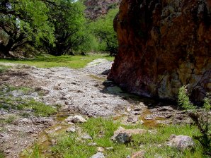
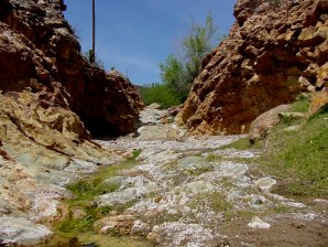
Riparian Areas Also Water Flows Here Year Round 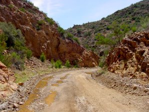
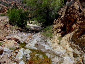
Water Even Runs
Down The Road Then Crosses Back
Into The Creek 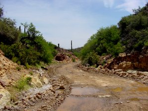

Water Crossing Over Castle Creek Flows
Between This Area
Toward Castle Hot Springs 

Looking North Looking North 
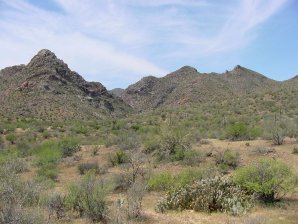
Looking North Looking South 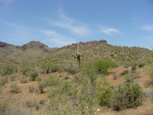
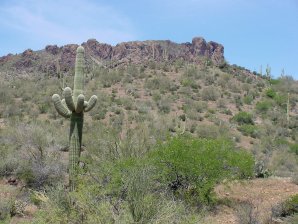
A Hole In The Rock
A Possible Ancient Anazazi
Sun Watch Station The Anazazi Used Them
To Keep Track Of Seasons 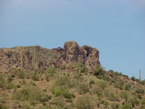
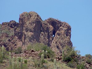
It Certainly Is In
The Correct Allignment Position
To The Sun
To Be One! Hole In The Rock
Close Up 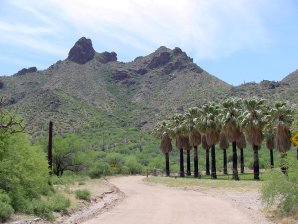
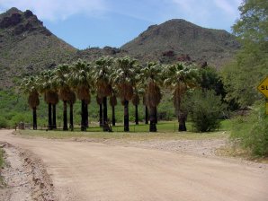
Looking Back Toward The SW
Toward The Old Ranch Washingtonia Palms
Were Very Popular
In The Late 1800's 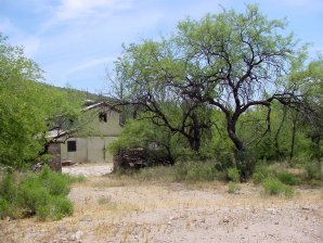
Looking East To The Old Barn Looking Back Toward The West
Toward The Old Ranch 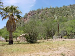
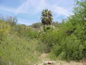
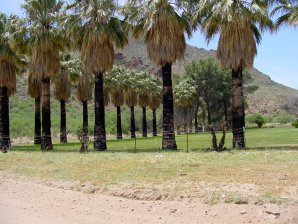
View NW Toward Stone Building NE View, Washingtonia Palms
Thought To Be Only Native Palm
Growing Wild In Arizona 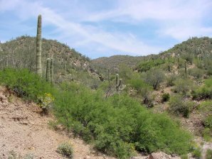
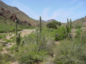
SE View,
Native Washingtonia Palms
Center Of Picture Looking Back Toward Ranch 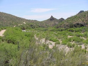
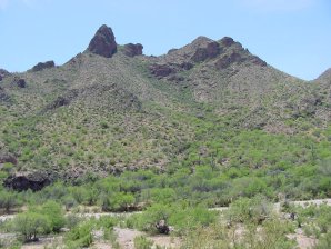
South Castle Creek View
Washingtonia Palms Near Road West View Of Castle Creek 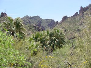
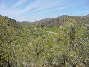
Palms In Above Picture From Road Looking Back Toward Ranch 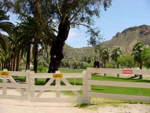
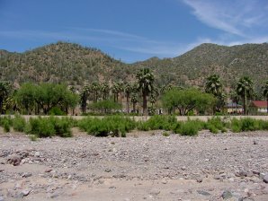
About A Mile Further Here Is
Castle Hot Springs Resort
Looking East It Is Private Property
Being Restored
Lots Of Keep Out Signs
No Stopping Signs
But, It Is A Public Road! 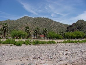
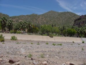
Looking North Looking North 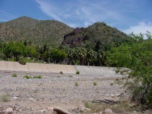
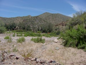
Looking North Looking North 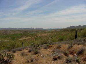
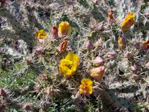
About 5 Miles From
Castle Hot Springs
The North End Of Lake Pleasant
Commonly Called "The Mud Flats"
Good For Cat Fishing! Cactus Flowers Seen
By The Road

We Are Proud Of Our SafeSurf Rating!

Click On Any Of The Following Links By Amazon.Com
For Books, & Videos About Touring Arizona. No Obligation!
Click On Any Of The Following Links By Amazon.Com
For Camping Gear. No Obligation!
Back To Arizona Tours Page
Back To DeLange Home Page
Travels & Tours
Pictures, Photos, Images, & Reviews.

Google Map To Castle Hot Springs, Arizona. |
|---|
When we go to Castle Hot Springs by way of Castle Creek we are taking a short 1/2 day tour that can easilly be extended to a longer tour depending upon your own choosing as to how long you wish to stop and walk around the areas. It also makes for a nice picnic trip in the spring and fall Just about any vehicle can make the trip. Be sure to carry extra food and water just in case. There are other people on the road from time to time, so if you have trouble, I suggest just waiting by your vehicle until someone comes along. Part of the trip is out of the service area for cell phones. You will see small cattle ranches, unusual rock formations and mountains, lots of wildlife - depending upon the time of day or night, part of the old resort known as Castle Hot Springs, and some natural artesian springs or wells that feed water into Castle Creek, which is surrounded by the rocky cliffs and crags of the Bradshaw Mountains. Some of the water that flows from these artesian wells is seasonable depending upon rainfall in the area that feeds the springs. You will also notice that there appears to be a lot of minerals in the water probably from the multi-colored rock formations surrounding Castle Creek and some of the other creeks that supply water to the area. You can get to this area by taking the Lake Pleasant Road off of Highway 74. This road is closest to Phoenix. Don't go into the Lake Area itself, simply keep going North until you get to the end of the pavement, keep going North and you will see signs that say Castle Hot Springs Road. Then go West toward Castle Hot Springs. You can also get to this area by taking the Castle Hot Springs Road off of Highway 74. This road is closest to Wickenburg. Either road you take will connect to the other, so if you want to take either one, it really does not matter. The road to Lake Pleasant Road off of Highway 74 is closer to Castle Hot Springs. The tour on this page will start from the Castle Hot Springs Exit at Highway 74 going from the West to the East toward Lake Pleasant. We will cross a clearly marked area leaving Maricopa County and entering Yavapii County. I will start photos on the page from about two miles past that point. Castle Hot Springs enjoys a rich and lengthy history reaching back to the pre-settlement Apaches who gave healing powers to the hot, clear water that poured out from the canyon rock. Castle Hot Springs also served as the first territorial capital of Arizona as well as a retreat for many wealthy businessmen, politicians, and even presidents of the United States. During its time as the territorial winter capital of the Arizona Territory, Castle Hot Springs was both the residence of the Territorial Governor and a local jail. Castle Hot Springs attracted many of America's wealthiest and most well-known families, including the Rockefellers, Carnegies, Cabots, and the Wrigleys. United States Presidents; including Theodore Roosevelt, Warren Harding, Woodrow Wilson, and Herbert Hoover also stayed there. John F. Kennedy actually spent three months at the resort in 1945, when he was recovering from wounds received during World War II as a Naval officer. The actor, Clark Gable and actress, Carole Lombard also spent their honeymoon at the resort. The author, Zane Grey also stayed there. President John F. Kennedy spent time his there during World War II, when Castle Hot Springs was leased to the military to house recuperating pilots. This special service earned Castle Hot Springs a special dispensation, allowing the American flag to be flown 24 hours a day on nearby Salvation Peak. Today the flag is maintained by the Boy Scouts of America. The hot springs are actually fed by an enormous cistern created by the displacement of tertiary volcanic rock, which occurred tens of thousands of years ago. Each day, this underground reservoir produces about 200,000 gallons of water at about 122 degrees Fahrenheit�the hottest temperature known for any spring, in the world, which is not volcanically active. The waterfall emerges from a crack in the rock wall, which supplies Castle Creek and its three deep pools with water that is very pure, odorless, and crystal clear. Its quality indicates that the source comes from a depth of about 7,000 to 10,000 feet. Its lush native and introduced vegetation can be found growing here. You will find saguaro, hedgehog, and ocotillo blooming alongside manicured palms and fruit trees, including oranges, grapefruits, and figs. The U.S. Fish and Wildlife Service has even made attempts to reintroduce the federally endangered Gila topminnow to Castle Creek. The hot springs and associated creek also provide critical habitat to populations of toads, and frogs. Flying insects are attracted to these waters providing food for the nearby colonies of bats, including the Myotis lucifugus occultus bat, which is the only subspecies of bat found in Arizona. We hope that you will enjoy the area as much as we do.
|
If you are planning to visit Castle Hot Springs by way of Castle Creek, you may need to purchase some outdoor gear, or some fishing gear to use at nearby Lake Pleasant. We also have some links to Priceline.com on this page since they can arrange all of your air flights, hotels and a car; if you are flying into the Phoenix area. You may need some outdoor clothing and equipment, if you plan to visit the Castle Creek area. We have some links to Altrec on this page since they are a good online source for outdoor gear. We of course, appreciate your use of the advertising on our pages, since it helps us to keep our pages active.
|
 |  |
| Looking East Toward Castle Hot Springs | Looking North East |
|---|---|
 |  |
| Looking North | Looking North East Bradshaw Mountains In Distance |
 |  |
| Castle Creek, Mineral Water | Castle Creek, Lots Of Color! |
 |  |
| Lots Of Mineralization | Many Lovely Riparian Plants |
 |  |
| Nice Grassy Rest Areas | Great For Picnics |
 |  |
| Riparian Areas Also | Water Flows Here Year Round |
 |  |
| Water Even Runs Down The Road | Then Crosses Back Into The Creek |
 |  |
| Water Crossing Over | Castle Creek Flows Between This Area Toward Castle Hot Springs |
 |  |
| Looking North | Looking North |
 |  |
| Looking North | Looking South |
 |  |
| A Hole In The Rock A Possible Ancient Anazazi Sun Watch Station | The Anazazi Used Them To Keep Track Of Seasons |
 |  |
| It Certainly Is In The Correct Allignment Position To The Sun To Be One! | Hole In The Rock Close Up |
 |  |
| Looking Back Toward The SW Toward The Old Ranch | Washingtonia Palms Were Very Popular In The Late 1800's |
 |  |
| Looking East To The Old Barn | Looking Back Toward The West Toward The Old Ranch |
 |  |
| View NW Toward Stone Building | NE View, Washingtonia Palms Thought To Be Only Native Palm Growing Wild In Arizona |
 |  |
| SE View, Native Washingtonia Palms Center Of Picture | Looking Back Toward Ranch |
 |  |
| South Castle Creek View Washingtonia Palms Near Road | West View Of Castle Creek |
 |  |
| Palms In Above Picture From Road | Looking Back Toward Ranch |
 |  |
| About A Mile Further Here Is Castle Hot Springs Resort Looking East | It Is Private Property Being Restored Lots Of Keep Out Signs No Stopping Signs But, It Is A Public Road! |
 |  |
| Looking North | Looking North |
 |  |
| Looking North | Looking North |
 |  |
| About 5 Miles From Castle Hot Springs The North End Of Lake Pleasant Commonly Called "The Mud Flats" Good For Cat Fishing! | Cactus Flowers Seen By The Road |

We Are Proud Of Our SafeSurf Rating!

Click On Any Of The Following Links By Amazon.Com
For Books, & Videos About Touring Arizona. No Obligation!
Click On Any Of The Following Links By Amazon.Com
For Camping Gear. No Obligation!
Back To Arizona Tours Page
Back To DeLange Home Page
| Back To Arizona Tours Page
|
| Back To DeLange Home Page
|


