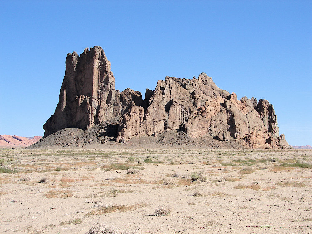
Church Rock, Near Kayenta. Navajo Nation, Arizona.
Hikes, Travels, & Tours
Pictures, Photos, Images, & Reviews.
George & Eve DeLange
October 12, 2011

October 12, 2011

We Are Proud Of Our SafeSurf Rating!

Click On Any Of The Following Links By Amazon.Com
For Books, & Videos About Touring Arizona. No Obligation!

 |
| Church Rock, Near Kayenta. Navajo Nation, Arizona. October 12, 2011. Background Is Looking North At The South Side Of Monument Valley. |
|---|
 |
| Outcropping Plug Mistaken For Church Rock, Near Kayenta. Navajo Nation, Arizona. October 12, 2011. Background Is Looking North At The South Side Of Monument Valley. |
 |
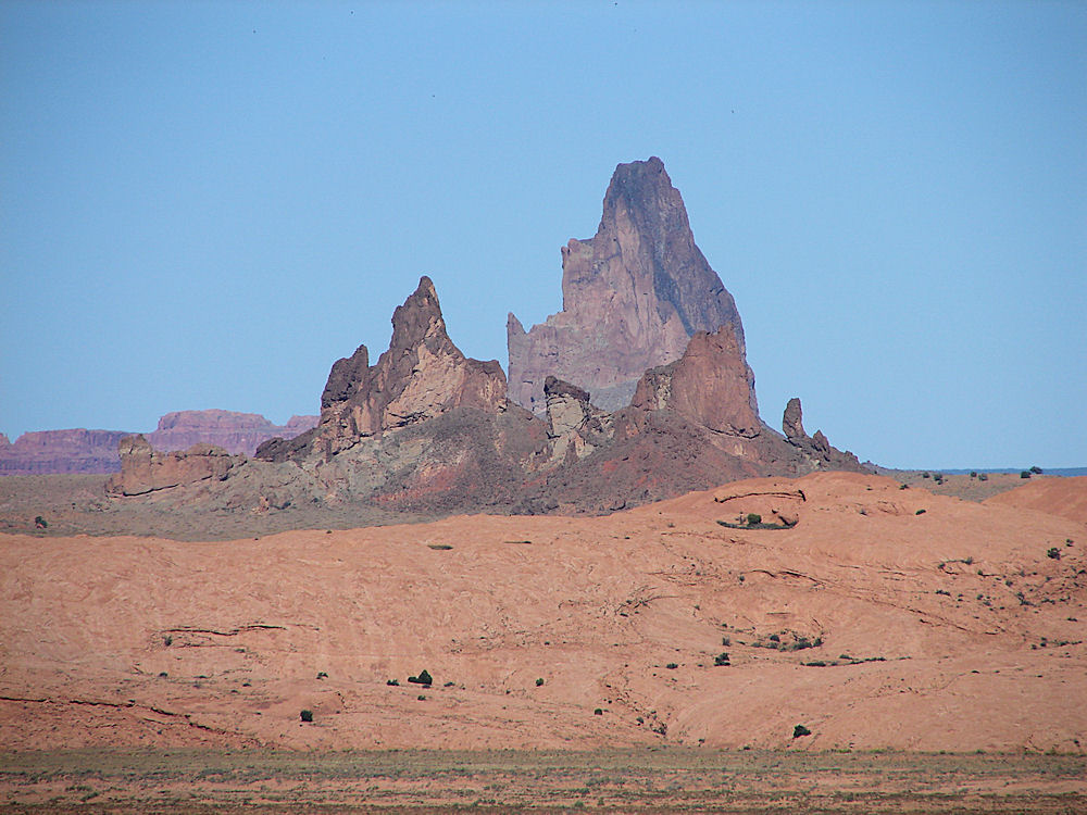
| Agathla Peak Or El Capitan, Viewed From Near Kayenta. Navajo Nation, Arizona. October 12, 2011. |

Church Rock, Navajo Nation, Arizona.
We wish to thank Wikipedia, the free encyclopedia for some of the information on this page. We share information with Wikipedia.
Church Rock (elevation 5580 feet) is a very prominent geologic feature (volcanic neck), north of US Route 160. It is located about 1/2 mile west of the Navajo Nation Reservation Route 59 intersection. If coming in on US Route 160, going east, it is about 5 1/2 miles east of US Route 163, in Kayenta, past the Airport, on US Route 160. Other volcanic necks are visible in the background to the the right of Church Rock. If you look closely, you can see the sharp, cone-shaped rise of Agathla Peak on the horizon to the right. Agathla Peak (Navajo: Aghaala, Spanish: El Capitan) is a peak south of Monument Valley, Arizona, over 1500 feet high. It is about 7 miles north of Kayenta and is visible from U.S. Route 163. The English name Agathla is derived from the Navajo name aghaala� meaning 'much wool', apparently named for the fur of antelope and deer accumulating on the rock. It is considered sacred by the Navajo People. Agathla Peak is an eroded volcanic plug consisting of volcanic breccia cut by dikes of an unusual igneous rock called minette. It is one of many such volcanic diatremes that are found in Navajo country of northeast Arizona and northwest New Mexico. Agathla Peak and Shiprock in New Mexico are the most prominent. These rocks are part of the Navajo Volcanic Field, in the southern Colorado Plateau. Ages of these minettes and associated more unusual igneous rocks cluster near 25 million years. During the mid-Tertiary Period (about 20-30 million years ago) it was a geologically active period of time in Arizona. In fact, there was so much crystal melting, intrusive and extrusive volcanism, faulting, and general geologic activity that the time period aqnd activity was given its own name, the Mid-Tertiary Orogeny. The word Orogeny comes from the Greek words for mountain and creating and means, it was a mountain building event at that time of our history. All this geological activity then created another geologic time period called, the Mid-Tertiary Ignimbrite Flare-up. Ignimbrites are the rocks formed by the widespread deposition and consolidation of volcanic ash flows and nuees ardentes. Over the course of several million years volcanoes in southeast Arizona sent millions of cubic miles of ash into the air and rushing down volcano slopes in incandescent avalanches. By the end of this flare-up, huge calderas were left to be buried, uplifted, and eroded, such as the Superstition Mountains east of Phoenix and the Chiricahua Mountains further south. Then Arizona went through the Jurassic geologic time period, about 180 million years ago. During this time period, the landscape shifted as wind-blown dune fields, deltas, and floodplains left their traces in the sedimentary rock record.After some more time; these sands, muds, and clays lithified as they were buried under thousands of feet of subsequent deposits. These rocks would rise again to be exposed as the Glen Canyon and San Rafael groups around Church Rock. Next, came the Mid-Tertiary time period, about 20-30 million years ago. During this period a change in tectonic forces raised mountains, elevated and faulted the Colorado Plateau, and changed the course of the Colorado River. Explosive volcanism occurred as rising magmas followed faults to the surfaceof the earth. Then during the last 20 million years until today. This area was covered with sedimentary rock, but it began to erode, removing most of the surface dirt. But, the more resistant dikes and volcanic necks eroded more slowly, leaving Church Rock and other outcroppings, as we see them today.
|
If you are planning to visit Church Rock, you will need to fly into a local international airport and then catch a regional flight to the Four Corners Regional Airport (FMN / KFMN). This airport has domestic flights from Farmington, New Mexico and is about 25 miles from the center of Shiprock, NM. Then you could rent a car. We recommend visiting Church Rock when also traveling by car to another major city in the Four Corners Area.
There are many hotels and motels in Arizona & New Mexico, and if you need a place to stay; Priceline.com can arrange that for you. We have personally, booked flights, hotels, and vacations; through Priceline.com and we can highly recommend them. Their website is also easy to use! We have some links to Priceline.com on this page since they can arrange all of your air flights, hotels and car. We also have some links to Altrec.com on this page since they are a good online source for any outdoor camping gear and clothing that you may need. We of course, appreciate your use of the advertising on our pages, since it helps us to keep our pages active. Whenever you make a purchase from a link on our page we get credit for that transaction. Again, Thanks!
|
 |  |
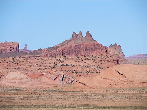
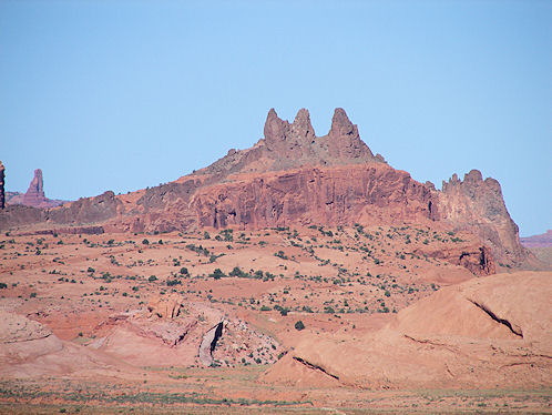
| Owl Rock & John Fords Point Viewed From Near Kayenta. Navajo Nation, Arizona. | Owl Rock & John Fords Point Viewed From Near Kayenta. Navajo Nation, Arizona. |
|---|
We Are Proud Of Our SafeSurf Rating!


| Back To Arizona Tours Page
|
| Back To New Mexico & Colorado Tours Page
|
| Back To DeLange Home Page
|


