Lee's Ferry, Arizona.
History & Historical
Travels & Tours, Pictures, Photos, Images, & Reviews.
George And Eve DeLange
October 15-18, 2001
Google Map To Lee's Ferry, Arizona.
View Larger Map
We Are Proud Of Our SafeSurf Rating!

Items For Sale By Amazon.Com No obligation!
In about 1861 to 1863, Brigham Young had directed various LDS church members to settle along the Little Colorado River in Arizona and in other places in Arizona which made it necessary to be able to cross the Colorado River and to enter into Arizona. In March of 1864, Mormon frontiersmen and Indian missionary Jacob Hamblin and his men built a raft at the mouth of the Paria and made the first successful crossing at the point on the Colorado that would become Lees Ferry, transporting all fifteen men, their supplies and horses. Hamblin was on a mission to warn the Navajo of northern Arizona to stop making raids into Utah, stealing livestock and threatening Mormon expansion. The lands into which the pioneers wanted to move was viewed as "unsettled" territory, theirs for the taking under the precepts of Manifest Destiny, despite millennia of native occupation. Over the next few years, the "war" between the natives and the Mormons escalated, with the Paiute beginning to make raids on other pioneer settlements as well. In an effort to deflect native threats to their vulnerable southeastern frontier, the Mormons posted guards at the Ute Ford/Crossing of the Fathers and at "Pahreah Crossing" (Lees Ferry) in the winter of 1869-1870. A small stone building and corral were erected and named "Fort Meeks." With the help of local Paiutes, Hamblin cleared some land along the Paria, dug an irrigation ditch, and sowed some wheat. This first farming attempt at Lees Ferry, however, was a failure. The years from 1876 to 1890 were the busiest ever for the ferry operation. Successful Mormon colonization along the Little Colorado River in Arizona funneled increased emigrations through Lees Ferry. In addition, the completion of the Mormon Temple in St. George, Utah brought Mormon couples from Arizona settlements to have their marriages solemnized in the temple, earning the road in between the informal title, "The Honeymoon Trail." Ferriage fees for Mormon travelers at the time were $2.00 per wagon, $1.00 per horse and rider, and $0.25 per head of stock, while non-Mormons paid about 50% more. Located 15.3 miles (24.4 km) down the river from Glen Canyon Dam, Lees Ferry is a meeting of the old and the new. A natural corridor between Utah and Arizona, Lees Ferry figured prominently in the exploration and settlement of the surrounding canyon country. The Lees Ferry and Lonely Dell Ranch Historic Districts offer a glimpse into western pioneer life of the late 1800s. Lees Ferry may be reached from Page by driving 23 miles (37 km) south on Hwy. 89 to Bitter Springs. Then turn north on Hwy. 89A and drive 14 miles (22 km) to Navajo Bridge. The Lees Ferry junction is approximately 300 yards (90 m) west of the bridge, on the right. Located approximately 100 yards (90 m) upriver from the boat launch ramp on the Colorado River are several historic buildings. The small rock structure, built by Charles H. Spencer in 1913, functioned until 1923 as a post office for area residents and gold miners working the canyons. The largest and most historically significant building in this area is the rectangular structure commonly called Lees Ferry Fort. Built by Mormons from St. George for protection during the Navajo uprising in 1874, the building later served, in an effort to restore friendly relations, as a Navajo trading post. Farther upriver, from 1916 through the 1950s, the U.S. Geological Survey constructed several buildings from which the water flow of the Colorado River was measured. Yet farther upriver, the American Placer Company, owned by Charles Spencer, attempted gold extraction from the chinle shale in the early 1900s. A large boiler and the sunken remains of the steamboat Charles H. Spencer can be seen. Approximately one mile (1.6 km) upriver from the historic district is Lees Ferry's most important ferry crossing site. Here, ferryboats operated from 1873 to 1928. Most of the early Mormon emigrants from Utah, heading to Arizona, crossed the river at this site. In 1871, John Doyle Lee (for whom Lees Ferry is named) became the first permanent resident of the area. Lee established a ranch on the valley floor within a large meander of the Paria River. When Emma Lee first saw the isolated valley that was to be her home, she cried, "Oh, what a lonely dell," and ever after, the place was known as Lonely Dell. Crops and livestock raised here provided economic support for ferry operators, their families, and others through the 1940s. Located at the ranch site is a log cabin believed to have been built by John D. Lee in the early 1870s. The small log building near the cabin was used as a blacksmith shop. A fruit orchard of pear, apricot, peach, and plum trees is maintained by the National Park Service, creating a semblance of the historic scene. A long rock building, constructed in 1916 by the Bar Z Ranch, functioned as a hub for cattle ranching activities. Leo and Hazel Weaver, two of many ranch owners, added a wood-frame wing on the east end of the rock house in 1936. The ranch cemetery, located about 200 yards (180 m) northwest of the ranch buildings, contains graves dating from 1874 to 1928. Buried here are four of Warren Johnson's children, who contracted diphtheria from a passing traveler and died within a period of four weeks. This is rugged country. Temperatures can be extreme, ranging from 0�F in the winter to 110�F in the summer (-18� to 42�C). Flash floods are possible during stormy weather and can occur even when the sky is clear overhead. Always carry plenty of water - one gallon (4 L) per person per day is recommended. Ask at the ranger station for further information and current hiking conditions. One Mile River Trail - This trail starts at the Lees Ferry Historic Fort and follows the old wagon road to the upper ferry crossing site. The two-mile round-trip walk takes about an hour. Spencer Trail - This very strenuous trail, which is not maintained, begins at marker post #6 along the One Mile River Trail and climbs a 1500 foot (457 m) vertical cliff. This trail, an historic route, is extremely difficult to follow. Attempt this hike in cool weather and allow at least three hours to complete it. Cathedral Wash - Parking for this hike is at the second pullout from Hwy. 89A, along Lees Ferry Road. This two mile (3.2 km) hike is not along a defined trail but follows the intermittent stream bed, or wash, inside a narrow canyon with interesting rock formations. During wet periods, be alert for flash floods, mud holes, and plunge pools. The aerial photograph below shows the location of the original ferry crossing, at the narrow point of the river between the red and blue asterisks. This is also the location of the modern boat launch (red asterisk), as well as the USGS gauging line, which measures the flow of the Colorado River as dictacted by the 1922 Colorado River Compact between the seven states which benefit from diverted Colorado River water. The blue asterisk denotes the beginning of the rough ledge of the Shinarump congolmerate, a steep and craggy formation rising above the river, visible here as the light colored strip between the river and the red sandstone. During the ferry days, the wagon route for travelers across the Colorado ran along this formation for one and a half miles. Despite attempts to level the hard rock, the road was so difficult that it was proclaimed the worst stretch of frontier road in the west, and nicknamed "Lee's Backbone."
|
If you are planning to visit Lee's Ferry and you are coming from outside of Arizona, you could fly into Saint George, Utah or Page, Arizona and then rent a car. Some people come up from Flagstaff, Arizona and stay overnight in Jacob's Lake, or Page, Arizona. There are several options. There are hotels and motels all along the way in the nearby towns. We have some links to Priceline.com on this page since they can arrange all of your air flights, hotels and car. You may need some outdoor clothing and equipment, if you plan to visit Lee's Ferry. In addition, you may wish to do some fishing. We have some links to Amazon.Com since they are a good online source for fishing gear. We of course, appreciate your use of the advertising on our pages, since it helps us to keep this page active.
|
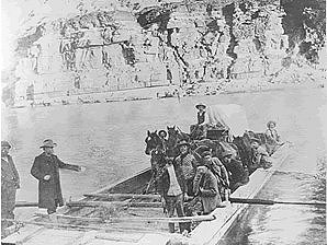 | 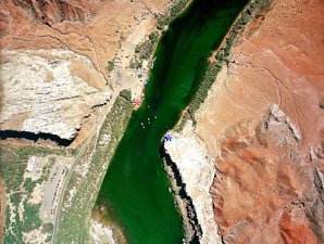 |
| Early Crossing At "Lees Ferry." | Crossing Was Between Red And Blue Marks. |
|---|---|
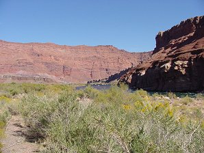 | 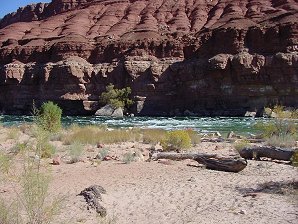 |
| Looking East Toward Crossing In Center Of Photo. | Colorado River. One Mile West Of Crossing. |
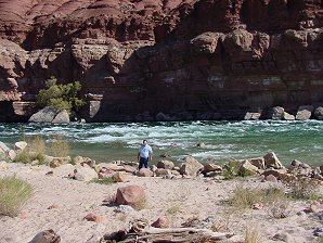 | 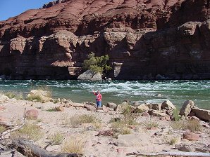 |
| The Water Is Cold. | Full Of Trout Too! |
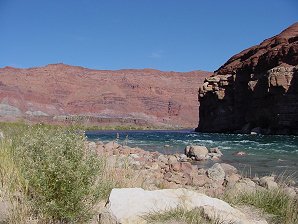 | 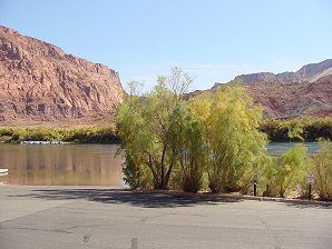 |
| The Crossing Is Just Around The Curve. | The Tree Marks The Edge Of The Crossing. |
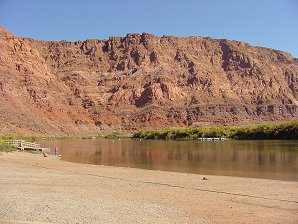 | 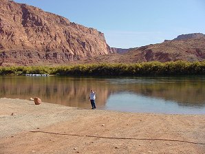 |
| It's Wide And Shallow! | Sure Is! |
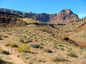 | 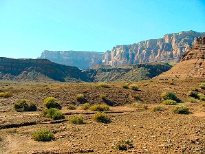 |
| Lees Ferry Is Below The Red Mountain. | Vermilion Cliffs NE Of Lees Ferry. |
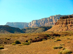 | 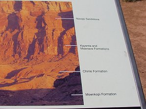 |
| Vermilion Cliffs. | Names Of Rock Formations. |
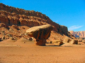 | 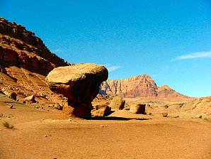 |
| Unusual Rocks. | Unusual Rocks. |
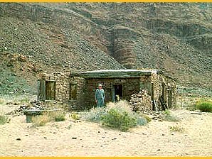 | 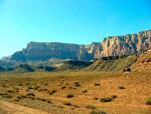 |
| Lee's Ferry Fort c. 1972. | Vermilion Cliffs. |

We Are Proud Of Our SafeSurf Rating!

Items For Sale By Amazon.Com No obligation!


