We Are Proud Of Our SafeSurf Rating!

Arizona Travels & Tours
Pictures, Photos, Images, & Reviews.
Loma del Rio
Ancient Hohokam Ruins
Papago Park, Tempe, Arizona, USA
George and Eve DeLange
Google Map To Loma del Rio, Ancient Hohokam Ruins
Papago Park, Tempe, Arizona
Click On Any Of The Following Links By Amazon.Com
For Books, & Videos About About Arizona Native American Ruins. No Obligation!

 |
| Frank Midvale Archaeological Ruins & Canals Map. Loma del Rio. Papago Park, Tempe, Arizona. Ancient Hohokam Ruins & Canal. |
|---|
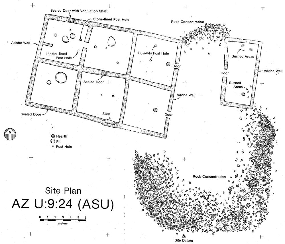 |
| Arizona State University Site Plan of Loma del Rio Ancient Hohokam Ruins. Papago Park, Tempe, Arizona. |
|---|
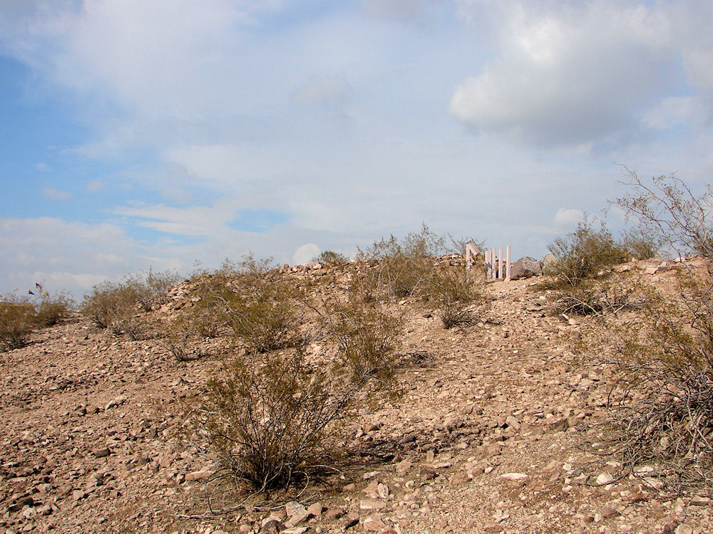 |
| Loma del Rio. Papago Park, Tempe, Arizona. Ancient Hohokam Ruins & Canal. Photo January 25, 2010. |
|---|
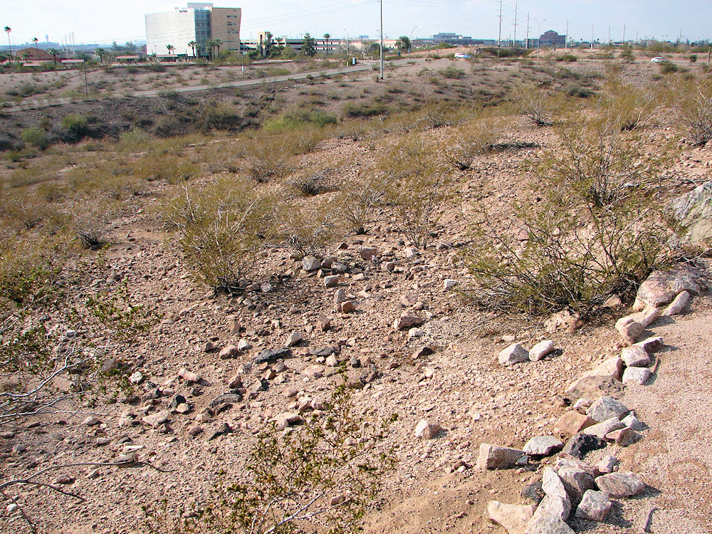 |
| Terrace Farming Location. Loma del Rio. Papago Park, Tempe, Arizona. Ancient Hohokam Ruins & Canal. Photo January 25, 2010. |
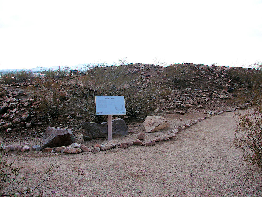 |
| Loma del Rio. Papago Park, Tempe, Arizona. Ancient Hohokam Ruins & Canal. Photo January 25, 2010. |
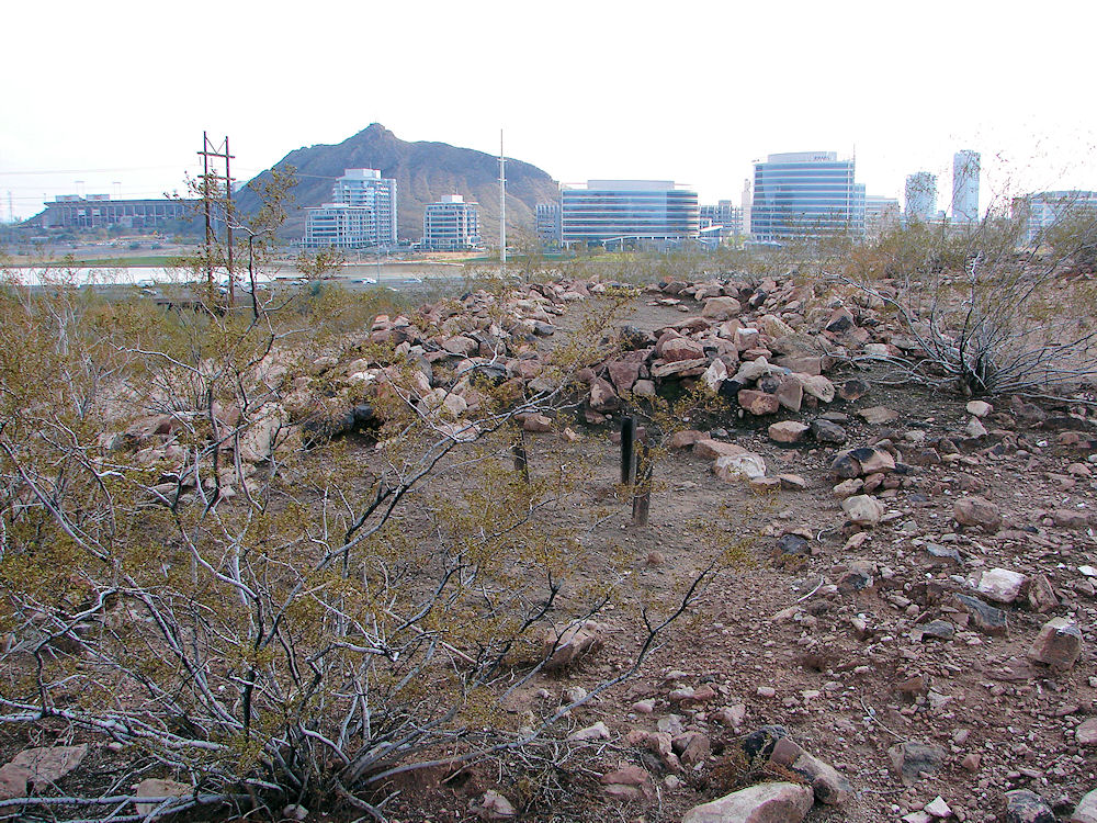 |
| Loma del Rio. Papago Park, Tempe, Arizona. Ancient Hohokam Ruins & Canal. Photo January 25, 2010. |
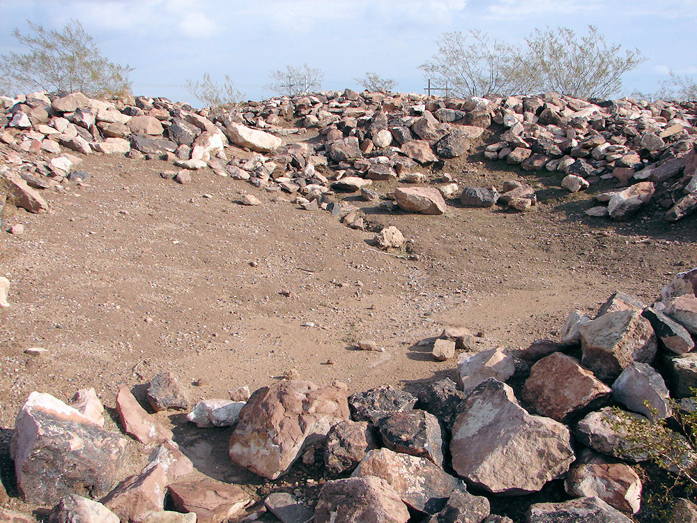 |
| Loma del Rio. Papago Park, Tempe, Arizona. Ancient Hohokam Ruins & Canal. Photo January 25, 2010. |
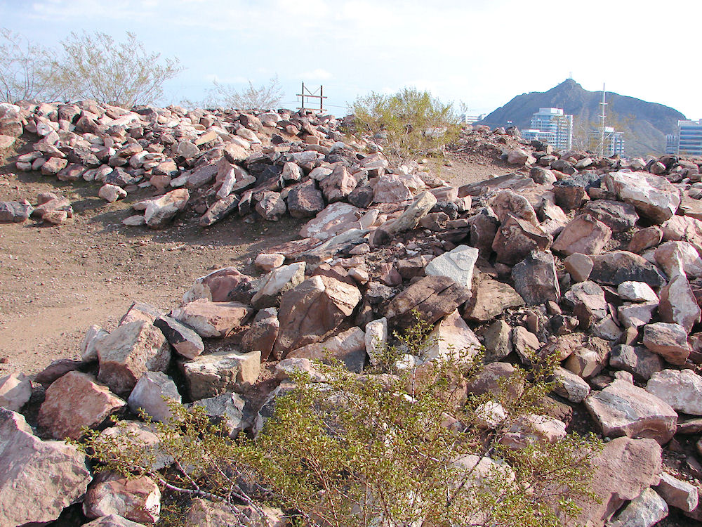 |
| Loma del Rio. Papago Park, Tempe, Arizona. Ancient Hohokam Ruins & Canal. Photo January 25, 2010. |
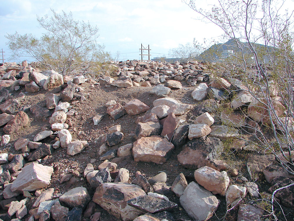 |
| Loma del Rio. Papago Park, Tempe, Arizona. Ancient Hohokam Ruins & Canal. Photo January 25, 2010. |
Loma del Rio or ("hill by the river") is located on the crest of a ridge on the north side of the Rio Salado; within the 296 acre City of Tempe portion of the 1500 total acre Papago Park. This an easy way to actually visit an ancient Hohokam ruins in Arizona. Many of the locals don't even know that this ancient Hohokam ruins exists and is in the Papago Park, of the City of Tempe, Arizona. The excavation of Loma del Rio was conducted by Arizona State University's Anthropology Department over the course of three field seasons from 1984 to 1986. It is thought that the Hohokam were the first people to settle Tempe. The "Loma del Rio" Ruins, which dates from the Hohokam Classic Period or Salado period (a.d. 1200-1450), was listed on the National Register of Historic Places on October 17, 2006. A Google Earth Map search marks the center of the Loma del Rio Ruins at 33o 26' 14.60" N 111o 56' 20.71" W. The elevation is about 1,227 feet. Loma del Rio consists of six connected residential rooms and another room which was set apart, probably used for cooking. Later on in time, the doorways in three of the rooms were sealed off and may have been used for storage. These rooms could have been entered through an opening in the roof, using a ladder. This group of rooms had a walled plaza and an outdoor cobble-paved patio. It is thought that the site might have been a residence for about 15 to 20 people. A network of crescent - shaped terrace gardens were built into the hillside to the west and the south of the residential rooms. These terrace gardens could have been used for growing agave or century plant, because agave plants required no irrigation. The Hohokam used the fibers from the aguave leaves to weave cloth or to make rope. Aguave would have also been an important food source, especially during drought. Stone tool fragments and pottery found at Loma del Rio suggest that trading was taking place with other far away Hohokam sites such as Casas Grandes, in Mexico and in Flagstaff, Arizona. The people living at Loma del Rio probably traded with the larger and more well known Hohokam communities in the Salt River Valley, such as Pueblo Grande, and Mesa Grande. The earthen canal south of Loma Del Rio next to the LoPiano habitat is one of the oldest canals in the valley. It is called Indian Bend Pump Ditch. According to oral tradition, the Hohokam may be the ancestors of the historic Akimel O'odham and Tohono O'odham peoples in Southern Arizona. According to oral tradition, the Hohokam may be the ancestors of the historic Akimel O'odham and Tohono O'odham peoples in Southern Arizona. The Hohokam culture, which spanned some 1450 years � from 1 A. D. in the first millennium to A. D. 1450 � suddenly appeared and vanished into the darkness of history. During that time, the Hohokam raised new standards in innovation, art, and craftsmanship. They also had trade and cultural connections into Mesoamerica. Based upon the first archaeological evidence, researchers believed that early Hohokam pioneers into northern Sonora and southern Arizona, imported a more advanced Mesoamerican influence into the area, founding the Hohokam culture, around the beginning of the first millennium. Based upon later archaeological evidence, other researchers believed that local descendants of the ancient hunting and gathering traditions of the desert, responded to influences from Mesoamerica and emerged as the Hohokam. Yet other students have suggested that the Hohokam immigrants arrived from an unknown Mesoamerican region and swept across the deserts of southern Arizona and northern Mexico. It is thought by those researchers that the Hohokam immigrants probably over ran the hunter/gatherers in the region of southern Arizona, sometime in the second half of the first millennium. Yet other investigators say that the Hohokam region was nothing more than a Mesoamerican frontier outpost. And others believe that the Hohokam culture represented nothing more than a local cultural development with a Mesoamerican tint. In any case, not much is known about their origins. The Hohokam occupied a geologically and ecologically diverse region, which extended from the basin and range and the low desert country of northern Sonora and southern Arizona northward into the Mogollon Rim escarpment and onto the southwestern edge of the Colorado Plateau. The Hohokam people had many settlements in the Gila and Salt River valleys of southern Arizona. They built rectangular pit houses from earth, rather than stone, and lived in small villages. They cremated their dead and placed the ashes in a specially prepared pit Although the Hohokam relied a great deal on hunting and gathering, they also were skilled farmers and excellent engineers. They were a peaceful people who cooperated to build large canal networks. Some of their canals were over ten miles long and used gravity to control water flow and to flush out the silt. Between the 7th and 14th centuries they built and maintained these extensive irrigation networks along the lower Salt and middle Gila rivers that rivaled the complexity of those used in the ancient Near East, Egypt, and China. These were constructed using relatively simple excavation tools, without the benefit of advanced engineering technologies. These highly successful agricultural techniques produced a surplus of food. Villages and populations grew. Over the next 1500 years the Hohokam expanded their settlements into the Tucson Basin, then to the Phoenix area, and as far north as present-day Flagstaff.
Parks Offices:
3500 S. Rural Rd. Tempe AZ 85282 (480) 350-5200
|
If you are planning to visit Loma del Rio. And if you are coming from outside of Arizona, you could fly into the Phoenix Sky Harbor International Airport and then rent a car. There are many hotels and motels in the area. We have some links to Priceline.com on this page since they can arrange all of your air flights, hotels and car. We also have some links to Altrec.com on this page since they are a good online source for any outdoor camping gear and clothing that you may need. We of course, appreciate your use of the advertising on our pages, since it helps us to keep our pages active.
|
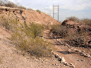 | 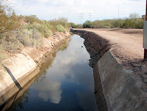 |
| Abandoned Railroad Cut Phoenix & Eastern Company. Loma del Rio. Tempe, Arizona. | Indian Bend Pump Ditch Loma del Rio. Tempe, Arizona. |
|---|
We Are Proud Of Our SafeSurf Rating!

Click On Any Of The Following Links By Amazon.Com
For Books, & Videos About About Arizona Native American Ruins. No Obligation!
Click On Any Of The Following Links By Amazon.Com
For Books, & Videos About Touring In Arizona. No Obligation!
Here Are Some Links To The Very Best & Most Popular Items Sold On Amazon.Com
To Learn More! Click The Links Below. No Obligation, Of Course!
Back To Arizona Tours Page
Back To DeLange Home Page
Here Are Some Links To The Very Best & Most Popular Items Sold On Amazon.Com
To Learn More! Click The Links Below. No Obligation, Of Course!


