Arizona Travels & Tours
Pictures, Photos, Images, & Reviews.
Sears Point Petroglyph Site
Near Dateland, Arizona, USA
George & Eve DeLange
Google Map To Sears Point Petroglyph Site, Near Dateland, Arizona
View Larger Map

Click On Any Of The Following Links By Amazon.Com
For Books, & Videos About About Arizona Native American Ruins. No Obligation!
 |
| Sears Point Petroglyph Site, Near Dateland, Arizona. Photo May 15, 2010. |
|---|
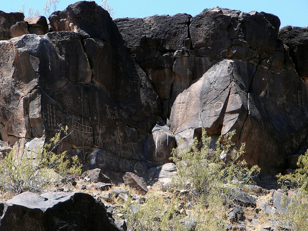 |
| Sears Point Petroglyph Site, Near Dateland, Arizona. Photo May 15, 2010. |
 |
| Sears Point Petroglyph Site, Near Dateland, Arizona. Photo May 15, 2010. |
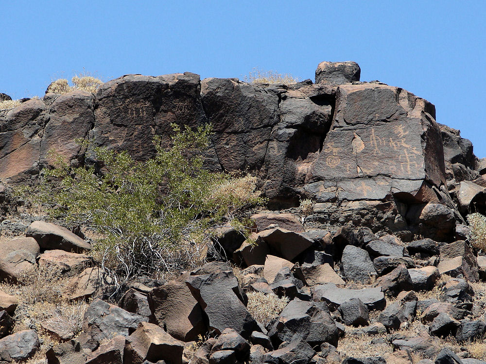 |
| Sears Point Petroglyph Site, Near Dateland, Arizona. Photo May 15, 2010. |
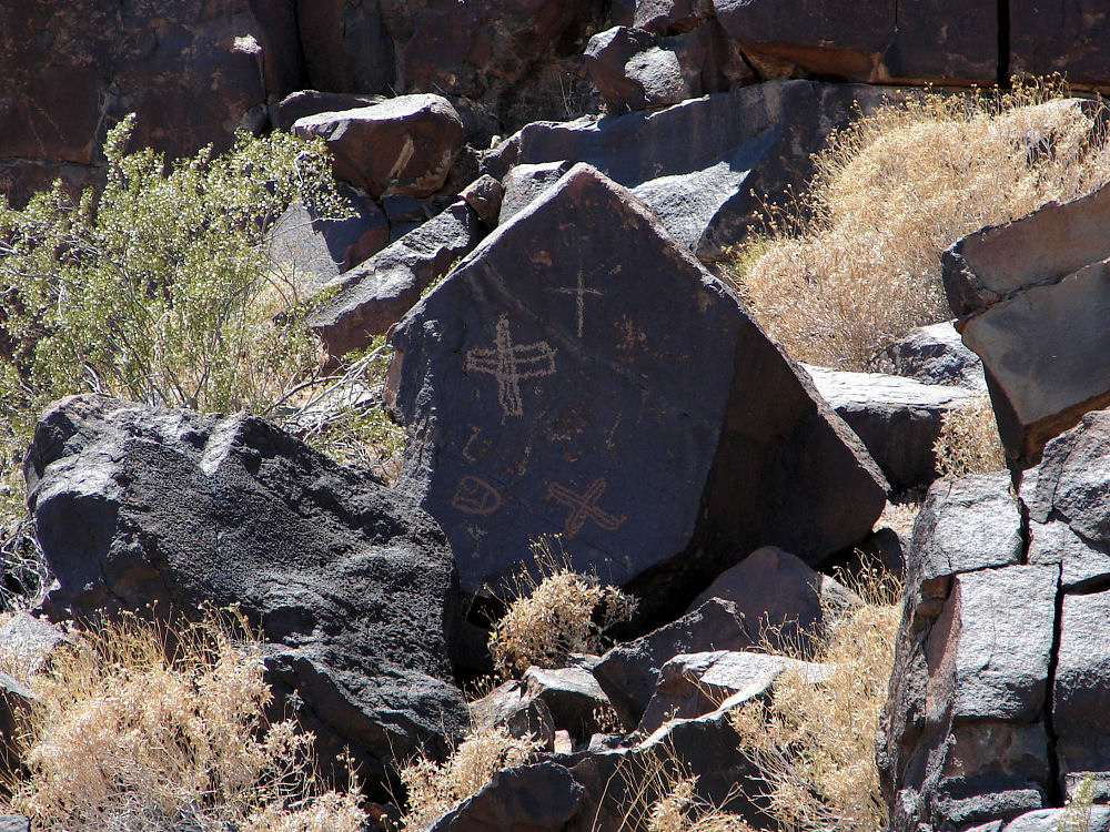 |
| Sears Point Petroglyph Site, Near Dateland, Arizona. Photo May 15, 2010. |
Sears Point, is an isolated area of black mesas along the Gila River in Arizona. Sears Point consists of petroglyphs, trails, rock alignments and other features which extend for miles along the southern bank of the Gila River. The Sears Point Petroglyph Site can be found on the along the southern bank of the Gila River about 4 1/2 miles from Dateland, Arizona. The Sears Point Petroglyph Site was listed on the National Register of Historic Places on October 16, 1985. A Google Earth Map search marks the center of the Clearing Parking Area of the Sears Point Petroglyph Site at 32o 55.737' N 113o 22.181 W. The elevation is about 427 feet. During prehistoric times the Gila River flowed west out of the Mountains of western New Mexico, and then made a wide turn near the modern day town of Gila Bend and then continued west on its journey to empty into the Colorado River. Three prehistoric cultures were believed to have used the Sears Point area between about 10,000 B.C. and 1,450 A.D. They were known as the Desert Archaic, Patayan, and Hohokam Cultures. Prehistoric peoples have used numerous trails along the Gila River as they traveled throughout the area. During more modern times many of these same trails were used during the discovery and settlement of America. Juan Bautista de Anza Bezerra Nieto (July 1736 - December 19, 1788), traveled along parts of these ancient trails as he led his expedition to provide an overland route to Alta California for use in transporting supplies and colonists from the outermost reaches of northern New Spain. The King of Spain wanted the Viceroy to initiate this strong colonizing effort in "Alta California" to combat encroachments into the areas by other European powers such as England and Russia. Thereby ensuring Spanish control over the recently rediscovered San Francisco harbor. Juan Bautista de Anza Bezerra Nieto left with 3 padres, 20 soldiers, 11 servants, 35 mules, 65 cattle, and 140 horses he set forth from Tubac south of present day Tucson, Arizona. His expedition took a southern route along the Rio Altar (Sonora y Sinaloa, New Spain), then paralleled the modern Mexico/California border, and then crossed the Colorado River at its confluence with the Gila River; in the domain of the Yuma tribe with which he established good relations. This trail is now known as the Juan Bautista de Anza National Historic Trail. One of these other ancient trails is called the Gila Trail, which was used in the 1840's by many thousands of people as a route to the gold fields in California. Stephen W. Kearney's Mormon Battalion camped at Sears Point on December 30, 1846, along what came to be known as the Mormon Battalion Trail. The trail was later used by the Butterfield Overland Mail Route, which followed the course of the Gila River as it wound its way past Sears Point as it provided overland mail service route from the Mississippi River to San Francisco.
The Desert Archaic Period:
The Desert Archaic Period is part of the Archaic stage or "Meso-Indian Period" or second period of human occupation in the Americas, first proposed by Gordon Willey and Philip Phillips in 1958; from around 8,000 B.C. to 1,000 B.C. The period has been further subdivided by region and then time. For-instance, the Archaic Southwest tradition in Arizona is subdivided into the Dieguito-Pinto, Oshara, Cochise and Chihuahua cultures. The Archaic stage is characterized by subsistence economies supported through the exploitation of nuts, seeds and shellfish. The people living at Sears Point at this time were well adapted to living in the harsh desert conditions. They also migrated seasonally based on the ripening of various plants and seasonable hunting conditions. Sears Point was a more lush area at this time and the water and plants of the Gila River were an important part of their survival. The Archaic stage's ending is defined by the adoption of sedentary farming.
Ceramic Period, Patayan and Hohokam People: Both the Patayan and Hohokam peoples lived in the area of the Gila River and Sears Point during what is known as the Ceramic Period. These people experimented with early agriculture and their ceramics became important to them for food storage. It is thought that changes in their population densities and rainfall, may have caused this shift from a hunting and gathering emphasis, to a more sedentary agricultural life closer to the major streams and rivers.
Sears Point is unusual in the sense that it suggests an unusual association between various Patayan and Hohokam characteristics, which cannot be seen anywhere else. We see a new style of petroglyphs being superimposed over older Archaic-period petroglyphs here. This new style is known as the Sears Point Patayan. It is thought that Sears Point may have been a boundary area between the older Archaic-period culture and the Patayan culture; where the two groups may have had contact with each other.
The Hohokam:
It is known that the ancient Hohokam people once lived and farmed here. Evidence or ruins of their culture have been found in the area. Some date from their late Pioneer Period (AD 350-AD 550). Some villages dating into their Early Colonial Period (AD 550-AD 700) are found towards the north and west of Painted Rock. In addition village ruins of their Sedentary - Classic Period (AD 900-AD 1400) are found to the south and east. According to oral tradition, the Hohokam may be the ancestors of the historic Akimel O'odham and Tohono O'odham peoples in Southern Arizona. The Hohokam culture, which spanned some 1450 years � from 1 A. D. in the first millennium to A. D. 1450 � suddenly appeared and vanished into the darkness of history. During that time, the Hohokam raised new standards in innovation, art, and craftsmanship. They also had trade and cultural connections into Mesoamerica. Based upon the first archaeological evidence, researchers believed that early Hohokam pioneers into northern Sonora and southern Arizona, imported a more advanced Mesoamerican influence into the area, founding the Hohokam culture, around the beginning of the first millennium. Based upon later archaeological evidence, other researchers believed that local descendants of the ancient hunting and gathering traditions of the desert, responded to influences from Mesoamerica and emerged as the Hohokam. Yet other students have suggested that the Hohokam immigrants arrived from an unknown Mesoamerican region and swept across the deserts of southern Arizona and northern Mexico. It is thought by those researchers that the Hohokam immigrants probably over ran the hunter/gatherers in the region of southern Arizona, sometime in the second half of the first millennium. Yet other investigators say that the Hohokam region was nothing more than a Mesoamerican frontier outpost. And others believe that the Hohokam culture represented nothing more than a local cultural development with a Mesoamerican tint. In any case, not much is known about their origins. The Hohokam occupied a geologically and ecologically diverse region, which extended from the basin and range and the low desert country of northern Sonora and southern Arizona northward into the Mogollon Rim escarpment and onto the southwestern edge of the Colorado Plateau. The Hohokam people had many settlements in the Gila and Salt River valleys of southern Arizona. They built rectangular pit houses from earth, rather than stone, and lived in small villages. They cremated their dead and placed the ashes in a specially prepared pit Although the Hohokam relied a great deal on hunting and gathering, they also were skilled farmers and excellent engineers. They were a peaceful people who cooperated to build large canal networks. Some of their canals were over ten miles long and used gravity to control water flow and to flush out the silt. Between the 7th and 14th centuries they built and maintained these extensive irrigation networks along the lower Salt and middle Gila rivers that rivaled the complexity of those used in the ancient Near East, Egypt, and China. These were constructed using relatively simple excavation tools, without the benefit of advanced engineering technologies. These highly successful agricultural techniques produced a surplus of food. Villages and populations grew. Over the next 1500 years the Hohokam expanded their settlements into the Tucson Basin, then to the Phoenix area, and as far north as present-day Flagstaff. Sears Point Petroglyph Site is on the extreme western edge of the Hohokam cultural area. As you travel east from Sears Point Petroglyph Site the petroglyphs take on more typical Hohokam Culture characteristics, and as you travel further west, the petroglyphs take on more typical Patayan Culture characteristics. This is way to actually visit some very remote ancient Desert Archaic, Patayan and Hohokam petroglyphs in Arizona.
To Get There: Take Interstate 8 east from Yuma for about 75 miles to Spot Road at exit 78. On the north frontage road head east for about 1 mile to Avenue 76 E. Avenue 76 E is at 32o 50.359' N 113o 20.125' W. The elevation is about 532 feet. Then go north along the dirt road for about 7 miles. Park in the cleared area in front of the ridge, without passing the carsonite posts. The dirt road is not maintained by BLM, and is very rough. It can be muddy and dangerous after rain. CONTACT:
Bureau of Land Management
|
If you are planning to visit the Sears Point Petroglyph Site, Near Dateland, Arizona. And if you are coming from outside of Arizona, you could fly into the Phoenix Sky Harbor International Airport and then rent a car. You also could fly into the Yuma International Airport (IATA: YUM, ICAO: KNYL, FAA LID: NYL), which is a shared-use airport together with Marine Corps Air Station Yuma, located three nautical miles south of the central business district of Yuma, Arizona. It is mostly used for military aviation, but it is also served by two commercial airlines. There are many hotels and motels in the area. We have some links to Priceline.com on this page since they can arrange all of your air flights, hotels and car. We also have some links to Altrec.com on this page since they are a good online source for any outdoor camping gear and clothing that you may need. We of course, appreciate your use of the advertising on our pages, since it helps us to keep our pages active.
|
 | 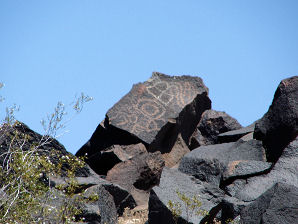 |
| Sears Point Petroglyph Site Near Dateland, Arizona | Sears Point Petroglyph Site Near Dateland, Arizona |
|---|---|
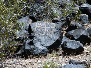 | 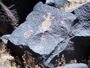 |
| Sears Point Petroglyph Site Near Dateland, Arizona | Sears Point Petroglyph Site Near Dateland, Arizona |
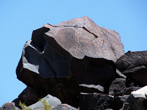 | 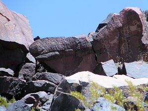 |
| Sears Point Petroglyph Site Near Dateland, Arizona | Sears Point Petroglyph Site Near Dateland, Arizona |
We Are Proud Of Our SafeSurf Rating!

Click On Any Of The Following Links By Amazon.Com
For Books, & Videos About About Arizona Native American Ruins. No Obligation!
Click On Any Of The Following Links By Amazon.Com
For Books, & Videos About Touring Arizona. No Obligation!


