Walnut Canyon National Monument
Sinagua Ruins
Flagstaff, Arizona
Hikes, Travels, & Tours
Pictures, Photos, Images, & Reviews.
George & Eve DeLange.
September 01, 2009

Google Map To Walnut Canyon National Monument Sinagua Ruins, Flagstaff, Arizona.
View Larger Map
A Monsoon Season Thunderstorm with heavy rain started as we began our tour into Walnut Canyon National Monument. Imagine how we felt as we descended into the canyon and the lightning, thunder, and heavy rain began.
We took shelter in one of the Sinagua dwellings under the ledge of the cliffs. We learned first hand of the shelter that these humble dwellings provided the ancient people who lived here.
Enjoy the natural experience!

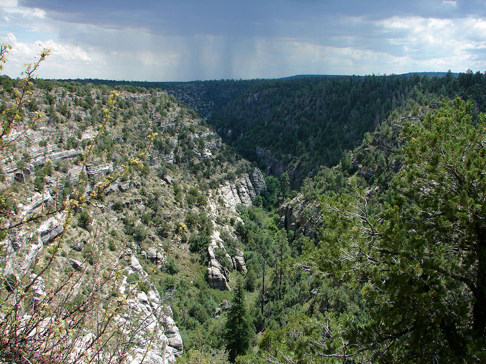
Island Trail Views: Walnut Canyon, Flagstaff, Arizona. Photos Taken September 01, 2009. 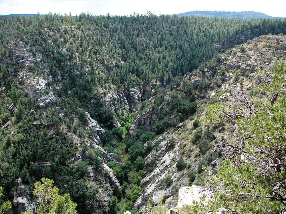
Island Trail Views: Walnut Canyon, Flagstaff, Arizona. Photos Taken September 01, 2009. 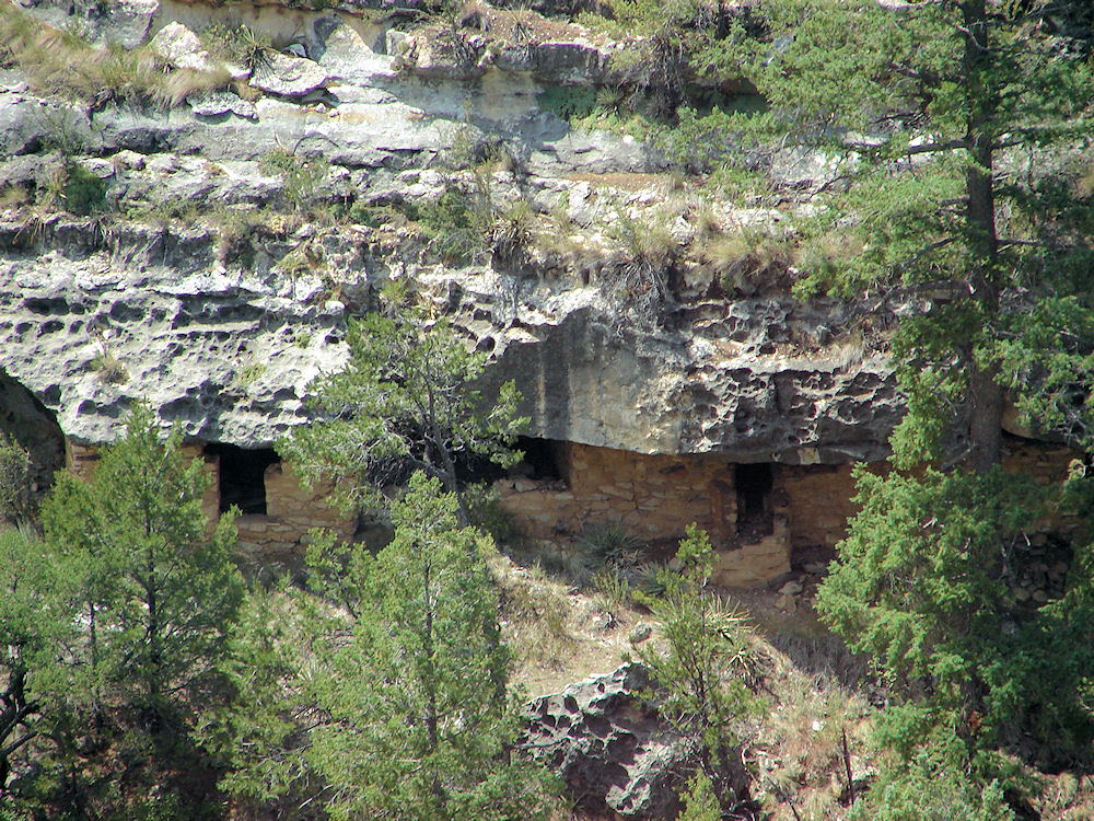
Island Trail Views: Note The T - Shaped Window It Appears In
Stone Masonry Villages Of The Sinagua, Anasazi (ancient Hopi), Of The Southwest.
ie.. It Is Found, At Chaco Canyon In Northern New Mexico and Mesa Verde In Southwestern Colorado.
It Is Often Found In Mayan Structures ie... Palenque, Mexico. The Mayan Word I'Q (ish) Refers To The Wind God.
Walnut Canyon National Monument Ancient Sinagua, Ruins, Flagstaff, Arizona. Photos Taken September 01, 2009. 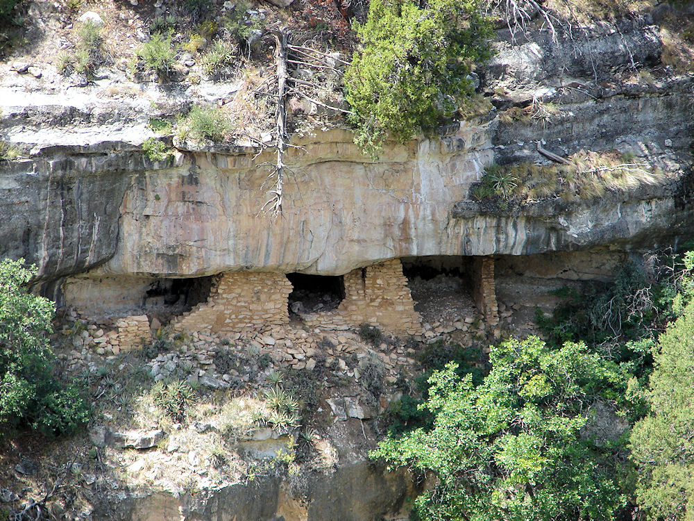
Island Trail Views: Walnut Canyon, Flagstaff, Arizona. Photos Taken September 01, 2009. 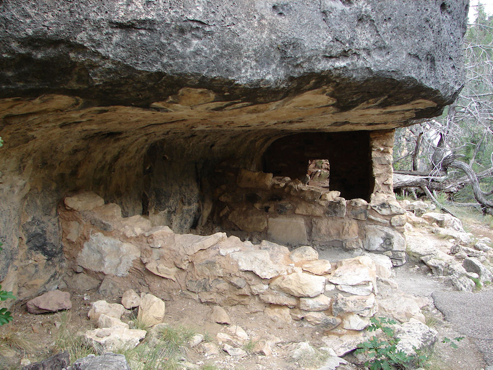
Island Trail Views: Walnut Canyon, Flagstaff, Arizona. Photos Taken September 01, 2009. 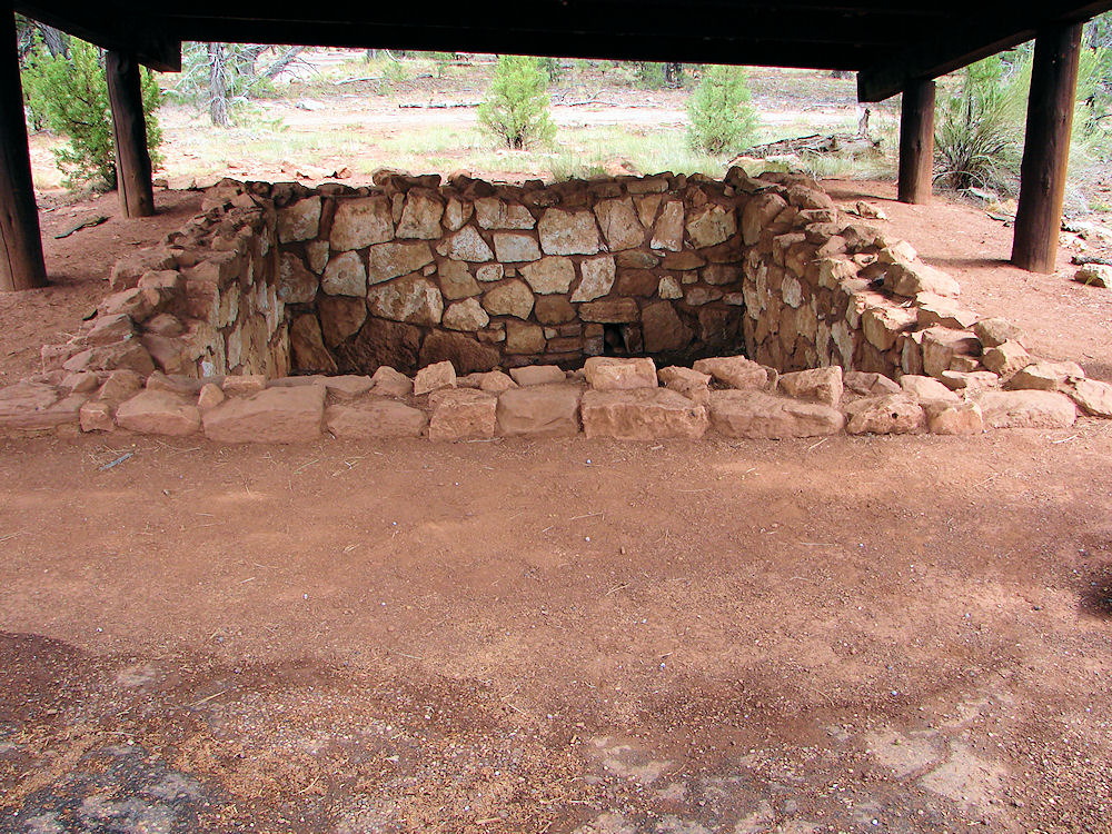
Rim Trail Views: Pit House At Walnut Canyon, Flagstaff, Arizona. Photos Taken September 01, 2009. Rim Trail Views: Pueblo At Walnut Canyon, Flagstaff, Arizona. Photos Taken September 01, 2009.
Walnut Canyon National Monument is a United States National Monument located about 10 miles southeast of downtown Flagstaff, Arizona, just off of Interstate 40.
A Google Earth Map search marks the Main Entrance to the Walnut Canyon National Monument Visitor Center at about: 35o 10' 18.35" N 111o 30' 33.80" W. The rim is at about 6,709 feet elevation. The canyon's floor is about 350 feet lower.
Walnut Canyon, near Flagstaff, Arizona was proclaimed a national monument on November 30, 1915. It was transferred from the USDA Forest Service to the National Park Service on August 10, 1933. Walnut Canyon National Monument was listed on the National Register of Historic Places on October 15, 1966.
Walnut Canyon lies on the Colorado Plateau and cuts through the Permian Kaibab Limestone, which exposes the Toroweap Formation and Coconino Sandstone. This same Kaibab formation also forms the rim of the Grand Canyon. Crossbedding is found in the Coconino Sandstone.
The Sinagua (seen-ah-gwa):
The Sinagua are the best known regional group that anthropologists refer to as the Western Anasazi. The Sinagua occupied an area between Flagstaff and Phoenix, Arizona, including the Verde Valley and significant portions of the Mogollon Rim country, between about 500 and about 1,425 AD. They led a simple life based on corn farming and subsistence hunting and gathering at the periphery of the three major Southwest cultures.
After volcanic activity improved soil conditions around 1,000 AD, the Sinagua began to thrive by assimilating various elements from the major cultural groups. From the Hohokam they acquired village life and the use of ball courts; from the Anasazi they adopted cliff dwellings and water conservation practices; from the Mogollon they adopted pottery styles.
By the late 1,450s, the same natural and social stresses that destroyed the other cultures of the region engulfed the Sinagua as well. By about 1,425, they had completely disappeared. But, their dwellings and religious shrines can be found all over Central Arizona. One is even located in a city park in the city of Phoenix!
The early Sinagua sites consist of pit houses. Their later structures more closely resembled the pueblo architecture found in other cultures throughout the southwestern United States.
The name Sinagua was given to this culture by archaeologist Harold Colton, founder of the Museum of Northern Arizona. Sinagua is derived from the Spanish words "sin" meaning "without" and "agua" meaning "water", referring to the name "Sierra Sin Agua" which was originally given by the Spanish explorers to the San Francisco Peaks near Flagstaff, Arizona.
Colton also distinguished between two different Sinagua cultures. The Northern Sinagua were clustered around the Flagstaff area, with Elden Pueblo, Walnut Canyon National Monument, Wupatki National Monument, being the best-known publicly-accessible sites. The Southern Sinagua were found throughout the Verde Valley of Central Arizona. Most notable sites open to the public being; Montezuma's Castle, Montezuma's Well, Tuzigoot National Monument, the Palatki Archaeological Site, and the V-Bar-V Petroglyph Site.
The last known recording of Sinagua occupations for any of the Sinagua sites are of those in Montezuma Castle National Monument in about 1,425 AD.
The reasons for the abandonment of their habitation sites are not yet known; but warfare, drought, and clashes with the newly-arrived Yavapai people are possible suggestions.
Several of the Hopi clans trace their roots to immigrants from the Sinagua culture. The Hopi clans believe their ancestors left the Verde Valley for religious reasons.
Walnut Canyon & The Sinagua:
Several hundred of the Sinagua Native American's, built over 80 cliff dwellings along both sides of Walnut Canyon.
The dwellings were built into the natural recessed overhangs in the walls of the canyon. This provided a natural roof, sheltering them from the elements.
The three side walls were made of up of stacked rocks, the back of the natural recesses acted as the fourth back wall and the rock ledge floor was the cliff dwellings natural floor.
The individual dwellings are very small by today's standards, (approximately 6.5 feet high by 19.7 feet long by 9.8 feet deep), but they were large enough for the Sinagua to cook a meal over open flames and to lie down for a night's sleep. They also were easy to keep warm on a cold winter's night.
Most of the Sinagua cliff dwellings were built facing south, probably so the sun's rays were cast on their homes during most of the daylight hours to make the winter cold periods more bearable.
Archaeologists are fairly sure that the Sinagua of Walnut Canyon were skilled farmers that climbed up the trails from their homes each day to the canyon rim to plant, cultivate, and harvest; the corn, beans, and squash that were staple agriculture products of these people. They also collected wild plants, and berries to add to their diet. In addition
they hunted the local wild game.
It is also known that the distant tribes from other regions as far away as California and Mexico, would trek along the trading routes to trade with the Sinagua.
Evidence suggests that they traded for salt, pottery, cotton, seashells and some semi-precious stones in exchange for their agriculture and hunting goods.
Other evidence that these people had connections into Mexico is the use of the "T" shaped doorways and windows in some of their structures.
In the Mayan tradition, �I�q� (ish) is the Breath, the Air, the Spirit.The symbol of �I�q� is drawn as a T, representing a doorway into the spirit world and other dimensions. The T forms half of a cross (the World Tree) and the other half lies in the spirit world.
Many of the Mayan temples have windows and doorways in the shape of a T. They are not only physical doorways but are also spiritual doorways (a portal into the spirit world). Additionally, this symbol represented the air, the wind and the divine breath of God.
The best known of the Mesoamerican wind gods is Ehecatl/Quetzalcoatal, when seen in his aspect as the lord of wind.
Several aspects of Ehecatl/Quetzalcoatal resemble those of Jesus Christ.
Visiting Walnut Canyon National Monument:
When you visit the monument you will actually be able to see the wonderful prehistoric cliff dwellings that are built into the canyon walls.
There are two main trails; the Island Trail and the Rim Trail.
The more difficult Island Trail leads to 25 cliff dwellings and a lot of the spectacular scenery of Walnut Canyon and its limestone walls. The Island Trail is about a 1 mile round-trip, taking about 1 hour round-trip.
The trail can be strenuous, especially for those not acclimated to its approximate 7,000' elevation. The trail actually descends 185 vertical feet into the canyon, and returns the same way.
The trail is paved, but it is not accessible to wheelchairs, due to the steep canyon terrain and many stairs. George has a severe muscle disorder similar to MS and he can walk the trail, but he needs several breaks to rest on the way. Use you own best judgement.
The easier walk is along the Rim Trail and through the surrounding Ponderosa Pine forest to visit the two overlooks into Walnut Canyon itself. On this trail you'll discover an ancient "pithouse" and pueblo set back from the canyon rim nearer to the ancient agricultural fields. The Rim Trail is about 0.7 mile round-trip and it takes about 30 minutes for the round-trip.
The first part of the trail, leading to the first canyon overlook, is paved and accessible to wheelchairs. The other is not easilly accessible to wheelchairs, but it could be done. Ask at the visitor center before deciding to proceed further.
You also can roam through the Walnut Canyon Visitor's Center and its small museum of artifacts. You can enjoy a relaxing picnic either before or after your tour. Or go on into Flagstaff and enjoy any of a vast number of restaurants.
There are many more dwellings to be seen up close in the canyon east of the actual Monument, however it is illegal to actually enter into the canyon. Backcountry hiking is not allowed in order to protect fragile archaeological sites.
Walnut Canyon Visitor Center
Open All Year Except They Are Closed December 25th.
November - April 9:00 AM - 5:00 PM MST
May - October 8:00 AM - 5:00 PM MST
Phone
(928) 526-3367
Be prepared for variable and extreme weather conditions: snow in winter, hot sun in summer with afternoon thunderstorms from Mid June To Mid September. Especially during spring, strong gusty winds on the rim and/or in the canyon.
Pets are not allowed on the trails, in the backcountry, in buildings, or tied to objects in the area. They are welcome in the parking areas on a leash. Warning: Summer temperatures may be fatal to pets left in vehicles.
How To Get There:
From Phoenix. Take I-17 North. On I-17, At Exit 340 A ,Go East on I-40. Leave I-40 at Exit 204, which is located 7.5 miles east of Flagstaff; onto East Walnut Canyon Road or NF-622, then drive south 3 miles to the canyon rim. Warning: It is a tight turn around for towed vehicles. There is a 40 foot maximum vehicle length advisory.
Walnut Canyon National Monument is about 2 hours and 20 minutes from Phoenix.
We have enjoyed this beautiful place since about 1945.
If you are planning to visit Walnut Canyon. And if you are coming from outside of Arizona, you could fly into Flagstaff, Arizona and then rent a car.
You also could fly into the Phoenix Sky Harbor International Airport and drive the 144 miles to Flagstaff.
Take the I-17 north to Flagstaff. I-17 will end and turn into Milton Road, leading you into Flagstaff. A trip of 144 miles (232 km) - 2 hours.
There is also a Sky Harbor - Flagstaff shuttle.
There are many hotels and motels in both areas and if you need a place to stay; Priceline.com can arrange that for you.
We have some links to Priceline.com on this page since they can arrange all of your air flights, hotels and car.
In addition, you may need to purchase some outdoor camping gear and clothing.
We also have some links to Altrec.com on this page since they are a good online source for any outdoor camping gear and clothing that you may need.
We of course, appreciate your use of the advertising on our pages, since it helps us to keep our pages active.
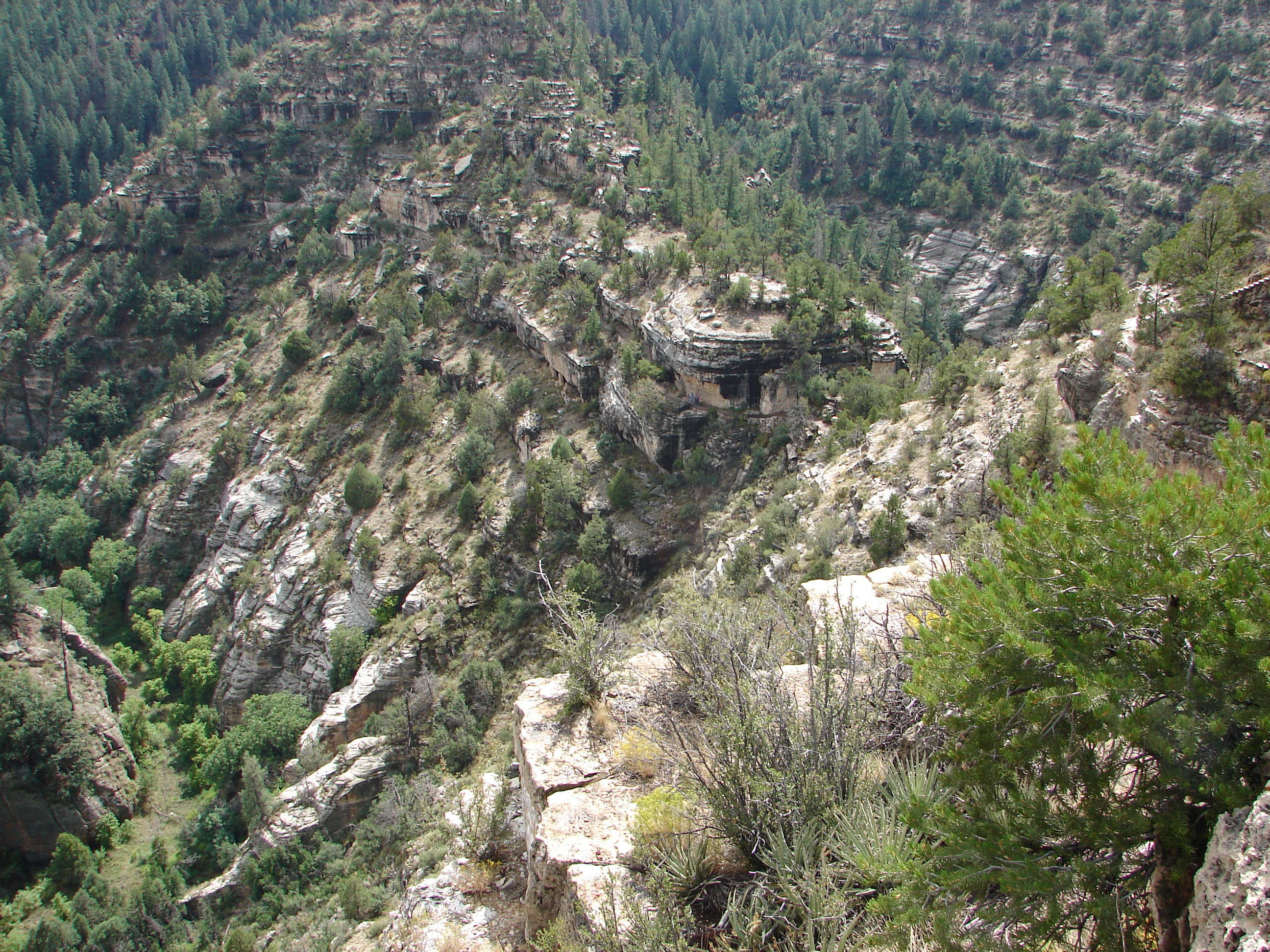
Island Trail
Seen From Rim Trail
Walnut Canyon National Monument Visitor Center
Seen From Rim Trail
Walnut Canyon National Monument

We Are Proud Of Our SafeSurf Rating!

Click On Any Of The Following Links By Amazon.Com
For Books, & Videos About About Arizona Native American Ruins. No Obligation!
Click On Any Of The Following Links By Amazon.Com
For Books, & Videos About Touring Arizona. No Obligation!
Back To Arizona Tours Page
Back To DeLange Home Page

George & Eve DeLange.
September 01, 2009

A Monsoon Season Thunderstorm with heavy rain started as we began our tour into Walnut Canyon National Monument. Imagine how we felt as we descended into the canyon and the lightning, thunder, and heavy rain began. We took shelter in one of the Sinagua dwellings under the ledge of the cliffs. We learned first hand of the shelter that these humble dwellings provided the ancient people who lived here. Enjoy the natural experience!
|

 |
| Island Trail Views: Walnut Canyon, Flagstaff, Arizona. Photos Taken September 01, 2009. |
|---|
 |
| Island Trail Views: Walnut Canyon, Flagstaff, Arizona. Photos Taken September 01, 2009. |
 |
| Island Trail Views: Note The T - Shaped Window It Appears In Stone Masonry Villages Of The Sinagua, Anasazi (ancient Hopi), Of The Southwest. ie.. It Is Found, At Chaco Canyon In Northern New Mexico and Mesa Verde In Southwestern Colorado. It Is Often Found In Mayan Structures ie... Palenque, Mexico. The Mayan Word I'Q (ish) Refers To The Wind God. Walnut Canyon National Monument Ancient Sinagua, Ruins, Flagstaff, Arizona. Photos Taken September 01, 2009. |
 |
| Island Trail Views: Walnut Canyon, Flagstaff, Arizona. Photos Taken September 01, 2009. |
 |
| Island Trail Views: Walnut Canyon, Flagstaff, Arizona. Photos Taken September 01, 2009. |
 |
| Rim Trail Views: Pit House At Walnut Canyon, Flagstaff, Arizona. Photos Taken September 01, 2009. |
| Rim Trail Views: Pueblo At Walnut Canyon, Flagstaff, Arizona. Photos Taken September 01, 2009. |
Walnut Canyon National Monument is a United States National Monument located about 10 miles southeast of downtown Flagstaff, Arizona, just off of Interstate 40. A Google Earth Map search marks the Main Entrance to the Walnut Canyon National Monument Visitor Center at about: 35o 10' 18.35" N 111o 30' 33.80" W. The rim is at about 6,709 feet elevation. The canyon's floor is about 350 feet lower. Walnut Canyon, near Flagstaff, Arizona was proclaimed a national monument on November 30, 1915. It was transferred from the USDA Forest Service to the National Park Service on August 10, 1933. Walnut Canyon National Monument was listed on the National Register of Historic Places on October 15, 1966. Walnut Canyon lies on the Colorado Plateau and cuts through the Permian Kaibab Limestone, which exposes the Toroweap Formation and Coconino Sandstone. This same Kaibab formation also forms the rim of the Grand Canyon. Crossbedding is found in the Coconino Sandstone. The Sinagua (seen-ah-gwa): The Sinagua are the best known regional group that anthropologists refer to as the Western Anasazi. The Sinagua occupied an area between Flagstaff and Phoenix, Arizona, including the Verde Valley and significant portions of the Mogollon Rim country, between about 500 and about 1,425 AD. They led a simple life based on corn farming and subsistence hunting and gathering at the periphery of the three major Southwest cultures. After volcanic activity improved soil conditions around 1,000 AD, the Sinagua began to thrive by assimilating various elements from the major cultural groups. From the Hohokam they acquired village life and the use of ball courts; from the Anasazi they adopted cliff dwellings and water conservation practices; from the Mogollon they adopted pottery styles. By the late 1,450s, the same natural and social stresses that destroyed the other cultures of the region engulfed the Sinagua as well. By about 1,425, they had completely disappeared. But, their dwellings and religious shrines can be found all over Central Arizona. One is even located in a city park in the city of Phoenix! The early Sinagua sites consist of pit houses. Their later structures more closely resembled the pueblo architecture found in other cultures throughout the southwestern United States. The name Sinagua was given to this culture by archaeologist Harold Colton, founder of the Museum of Northern Arizona. Sinagua is derived from the Spanish words "sin" meaning "without" and "agua" meaning "water", referring to the name "Sierra Sin Agua" which was originally given by the Spanish explorers to the San Francisco Peaks near Flagstaff, Arizona. Colton also distinguished between two different Sinagua cultures. The Northern Sinagua were clustered around the Flagstaff area, with Elden Pueblo, Walnut Canyon National Monument, Wupatki National Monument, being the best-known publicly-accessible sites. The Southern Sinagua were found throughout the Verde Valley of Central Arizona. Most notable sites open to the public being; Montezuma's Castle, Montezuma's Well, Tuzigoot National Monument, the Palatki Archaeological Site, and the V-Bar-V Petroglyph Site. The last known recording of Sinagua occupations for any of the Sinagua sites are of those in Montezuma Castle National Monument in about 1,425 AD. The reasons for the abandonment of their habitation sites are not yet known; but warfare, drought, and clashes with the newly-arrived Yavapai people are possible suggestions. Several of the Hopi clans trace their roots to immigrants from the Sinagua culture. The Hopi clans believe their ancestors left the Verde Valley for religious reasons. Walnut Canyon & The Sinagua: Several hundred of the Sinagua Native American's, built over 80 cliff dwellings along both sides of Walnut Canyon. The dwellings were built into the natural recessed overhangs in the walls of the canyon. This provided a natural roof, sheltering them from the elements. The three side walls were made of up of stacked rocks, the back of the natural recesses acted as the fourth back wall and the rock ledge floor was the cliff dwellings natural floor. The individual dwellings are very small by today's standards, (approximately 6.5 feet high by 19.7 feet long by 9.8 feet deep), but they were large enough for the Sinagua to cook a meal over open flames and to lie down for a night's sleep. They also were easy to keep warm on a cold winter's night. Most of the Sinagua cliff dwellings were built facing south, probably so the sun's rays were cast on their homes during most of the daylight hours to make the winter cold periods more bearable. Archaeologists are fairly sure that the Sinagua of Walnut Canyon were skilled farmers that climbed up the trails from their homes each day to the canyon rim to plant, cultivate, and harvest; the corn, beans, and squash that were staple agriculture products of these people. They also collected wild plants, and berries to add to their diet. In addition they hunted the local wild game. It is also known that the distant tribes from other regions as far away as California and Mexico, would trek along the trading routes to trade with the Sinagua. Evidence suggests that they traded for salt, pottery, cotton, seashells and some semi-precious stones in exchange for their agriculture and hunting goods. Other evidence that these people had connections into Mexico is the use of the "T" shaped doorways and windows in some of their structures. In the Mayan tradition, �I�q� (ish) is the Breath, the Air, the Spirit.The symbol of �I�q� is drawn as a T, representing a doorway into the spirit world and other dimensions. The T forms half of a cross (the World Tree) and the other half lies in the spirit world. Many of the Mayan temples have windows and doorways in the shape of a T. They are not only physical doorways but are also spiritual doorways (a portal into the spirit world). Additionally, this symbol represented the air, the wind and the divine breath of God. The best known of the Mesoamerican wind gods is Ehecatl/Quetzalcoatal, when seen in his aspect as the lord of wind. Several aspects of Ehecatl/Quetzalcoatal resemble those of Jesus Christ.
Visiting Walnut Canyon National Monument: When you visit the monument you will actually be able to see the wonderful prehistoric cliff dwellings that are built into the canyon walls. There are two main trails; the Island Trail and the Rim Trail. The more difficult Island Trail leads to 25 cliff dwellings and a lot of the spectacular scenery of Walnut Canyon and its limestone walls. The Island Trail is about a 1 mile round-trip, taking about 1 hour round-trip. The trail can be strenuous, especially for those not acclimated to its approximate 7,000' elevation. The trail actually descends 185 vertical feet into the canyon, and returns the same way. The trail is paved, but it is not accessible to wheelchairs, due to the steep canyon terrain and many stairs. George has a severe muscle disorder similar to MS and he can walk the trail, but he needs several breaks to rest on the way. Use you own best judgement. The easier walk is along the Rim Trail and through the surrounding Ponderosa Pine forest to visit the two overlooks into Walnut Canyon itself. On this trail you'll discover an ancient "pithouse" and pueblo set back from the canyon rim nearer to the ancient agricultural fields. The Rim Trail is about 0.7 mile round-trip and it takes about 30 minutes for the round-trip. The first part of the trail, leading to the first canyon overlook, is paved and accessible to wheelchairs. The other is not easilly accessible to wheelchairs, but it could be done. Ask at the visitor center before deciding to proceed further. You also can roam through the Walnut Canyon Visitor's Center and its small museum of artifacts. You can enjoy a relaxing picnic either before or after your tour. Or go on into Flagstaff and enjoy any of a vast number of restaurants.
There are many more dwellings to be seen up close in the canyon east of the actual Monument, however it is illegal to actually enter into the canyon. Backcountry hiking is not allowed in order to protect fragile archaeological sites. Walnut Canyon Visitor Center
Open All Year Except They Are Closed December 25th.
Phone
Be prepared for variable and extreme weather conditions: snow in winter, hot sun in summer with afternoon thunderstorms from Mid June To Mid September. Especially during spring, strong gusty winds on the rim and/or in the canyon. Pets are not allowed on the trails, in the backcountry, in buildings, or tied to objects in the area. They are welcome in the parking areas on a leash. Warning: Summer temperatures may be fatal to pets left in vehicles. How To Get There: From Phoenix. Take I-17 North. On I-17, At Exit 340 A ,Go East on I-40. Leave I-40 at Exit 204, which is located 7.5 miles east of Flagstaff; onto East Walnut Canyon Road or NF-622, then drive south 3 miles to the canyon rim. Warning: It is a tight turn around for towed vehicles. There is a 40 foot maximum vehicle length advisory. Walnut Canyon National Monument is about 2 hours and 20 minutes from Phoenix. We have enjoyed this beautiful place since about 1945.
|
If you are planning to visit Walnut Canyon. And if you are coming from outside of Arizona, you could fly into Flagstaff, Arizona and then rent a car. You also could fly into the Phoenix Sky Harbor International Airport and drive the 144 miles to Flagstaff. Take the I-17 north to Flagstaff. I-17 will end and turn into Milton Road, leading you into Flagstaff. A trip of 144 miles (232 km) - 2 hours. There is also a Sky Harbor - Flagstaff shuttle. There are many hotels and motels in both areas and if you need a place to stay; Priceline.com can arrange that for you. We have some links to Priceline.com on this page since they can arrange all of your air flights, hotels and car. In addition, you may need to purchase some outdoor camping gear and clothing. We also have some links to Altrec.com on this page since they are a good online source for any outdoor camping gear and clothing that you may need. We of course, appreciate your use of the advertising on our pages, since it helps us to keep our pages active.
|
 |  |
| Island Trail Seen From Rim Trail Walnut Canyon National Monument | Visitor Center Seen From Rim Trail Walnut Canyon National Monument |
|---|

We Are Proud Of Our SafeSurf Rating!

Click On Any Of The Following Links By Amazon.Com
For Books, & Videos About About Arizona Native American Ruins. No Obligation!
Click On Any Of The Following Links By Amazon.Com
For Books, & Videos About Touring Arizona. No Obligation!
| Back To Arizona Tours Page
|
| Back To DeLange Home Page
|


