Near The Papaloapan
River Basin & Lagoon
Also Called "The Waters Of Ripliancum,"
Veracruz, Mexico.
Travel & Tour
Pictures, Photos, Information, Images, & Reviews.
George & Eve DeLange
Google Map To Alvarado Port, or Puerto de Alvarado, Veracruz, Mexico.
View Larger Map
We Are Proud Of Our SafeSurf Rating!
Click On Any Of The Following Links By Amazon.Com
For Books Or Videos About The Papaloapan River Basin In Mexico. No Obligation!
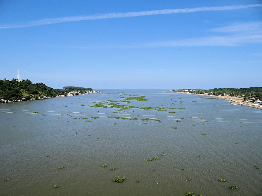
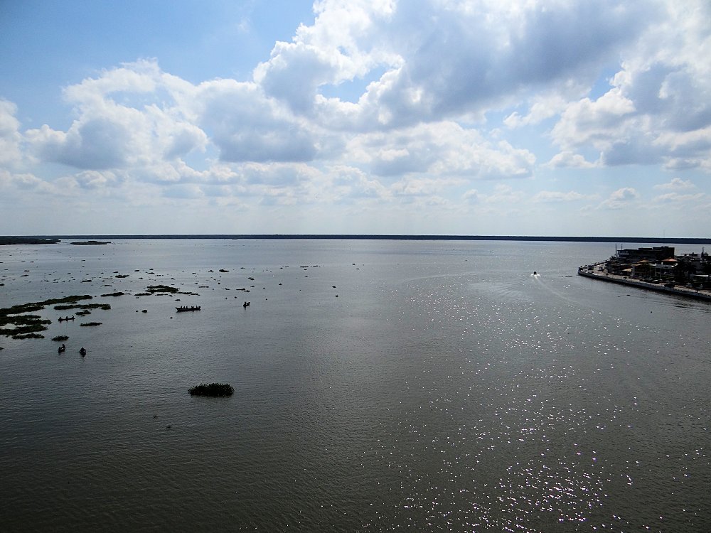
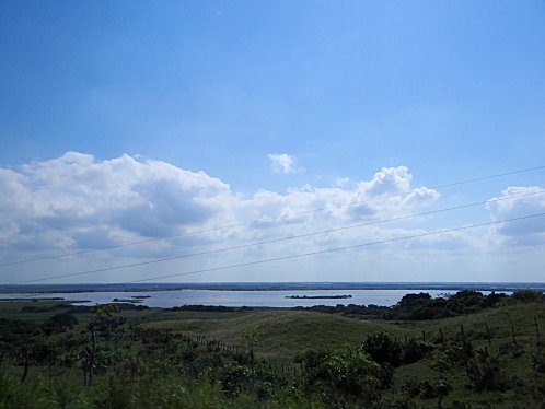
We wish to thank Wikipedia, the free encyclopedia for some of the information on our web page. We share images and information with Wikipedia. Port Alvarado, or Puerto de Alvarado is a city in the Mexican state of Veracruz. It's official name is; Ilustre, Heroica y Generosa Ciudad y Puerto de Alvarado. Puerto de Alvarado is located 64 km from the city of Veracruz, Veracruz, on Federal Highways 180 and 125. Alvarado is bordered by Boca del R�o, Tlalixcoyan, Medell�n, Ignacio de la Llave, Ciudad Lerdo de Tejada, Tlacotalpan and Acula. It is 10m above sea level. It lies in the so-called "Region Papaloapan" bordered on the south by the municipalities of Acula, Tlacotalpan and Lerdo de Tejada, on the east by the Gulf of Mexico and on the west by Ignacio de la Llave. The geographic size of Alvarado is 840 square kilometers with a population in the year 2000 of 22,608 people. Alvarado was founded in the 16th century. In 1518, Pedro de Alvarado arrived to Atlizintla and named the town and river after himself. Then in 1563, Juan de Sahag�n built the port of Alvarado. It was used to transport food to other countries. Its major exports are coffee, fruits, and sugar. Its major economies are in fishing and farming with sugar cane and the coffee being major products. Before the Spanish arrived, Port Alvarado was known as Atlizintla in the Mayan Language. Atlizintla means, "next to plenty of water." It was called Atlizintla, because it was southwest of the peninsula that forms between the opening or mouth of the Papaloapan River, and the Papaloapan Lagoon System; on the Gulf of Mexico . The Spanish named the city Alvarado after the name of the Spanish conquistador Pedro de Alvarado. By about 1600 Alvarado was known as; "San Cristobal de Alvarado," in honor of the patron saint of Alvarado. In the early twentieth century, the city was largely known only as "Alvarado." If you visit this area, you will be impressed by the large amount of fresh water in the area. To the east and northeast you will see the Gulf Of Mexico for as far as you can see. Then to the west you will see fresh water in the Papaloapan River basin for as far as you can see. Then as you travel towards the south or towards the southwest you will see land that is either covered with water in places or you will see numerous lakes. Indeed, this is a "Land Of Many Waters." The name Papaloapan comes from the Nahuatl language from the word, Papalotl, "butterfly," and apan, "that is," meaning "the river of butterflies." The Papaloapan River is a major river of Mexico, which flows into the Gulf of Mexico , mainly from the cities of Tuxtepec ( Oaxaca ), Alvarado , Tlacotalpan and Cosamaloapan ( Veracruz ). The Papaloapan River basin is the second largest river basin, in Mexico, in terms of its flow into the Gulf Of Mexico. Depending upon whose research you read, the length of the river is 354 km to 900 km. Most say it is about 900 km long. According to the 2005 census, 3,398,992 people in three states: Puebla, Oaxaca, & Veracruz; live upon its banks. From a satalite view, the image of the Papaloapan River basin resemble an inverted tree, with roots at the mouth of the basin and its branches being the multiple-streams of all sizes, which are increasing its flow of fresh water toward the Gulf Of Mexico. The land of the Papaloapan River basin is so very low in elevation during the last 430 km of its length that it only drops in elevation about 90 meters, until it empties into the Gulf Of Mexico. To prevent catastrophic floods, two huge dams have been built upon the Papaloapan River basin. They are the Presa Miguel Aleman, and the Cerro de Oro Dam upon the rivers Tonto, and Santo Domingo; which drain into the Papaloapan River basin. Their reservoirs join together and form the largest artificial lake in Mexico. During pre-Columbian times into the nineteenth century; the Papaloapan River basin was a major means of transportation, & trade in the region. During recent times, deforestation, has caused the widening of the river, & the raising of the elevation of its bottom, so that the river is no longer navigable. Ecological changes, mainly deforestation, have caused the widening of the river, & the elevation of the river bottom; so that the river is no longer navigable. Today, the Papaloapan River basin is densely populated, & its major problem is pollution. The pollution is from urban, agricultural, & industrial waste.
|
There are at least two directions you could travel when visiting Puerto de Alvarado. You could be traveling from Villahermosa or Veracruz, Mexico. The Carlos Rovirosa P�rez International Airport or Villahermosa International Airport (IATA: VSA, ICAO: MMVA) is the international airport located at Villahermosa, Tabasco, Mexico. It handles the national and international air traffic for the city of Villahermosa. To easily get to Puerto de Alvarado, we could suggest flying into Villahermosa, renting a hotel to stay in and a car to drive to Puerto de Alvarado. You could also rent a taxi through your hotels Concierge Services to drive you to and from Puerto de Alvarado. A great place to stay when visiting Puerto de Alvarado, in Veracruz, Mexico is the Crowne Plaza Hotel VILLAHERMOSA, TAB. PASEO USUMACINTA 1708 TABASCO; VILLAHERMOSA, 86035 MEXICO. The Crowne Plaza Villahermosa Hotel is ideal for business and pleasure. The Crowne Plaza Villahermosa Hotel is a modern style hotel offering full services in the city. It is about 2 miles from the La Venta Park. We have links on this page that will connect you with the Crowne Plaza Villahermosa Hotel. Another great place to stay when visiting Puerto de Alvarado, in Veracruz, Mexico is the Holiday Inn Express VILLAHERMOSA TABASCO 2000 PERIFERICO CARLOS PELLICER C. #4000; VILLAHERMOSA, 86035 MEXICO. It also provides complete services at a great price. It is about 1.5 miles from the La Venta Park. We have links on this page that will connect you with the Holiday Inn Express Villahermosa Hotel. Of course, there are many other hotels in Villahermosa to chose from, but the two we have recommended are ones that we have used ourselves. We suggest getting a hotel in Villahermosa and then letting them arrange either a car or a tour of Alvarado Port. They could also arrange a car or tour of Villahermosa, and/or the PARQUE LA VENTA. You also could arrange for a tour of the LaVenta Archaeological Site near Huimanguillo. You will need a full day for that tour. If you call the hotels Concierge Services ahead of your arrival, all of this can be pre-arranged for you. Your other option is to fly into the airport at Veracruz, Mexico and to use their services. The General Heriberto Jara International Airport or Veracruz International Airport (IATA: VER, ICAO: MMVR) is an international airport located at Veracruz, Veracruz, Mexico. It handles national and international air traffic for the city of Veracruz. We have personally stayed at the Fiesta Americana Veracruz, at Boulevard Manuel Avila Camacho s/n Fracionnamiento Costa de Oro, 94299 Veracruz We can highly recommend this hotel. There are also two Holiday Inn's in Veracruz, and we can recommend them also. Click on our IHG links. To easily get to Puerto de Alvarado, we would also suggest flying into Veracruz, renting a hotel to stay in and a car to drive to Puerto de Alvarado. You could also rent a taxi through your hotels Concierge Services to drive you to and from Puerto de Alvarado. We do this often, when traveling in Mexico. It is safe and it works!!! We have never experienced a problem doing it this way! Priceline.com can also arrange that for you. In fact, we think they are the best way to do it! We have personally, booked flights, hotels, and vacations, through Priceline.com and we can highly recommend them. Their website is very easy to use! We have some links to Priceline.com on this page, since they can arrange all of your air flights, hotels and car. We of course, appreciate your use of the advertising on our pages, since it helps us to keep our pages active.
|
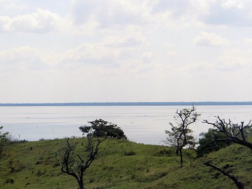 | 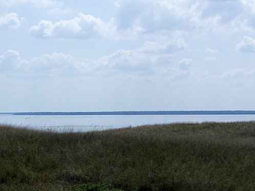 |
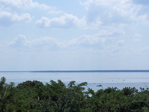
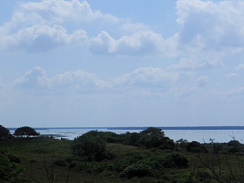
| Many Miles Away From Alvarado Port. Looking West, Driving South. Towards Alvarado Port, We See The Papaloapan River Basin & Lagoon, Veracruz, Mexico. Also Called: The "Waters Of Ripliancum." | Many Miles Away From Alvarado Port. Looking West, Driving South. Towards Alvarado Port, We See The Papaloapan River Basin & Lagoon, Veracruz, Mexico. Also Called: The "Waters Of Ripliancum." |
|---|---|
 |  |
| Many Miles Away From Alvarado Port. Looking West, Driving South. Towards Alvarado Port, We See The Papaloapan River Basin & Lagoon, Veracruz, Mexico. Also Called: The "Waters Of Ripliancum." | Many Miles Away From Alvarado Port. Looking West, Driving South. Towards Alvarado Port, We See The Papaloapan River Basin & Lagoon, Veracruz, Mexico. Also Called: The "Waters Of Ripliancum." |
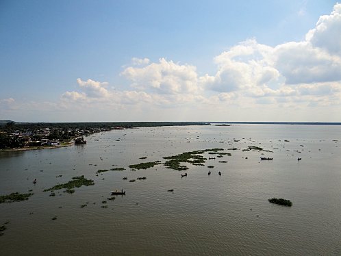 | |
| Looking West From Alvarado Port, or Puerto de Alvarado, Near The Papaloapan River Basin & Lagoon, Veracruz, Mexico. Also Called: The "Waters Of Ripliancum." | Looking West From Alvarado Port, or Puerto de Alvarado, Near The Papaloapan River Basin & Lagoon, Veracruz, Mexico. Also Called: The "Waters Of Ripliancum." |
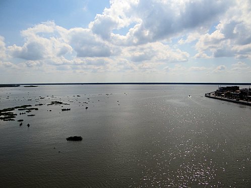 | 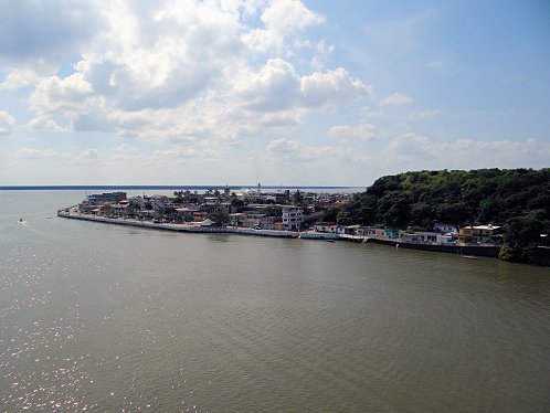 |
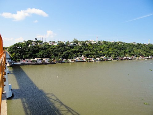
| Looking West From Alvarado Port, or Puerto de Alvarado, Near The Papaloapan River Basin & Lagoon, Veracruz, Mexico. Also Called: The "Waters Of Ripliancum." | Looking West From Alvarado Port, or Puerto de Alvarado, Near The Papaloapan River Basin & Lagoon, Veracruz, Mexico. Also Called: The "Waters Of Ripliancum." |
 | |
| Looking East To The Gulf Of Mexico From Alvarado Port, or Puerto de Alvarado, Near The Papaloapan River Basin & Lagoon, Veracruz, Mexico. Also Called: The "Waters Of Ripliancum." | Looking East To The Gulf Of Mexico From Alvarado Port, or Puerto de Alvarado, Near The Papaloapan River Basin & Lagoon, Veracruz, Mexico. Also Called: The "Waters Of Ripliancum." |
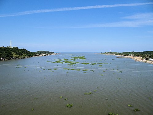 | 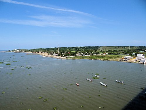 |
| Looking East To The Gulf Of Mexico From Alvarado Port, or Puerto de Alvarado, Near The Papaloapan River Basin & Lagoon, Veracruz, Mexico. Also Called: The "Waters Of Ripliancum." | Looking East To The Gulf Of Mexico From Alvarado Port, or Puerto de Alvarado, Near The Papaloapan River Basin & Lagoon, Veracruz, Mexico. Also Called: The "Waters Of Ripliancum." |
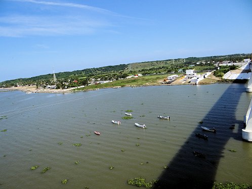 | 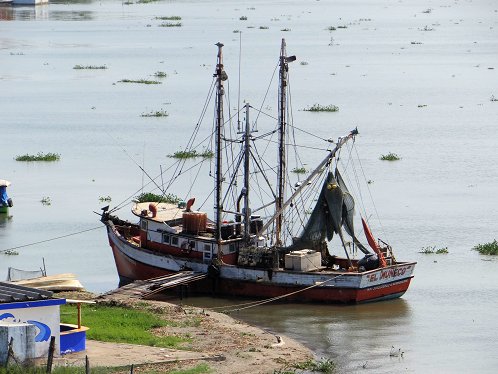 |
| Looking East To The Gulf Of Mexico From Alvarado Port, or Puerto de Alvarado, Near The Papaloapan River Basin & Lagoon, Veracruz, Mexico. Also Called: The "Waters Of Ripliancum." | Ship. Looking West From Alvarado Port, or Puerto de Alvarado, Toward The Papaloapan River Basin & Lagoon, Veracruz, Mexico. Also Called: The "Waters Of Ripliancum." |
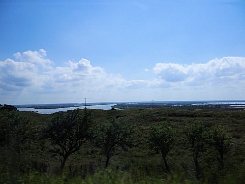 | |
| We See Water Everywhere ! Looking West Driving South From Alvarado Port, or Puerto de Alvarado, Near The Papaloapan River Basin & Lagoon, Veracruz, Mexico. Also Called: The "Waters Of Ripliancum." | We See Water Everywhere ! Looking West Driving South From Alvarado Port, or Puerto de Alvarado, Near The Papaloapan River Basin & Lagoon, Veracruz, Mexico. Also Called: The "Waters Of Ripliancum." |
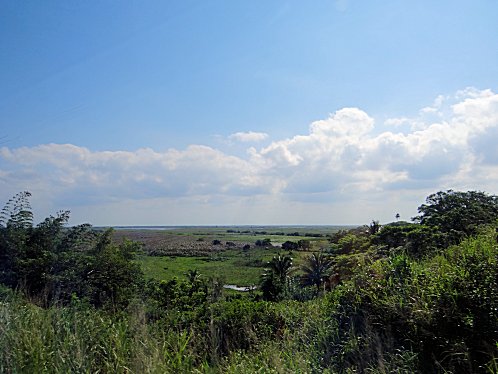 | 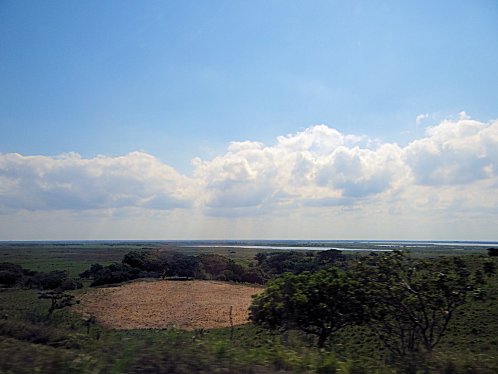 |
| We See Water Everywhere ! Looking West Driving South From Alvarado Port, or Puerto de Alvarado, Near The Papaloapan River Basin & Lagoon, Veracruz, Mexico. Also Called: The "Waters Of Ripliancum." | We See Water Everywhere ! Looking West Driving South From Alvarado Port, or Puerto de Alvarado, Near The Papaloapan River Basin & Lagoon, Veracruz, Mexico. Also Called: The "Waters Of Ripliancum." |
We Are Proud Of Our SafeSurf Rating!
Click On Any Of The Following Links By Amazon.Com
For Books Or Videos About Touring In Mexico. No Obligation!
Click On The Bottom Link Marked GO, Then Look At The Bottom Of The Page That Comes Up.
There You Will See Travel Agencies That Are Advised By Amazon.Com
For Touring In Mexico. No Obligation!
Here Are Some Links To The Very Best & Most Popular Items Sold On Amazon.Com
To Learn More! Click The Links Below. No Obligation, Of Course!
Other Olmec Ruins & Attractions!
There You Will See Travel Agencies That Are Advised By Amazon.Com
For Touring In Mexico. No Obligation!
Here Are Some Links To The Very Best & Most Popular Items Sold On Amazon.Com
To Learn More! Click The Links Below. No Obligation, Of Course!
Other Olmec Ruins & Attractions!


