Page Two.
Campache, México.
Travel & Tour
Pictures, Photos, Images, & Reviews.
George & Eve DeLange
Google Map To The Edzna or Etzná Archaeological Ruins.
Campache, Rio Bec Region, Mexico.
View Larger Map
We Are Proud Of Our SafeSurf Rating!
Click On Any Of The Following Links By Amazon.Com
For Books Or Videos About Touring In Mexico. No Obligation!
Edzna, Campeche: A brief history.
The ruins of Edzna lie 50 kilometers southeast of Campeche City; their architecture represents the southern extent of the Classic Maya architectural style known as the Puuc. Before the Puuc entered the area, however, Edzna was home to a thriving population who built the most extensive canal and irrigation network in the Maya region, supporting a population in the tens of thousands.
Edzna lies in a wide, flat valley in the drainage of the Rio Champoton. Good soils and a stable supply of water probably brought the first settlers here. The valley's first permanent residents entered the area about 400 B.C.; they were of a great migration of people from the Petén Jungle to the north of Yucatan.
The earliest Edzna (400-250 B.C.) was a small agricultural settlement at the northern end of the current site. They used the clay soils to build aguadas or artificial ponds with raised sides-to store water in the dry season.
Between 250 B.C. and A.D. 150, Edzna underwent a period of phenomenal growth, reaching its maximum population and extent. The key to its success was the construction of the huge system of canals and reservoirs. The aqueducts stretched for many kilometers, the longest being the 12-kilometer canal from the ceremonial center south to the Rio Champoton.
This huge project could not have been completed without thousands of laborers and decades of work.. Researchers believe this Late Preclassic city was the product of urban planning under the reign of one or two powerful monarchs.. Edzna also had a moat that surrounded Edzna for defensive purposes.
After A.D. 150, Edzna’s construction slows down and large-scale construction stops.
In A.D. 600, monumental construction suddenly resumes around the ceremonial center. Between A.D. 600 and 75O, the first stages of the Great and Little Acropolises were erected and the first dated stelae were carved. The hieroglyphic staircase at the base of the Building of Five Stories is dated A.D. 731.
A large part of this history can be found in "Archaeological Mexico, by Andrey Coe. We highly recommend reading this book prior to traveling to Mexico.
The Ing. Alberto Acuńa Ongay International Airport (IATA: CPE, ICAO: MMCP), also known as Campeche International Airport, is the international airport located in Campeche, Campeche, Mexico. It handles the national and international air traffic of the city of Campeche. It's operated by Aeropuertos y Servicios Auxiliares, a federal government-owned corporation.
There are several good hotels or motels in the Campeche area, and if you need a place to stay; Priceline.com can arrange that for you. In fact, we think they are the best way to do it!
We also have links on this page, that will connect you directly with several of the best hotels in in the Campeche area. Hotels that we have personally used!
We suggest getting a hotel, and then letting them arrange for either a car, or a tour of the Campeche area and/or the Río Bec Region. If you call their Concierge Services, ahead of your arrival, all of this can be pre-arranged for you.
We have used this method, many times, when traveling in Mexico. We have found it to be safe and it works!!! We have never experienced a problem, doing it this way!
Our first choice for exploring this region (only due to their location) is the Chicanna Ecovillage Resort at Xpujil. It is an OK place to stay but, don't expect a 5 star rating hotel. Their staff is not known to be helpful. There are no other nice places to stay in this central location. Hotels that are higher rated are only found in Campeche.
We have personally, booked flights, hotels, and vacations, through Priceline.com and we can highly recommend them. Their website is very easy to use!
We have some links to Priceline.com on this page, since they can arrange all of your air flights, hotels and car.
We of course, appreciate your use of the advertising on our pages, since it helps us to keep our pages active.
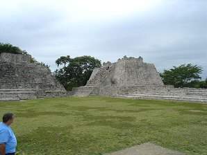
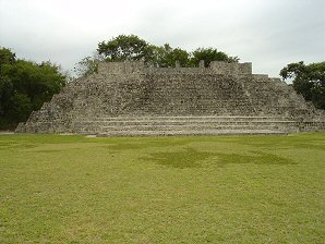
Left
"House Of The Moon"
"Southwest Temple."
On Right.
Steam Bath On Top. "House Of The Moon." 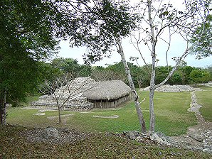
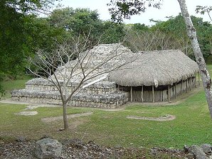
Temple Of Masks. Temple Of Masks. 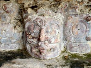
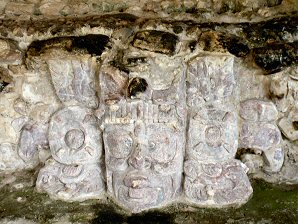
East Sun God,
"Kinich Ahau"
Also Known As
"Ah Xoc Kin." West Sun God,
"Kinich Ahau"
Also Known As
"Ah Xoc Kin." 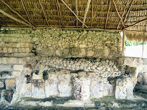
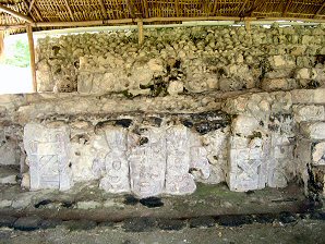
East Sun God. West Sun God. 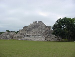
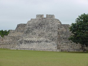
"South Temple." "South Temple." 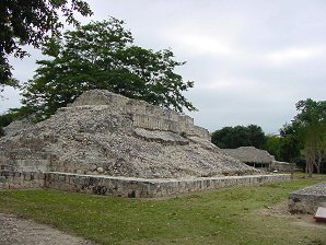
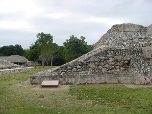
Ball Court. Ball Court. 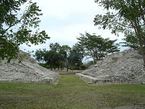
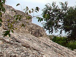
Ball Court. Close Up
Of Ball Court Ring. 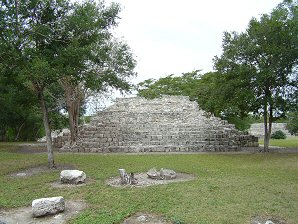
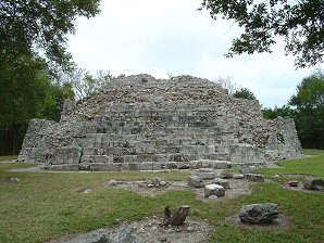
"Temple Of Decorated Stairs." "Temple Of Decorated Stairs." 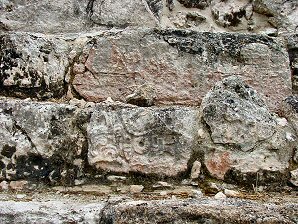
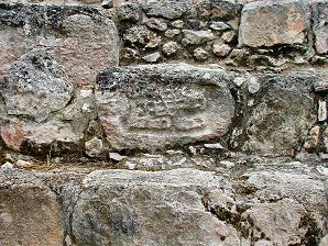
Stair Decoration. Stair Decoration. 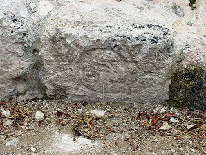
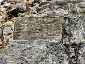
Stair Decoration. Stair Decoration. 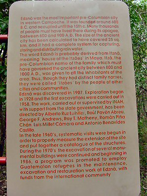
Sign Describing
"Platform Of
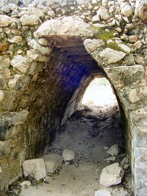
The Ambassadors." Arch Way In
Area Of Ambassadors. 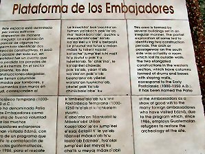
Sign Describing
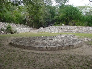
"Platform Of The Ambassadors." Circular Altar. 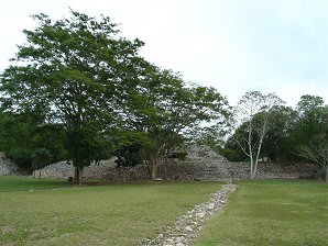
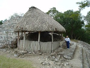
Structure 419-2. Structure 419-2. 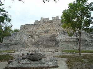
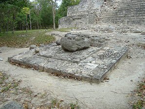
Serpent Head Altar. Serpent Head Altar. 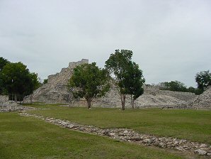
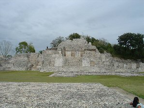
North Temple With
Nohoch-Na (Great House)
To The Right Background. "Platform Of The Knives."
Called So
Because Some Flint Knives
Were Found There. 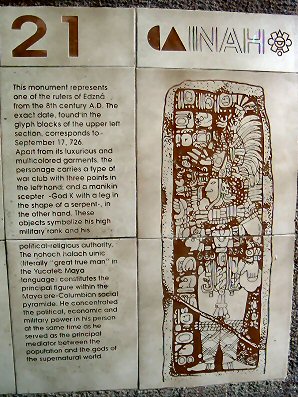
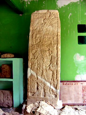
Stele 21 Description Sign. Stele 21 From The Puuc Patio. 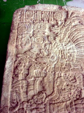
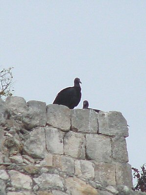
Detail Of Stele 21. Vulture Mother And Baby.
We Are Proud Of Our SafeSurf Rating!
Click On Any Of The Following Links By Amazon.Com
For Books Or Videos About Touring In Mexico. No Obligation!
Click Here On Links To Great Mexico Hotels.
Other Rio Bec Region Ruins!
Edzna, Campeche: A brief history. The ruins of Edzna lie 50 kilometers southeast of Campeche City; their architecture represents the southern extent of the Classic Maya architectural style known as the Puuc. Before the Puuc entered the area, however, Edzna was home to a thriving population who built the most extensive canal and irrigation network in the Maya region, supporting a population in the tens of thousands. Edzna lies in a wide, flat valley in the drainage of the Rio Champoton. Good soils and a stable supply of water probably brought the first settlers here. The valley's first permanent residents entered the area about 400 B.C.; they were of a great migration of people from the Petén Jungle to the north of Yucatan. The earliest Edzna (400-250 B.C.) was a small agricultural settlement at the northern end of the current site. They used the clay soils to build aguadas or artificial ponds with raised sides-to store water in the dry season. Between 250 B.C. and A.D. 150, Edzna underwent a period of phenomenal growth, reaching its maximum population and extent. The key to its success was the construction of the huge system of canals and reservoirs. The aqueducts stretched for many kilometers, the longest being the 12-kilometer canal from the ceremonial center south to the Rio Champoton. This huge project could not have been completed without thousands of laborers and decades of work.. Researchers believe this Late Preclassic city was the product of urban planning under the reign of one or two powerful monarchs.. Edzna also had a moat that surrounded Edzna for defensive purposes. After A.D. 150, Edzna’s construction slows down and large-scale construction stops. In A.D. 600, monumental construction suddenly resumes around the ceremonial center. Between A.D. 600 and 75O, the first stages of the Great and Little Acropolises were erected and the first dated stelae were carved. The hieroglyphic staircase at the base of the Building of Five Stories is dated A.D. 731. A large part of this history can be found in "Archaeological Mexico, by Andrey Coe. We highly recommend reading this book prior to traveling to Mexico.
|
The Ing. Alberto Acuńa Ongay International Airport (IATA: CPE, ICAO: MMCP), also known as Campeche International Airport, is the international airport located in Campeche, Campeche, Mexico. It handles the national and international air traffic of the city of Campeche. It's operated by Aeropuertos y Servicios Auxiliares, a federal government-owned corporation. There are several good hotels or motels in the Campeche area, and if you need a place to stay; Priceline.com can arrange that for you. In fact, we think they are the best way to do it! We also have links on this page, that will connect you directly with several of the best hotels in in the Campeche area. Hotels that we have personally used! We suggest getting a hotel, and then letting them arrange for either a car, or a tour of the Campeche area and/or the Río Bec Region. If you call their Concierge Services, ahead of your arrival, all of this can be pre-arranged for you. We have used this method, many times, when traveling in Mexico. We have found it to be safe and it works!!! We have never experienced a problem, doing it this way! Our first choice for exploring this region (only due to their location) is the Chicanna Ecovillage Resort at Xpujil. It is an OK place to stay but, don't expect a 5 star rating hotel. Their staff is not known to be helpful. There are no other nice places to stay in this central location. Hotels that are higher rated are only found in Campeche. We have personally, booked flights, hotels, and vacations, through Priceline.com and we can highly recommend them. Their website is very easy to use! We have some links to Priceline.com on this page, since they can arrange all of your air flights, hotels and car. We of course, appreciate your use of the advertising on our pages, since it helps us to keep our pages active.
|
 |  |
| Left "House Of The Moon" "Southwest Temple." On Right. Steam Bath On Top. | "House Of The Moon." |
|---|---|
 |  |
| Temple Of Masks. | Temple Of Masks. |
 |  |
| East Sun God, "Kinich Ahau" Also Known As "Ah Xoc Kin." | West Sun God, "Kinich Ahau" Also Known As "Ah Xoc Kin." |
 |  |
| East Sun God. | West Sun God. |
 |  |
| "South Temple." | "South Temple." |
 |  |
| Ball Court. | Ball Court. |
 |  |
| Ball Court. | Close Up Of Ball Court Ring. |
 |  |
| "Temple Of Decorated Stairs." | "Temple Of Decorated Stairs." |
 |  |
| Stair Decoration. | Stair Decoration. |
 |  |
| Stair Decoration. | Stair Decoration. |
 |  |
| Sign Describing "Platform Of The Ambassadors." | Arch Way In Area Of Ambassadors. |
 |  |
| Sign Describing "Platform Of The Ambassadors." | Circular Altar. |
 |  |
| Structure 419-2. | Structure 419-2. |
 |  |
| Serpent Head Altar. | Serpent Head Altar. |
 |  |
| North Temple With Nohoch-Na (Great House) To The Right Background. | "Platform Of The Knives." Called So Because Some Flint Knives Were Found There. |
 |  |
| Stele 21 Description Sign. | Stele 21 From The Puuc Patio. |
 |  |
| Detail Of Stele 21. | Vulture Mother And Baby. |
We Are Proud Of Our SafeSurf Rating!
Click On Any Of The Following Links By Amazon.Com
For Books Or Videos About Touring In Mexico. No Obligation!
Click Here On Links To Great Mexico Hotels.
Click Here On Links To Great Mexico Hotels.
Other Rio Bec Region Ruins!


