Northern Veracruz, Mexico
Travel & Tour
Pictures, Photos, Images, Information, Reviews.
George & Eve DeLange
Google Map To El Tajin Archaeological Ruins, Veracruz, Mexico.
View Larger Map
We Are Proud Of Our SafeSurf Rating!
Click On Any Of The Following Links By Amazon.Com
For Books Or Videos About Touring El Tajin, In Mexico. No Obligation!

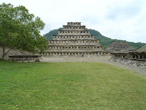
El Tajin's Famous "Pyramid Of The Niches". SW Corner.
 |
| El Tajin's Famous "Pyramid Of The Niches". SW Corner. |
|---|
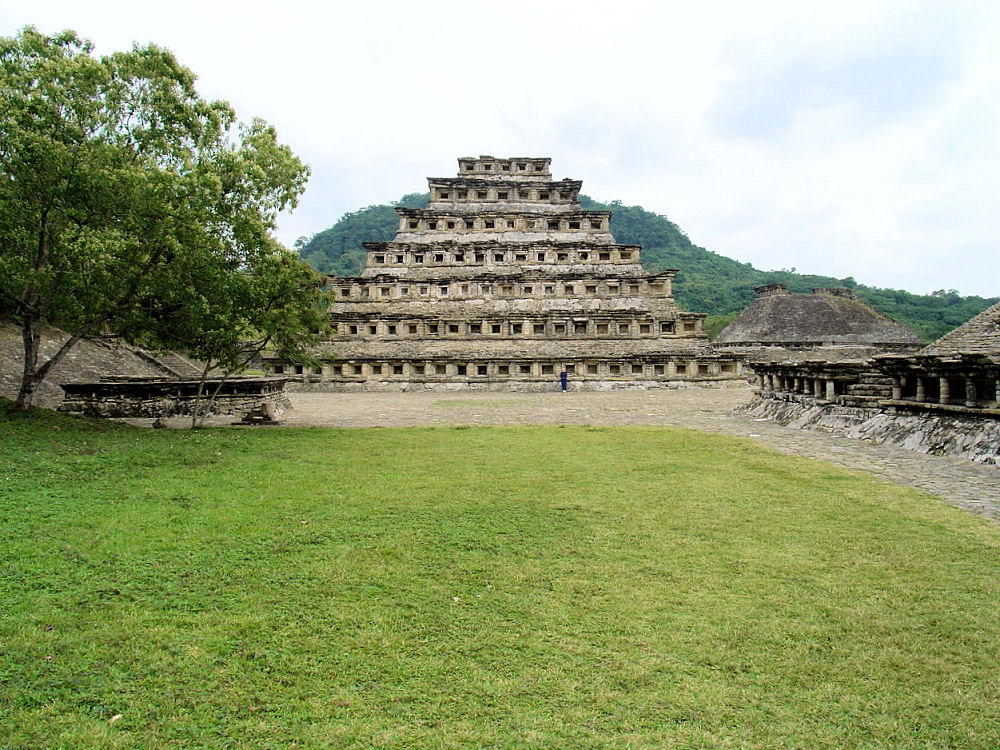 |
| Audrey DeLange At El Tajin's Famous "Pyramid Of The Niches". West Side Building 5, Right Background & Structure 12 Right Foreground. |
|---|
 |
| El Tajin Site Map From Andrew Coe's, "Archaeological Mexico." |
|---|
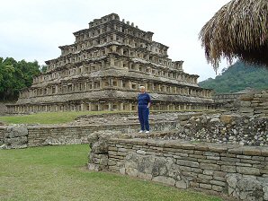
El Tajin [el tAhEn�] ("thunder") Archaeological Ruins, Veracruz, Mexico: 20�28'N 97�28'W. Discovered in the late eightennth century, the site derives its name from a modern Totonac belief that 12 old lords of the thunderstorm, known collectively as "Taj�n," live among its ruins. According to indigenous maps drawn at the time of the conquest, however, the site was once known as Mictlan, the "abode of the dead". This site has not been plagued with the tourists as much as Palenque, Chichen Itza, or Tulum. It is still a place where you can feel like you are the only person there. But, we think that will soon change. It already has the crowd of vendors at the front entrance, but they are not as agressive as at Palenque. We used Andrew Coe's, Archaeological Mexico as a guide book to explore this ruins. We followed his directions as we walked through the site and found that without his help we would have not understood what we were seeing. We strongly recommend that if you go to any of the archaeological sites in Mexico, you should make this book required reading. Then take the book with you as you explore the ruins. The museum, and restrooms are clean. We were here on January 20, 2004 at about 10:00AM. We needed about four hours to see most of the site. We actually were rather rushed and we would recommend that you plan to spend a full day on the site if possible. If you wish to really explore the site and take lots of pictures we recommend two days. Now that we look back at the tour, we wish that we had done so. We pretty much had the site to ourselves until about noon so we recommend getting there as soon as they open. We carried our own water and light snacks with us because it is a long walk to get back to the entrance where you can purchase food and drink. Also, be sure to use the restroom before going out on the site. It's a long walk back to the restroom area once you are on site. When we got back to the front entrance after our tour we were entertained by the Totonac dancers performing the Dance of the Voladores (Flying Men). Hanging by their feet from a rope, they spin down from the top of a pole and alight just before crashing into the ground. One man dances on top of the pole which is about a hundred feet in the air. He plays a pipe as he dances. It is beautiful to watch. These men perform to earn a living for their families. We recommend that you pay them if you watch. They collect money before the show. There are large gaps in El Tajin's chronology. Therefore, archaeologists still have a lot to learn about El Tajin. Archaeologists believe El Tajin became a regional power sometime about 100 A.D. There is not yet any evidence for a large earlier occupation. The region's Preclassic inhabitants were more closely related to the Huastecs of northern Veracruz than to the current Totonacs who were probably Postclassic arrivals. El Tajin's earliest center was around the Arroyo Group at the southern end of the site (near the entrance). Then from about 300 to 600 A.D. the construction crept north up into the valley and then up onto the ridges to the west. The foundations for the "Pyramid of the Niches" and the "Tajin Chico" area were built at this time. These early building complexes were well planned. As the city became more crowded, later buildings were built wherever there was room among the other structures. Although there is not any evidence for a large early occupation, archaeologists believe El Tajin became a regional power in about 100 A.D. The region's Preclassic inhabitants were more closely related to the Huastecs of northern Veracruz than to the Totonacs who came to the area during the Postclassic Era. El Tajin reached its apex of power between 900 A.D. to 1100 A.D. During the 10th century, its ruler was 13 Rabbit, who we see on a series of reliefs carved on the columns found in the "Building of the Columns". There are 17 ballcourts at the site. Some of the ballcourts may have been for practice, but the South and North Ballcourts were devoted to rituals. Early Postclassic El Tajin covered about 500 hectares and its population was about 30,000. Its empire extended along the Veracruz coast. Then by about 1150 A.D.their culture had collapsed and the city was almost abandoned. Archaeologists believe that El Tajin and the surrounding agricultural region could not support the large population. Then during the Late Postclassic Era of about 1200 A.D. to 1520 A.D., a new people moved into the area of El Tajin. These people were the Totonacs. OUR TOUR OF THE SITE We entered the parking lot by driving in from the south. At the north end of the parking lot there is a building complex with shops, a cafeteria, a museum, and the site entrance. The museum contains a few interesting objects, the most important pieces are the stone column reliefs that show 13 Rabbit, the 10th-century ruler of El Tajin, engaged in a ritual sacrifice. There are many vendors at the south and west end or the parking lot. Most of the ruins are alligned to the north-south axis of a narrow valley. We entered the site by heading north from the main entrance. We passed some small east west structures and then the main path enters the Arroyo Group, which is a large plaza flanked on four sides by large, relatively crudely constructed temples. Archaeologists believe this open space, occupying the city's entrance, was El Tajin�s main marketplace. On the north side of the plaza we could see Building 16, which contains many rows of niches typical of El Tajin. Beyond the plaza's southwestern corner there is an unrestored ballcourt. The path then exits the plaza's northeastern corner and passes between Ballcourts 13/14 on the left and 17/27 on the right. These are I-shaped with closed ends. From here, we followed a path which branches left into the site's Central Zone. In this Central Zone we found over a dozen large and small structures. The path then enters the South Ballcourt, which runs east west between Building 6 to the south and, opposite, the large platform of Building 5. This was probably a ritual ballcourt since it is one long straight court with no walls at the two ends and straight rather than sloping interior walls. Its walls are also decorated with six relief panels that explain the various rituals surrounding the Mesoamerican ball game at El Tajin. We now return to the ball court�s east side and the front of the large platform immediately to the north. Here we find five structures of varying sizes at the top of the platform; the largest is the central Building 5. Building 5 is a two-stage temple constructed from a low talud topped with a row of niches where the tablero would be and then a long talud rising to the top. Just above the first tier, the base of the central staircase is the site of a V-shaped sculpted column depicting a seated figure with a skull for a head.We could not get close enough to see it very well. Building 5 faces east over a small plaza containing a raised altar. On the plaza's east side we see Building 15, which is a long platform with two staircases going upward. The north side of this structure almost touches the twin Buildings 3 to the left and 23 to the right. Building 3 is a seven-level pyramid that was painted blue. Building 23 is among the last built at El Tajin, it has five tiers without niches. Looking to the west side of Building 3 we can see another small plaza. On the far side is the famous "Pyramid of the Niches", also called Building 1. This is El Tajin's most famous building. The "Pyramid of the Niches" rises 20 meters on seven tiers, with a wide staircase rising up its eastern side. This staircase is bordered by a step-and-fret motif; probably representing lightning. It is said, but not proven, that there are 365 niches in the structure, one for each day of the year. I have over 35 years of experience in astronomy and I could not see 365 niches and other than the fact that the sun could fill the east and west sides of the structure with light near equinox, I can see no other astronomical alignment. The seven tiers of Building One contain several square niches which number a total of 365. These niches each represent the days of the solar year. This structure may have been a giant calendar. The "Pyramid of the Niches" exterior was originally painted red, while the niches were painted black. The "Pyramid of the Niches" was built on another, far simpler temple that was built during the first phase of the urban center. Various sculptures, including a large royal figure, were found at the foot of the stairs. There are large square blocks along the base which held poles that probably had ritual banners attached to them. Just south of the "Pyramid of the Niches" stands a low platform running east - west, which was probably a residential complex. A large thatched roof covers a series of small rooms. Around the base of the outer wall runs a long, broken relief which still bears traces of red paint. Straight west we see Building 12, which rises in a two-stage structure similar to Building 5. Its unique feature also is its niches, which are separated from each other by freestanding columns rather than walls. Upon returning to the plaza in front of the "Pyramid of the Niches", we saw a large, low unrestored mound along its northern border. We then took the path exiting to the right (east) of it, where we entered a larger open space which contains the North Ballcourt. The North Ballcourt was probably for ritual purposes just like the South Ballcourt was. The walls of the North Ballcourt are about 26 meters long and they are decorated with six bas-relief panels, three each on the north and south sides. They are badly worn and only partially legible. To the west of the North Ballcourt we see a field of large pieces of rock and stucco, perhaps massive paving stones. From here, a path leads up a retaining wall to the terrace that contains the Tajin Chico (Little Tajin). Archaeologists believe this was an elite residential area where Tajin's rulers lived and held court. Tajin Chico has a commanding view over the city's ceremonial center. This terrace uses the valley's natural contours but it is almost totally man-made. ( Our Tour Is Continued On Page Two )
|
Holiday Inn
We suggest getting a hotel in the Poza Rica de Hidalgo area and then letting them arrange either a car or a tour of Poza Rica de Hidalgo and/or El Tajin. If you call the hotels Concierge Services ahead of your arrival, all of this can be pre-arranged for you. We do this all the time, when traveling in Mexico. It is safe and it works!!! We have never experienced a problem doing it this way! El Taj�n International Airport (IATA: PAZ, ICAO: MMPA) is an international airport located near Poza Rica, Veracruz, Mexico. The airport is named after the archeological site of El Taj�n. It handles national and international air traffic for the city of Poza Rica. It's operated by Aeropuertos y Servicios Auxiliares, a federal government-owned corporation. Therefore, we have placed a link to Priceline.com on this page so you can arrange your flights into and out of Poza Rica de Hidalgo, Mexico; as well as your hotel, when visiting this area. We also have links to Holiday Inn.
|
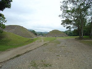 | 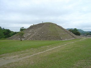 |
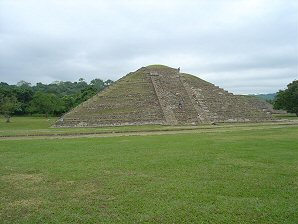
| Entering "Arroyo Group" From South Looking North, Building 16 In Background Pyramid On Left Is South Boundary Of The "Arroyo Group." | SE Corner Of Pyramid On South Side Of The "Arroyo Group." |
|---|---|
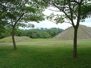 |  |
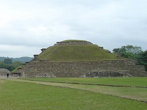
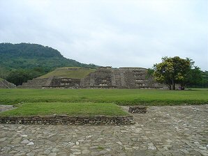
| Platform & Plaza, South Of The South Pyramid Of The "Arroyo Group" | Looking West Toward South Pyramid Of The "Arroyo Group." The "Arroyo Group" Was A Market Area. |
 |  |
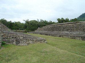
| Building 16 South Side, Looking North Notice Niches On West Side. | West Side, Building 16, Looking East First Building With Niches. |
 | 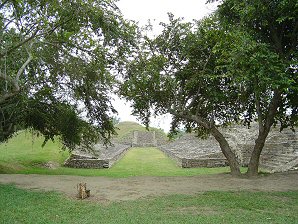 |
| Structure 17 & Structure 27 Ballcourt. Looking Northeast. | Structure 27 & Structure 17 Ballcourt. Looking South Toward Unidentfied Structure. |
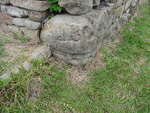 | 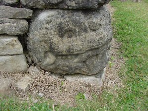 |
| Structure 17 & Structure 27 Ballcourt. Corner Stone Carving. | Structure 27 & Structure 17 Ballcourt. Corner Stone Carving. |
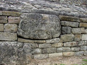 | 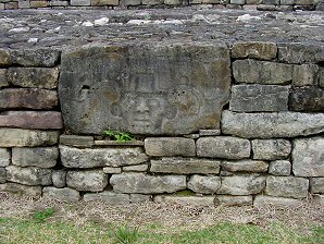 |
| Structure 17 & Structure 27 Ballcourt. Wall Stone Carving. | Structure 17 & Structure 27 Ballcourt. Wall Stone Carving. |
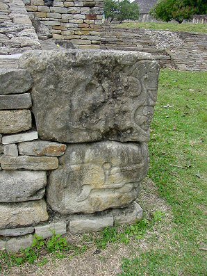 | 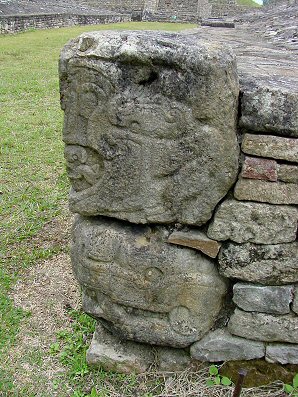 |
| Structure 17 & Structure 27 Ballcourt Corner Stone Carving. | Structure 27 & Structure 17 Ballcourt Corner Stone Carving. |
 | |
| Structure 17 & Structure 27 Ballcourt Corner Stone Carving. | Structure 27 & Structure 17 Ballcourt Corner Stone Carving. |
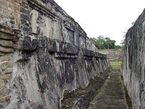 | 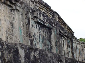 |
| Between Building 3 & Building 23 Original Blue Stucco | Between Building 3 & Building 23 Original Blue Stucco |
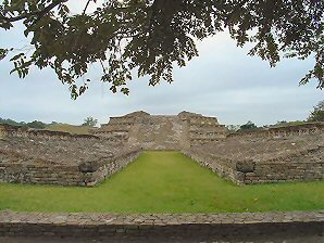 | 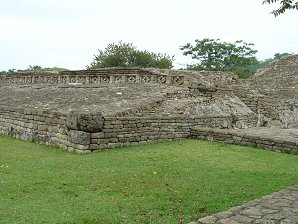 |
| Structure 13 & Structure 14 Ballcourt Looking South Toward Building 16 | Structure 13 & Structure 14 Ballcourt Looking Southwest |
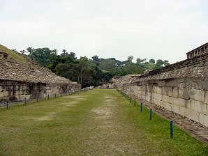 | 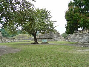 |
| South Ballcourt Looking West Formed From Sides Of Buildings 4 and 5 | Looking North From East Edge Of South Ballcourt L - Building 5, Middle Building 3, R - Building 15 |
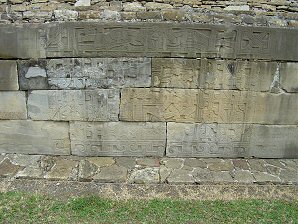 | 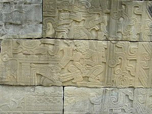 |
| South Ballcourt, South Central Relief Rain God Refills Pulque Vat | South Ballcourt, South Central Relief Puncturing Penis Refills Vat (Ouch)! |
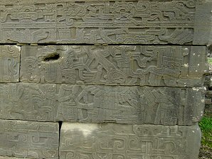 | 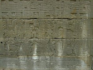 |
| South Ballcourt Reliefs, SW Corner Player In Bed, Eagle Dancing | South Ballcourt Reliefs, NW Corner Ballplayers Facing Each Other Tajin Rain God On Left |
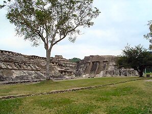 | 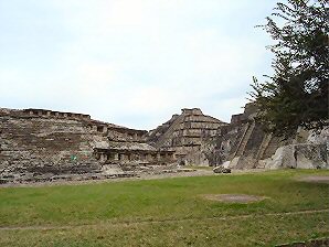 |
| L-R: Building 15, Building 3, Building 23 | "L-R: Building 15, Building 3, Building 23 |
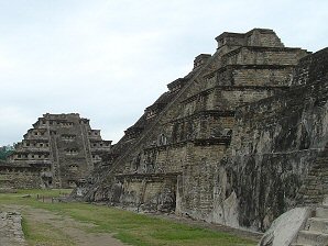 | 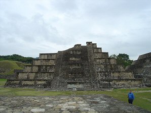 |
| Twin Building 3 "Pyramid Of The Niches" In Background | George DeLange At Twin Building 3, Building 23 On Right |
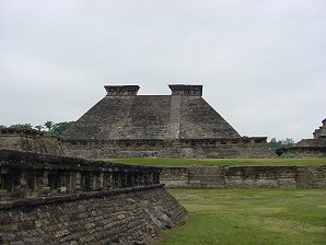 | 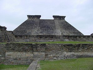 |
| Building Five Looking West Temple Deity Can Barely Be Seen | Building Five Looking West Temple Deity Located Above Middle Window Of Lower Teir |
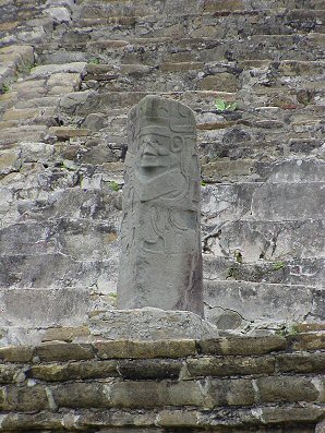 | 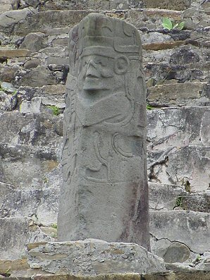 |
| V Shaped Statue Is Possible Temple Five Deity. | Same V Shaped Statue Is Also Possibly El Tajin's Deity. |
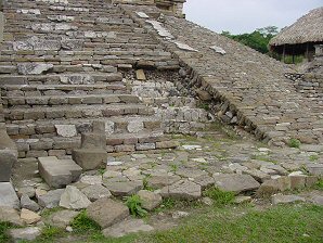 | 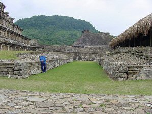 |
| Building 10 East Steps Residence Just South Of Building One Can Be Seen To The Right. | George DeLange At Residence Passageway South Of Building One. |
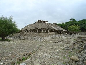 | 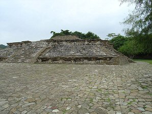 |
| Structure 12 Is Slightly Southwest Of "Pyramid Of The Niches" | Structure 12, Southwest Of "Pyramid Of The Niches." |
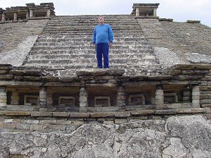 | 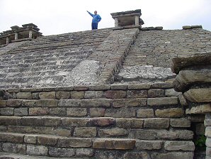 |
| George DeLange At East Steps Structure Twelve West Of Residence | George DeLange At East Top Tier Structure Twelve, West Of Residence |
 | 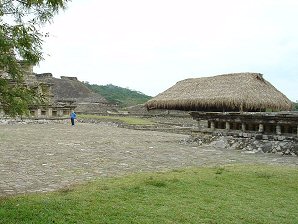 |
| Audrey DeLange At Building Of The Niches." West Side Building 5, Right Background Structure 12 Right Foreground | George DeLange At Thatch Covered Residence Platform South Of "Temple Of The Niches." Structure 12 Right Foreground |
 | 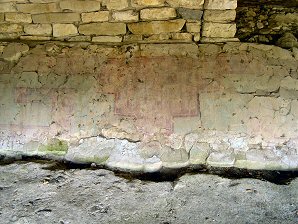 |
| Audrey DeLange On Small Thatch Covered Residence Platform South Of "Temple Of The Niches." | Stucco Frieze On North Side Of Platform. |
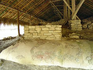 | 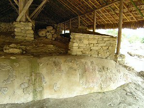 |
| Stucco Frieze On Northwest Of Platform | Stucco Frieze On South West Of Platform |
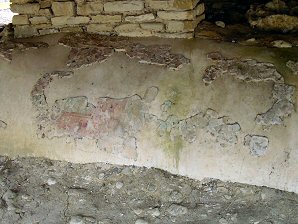 | 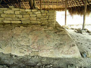 |
| Detail Of Stucco Frieze On North West Of Platform. | Stucco Frieze On North NW Corner Of Platform. |
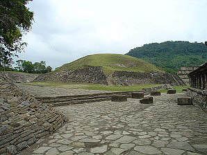 | 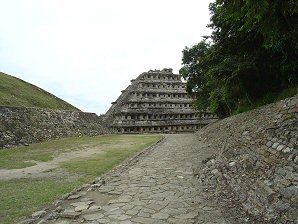 |
| Walking North NE Around The "Pyramid Of The Niches." We Come To A Large Mound Called "Building Four." And Patio East Of Pyramid. | Past "Building 4." The Large Mound On Left Looking Back To The South North Side Of "Pyramid Of The Niches." Retaining Wall To "Tajin Chico" On Right. |
We Are Proud Of Our SafeSurf Rating!
Click On Any Of The Following Links By Amazon.Com
For Books Or Videos About Touring In Mexico. No Obligation!
Click On The Bottom Link Marked GO, Then Look At The Bottom Of The Page That Comes Up.
There You Will See Travel Agencies That Are Recommended By Amazon.Com
For Touring In Mexico. No Obligation!
Here Are Some Links To The Very Best & Most Popular Items Sold On Amazon.Com
To Learn More! Click The Links Below. No Obligation, Of Course!
Other El Tajin Pages!
There You Will See Travel Agencies That Are Recommended By Amazon.Com
For Touring In Mexico. No Obligation!
Here Are Some Links To The Very Best & Most Popular Items Sold On Amazon.Com
To Learn More! Click The Links Below. No Obligation, Of Course!


