Quintana Roo, Yucatán Peninsula, México.
Travel & Tour
Pictures, Photos, Information, Images, Reviews.
George & Eve DeLange
Google Map To The Kinichna Archaeological Ruins.
Quintana Roo, Yucatán Peninsula, Mexico.
View Larger Map
We Are Proud Of Our SafeSurf Rating!
Click On Any Of The Following Links By Amazon.Com
For Books Or Videos About The Mayan People In Mexico. No Obligation!
Kinichna, Quintana Roo, a Mayan ruin near the Rio Bec Region. It actually is located closer to Kohunlich so it should be visited if you are already in the area of Kohunlich.
You could include Dzibanche in the same visit.
We drove on Mexico Highway 186, a paved two-lane road passing through several small Mayan villages. They still had many of the type of houses that the Maya have built for hundreds of years – thatched dwellings
with stone or pole walls, raised on a platform. Near the village of Nachi Chon, approximately 50 km west of Chetumal, we turned at the sign pointing to Dzbinche and Kinichna. A deeply potholed one-lane road runs through maize and cane fields to the deserted sites.
The Mayan sites of this area were mostly known only to archaeologists until recently and the small villages are unaffected by tourism. There are no services at the sites so be sure to take lots of water and food if desired.
Be sure you have plenty of gasolene since the station in Xpuhil is the only place to fill up after leaving Chetumal!
We spent our time walking all over the largest structure on site which is a large pyramid structure with many other structures attached to it.
At this time there are very few signs that actually point out what you are looking at on the site. The signs there are very unclear in their descriptions.
Almost all of our photos were taken at the main structure. They simply show the various parts of the structure.
We have links on this page that will connect you with several of the best hotels in Chetumal.
We suggest getting a hotel and then letting them arrange either a car or a tour of Chetumal and/or the Quintana Roo Region. If you call their Concierge Services ahead of your arrival, all of this can be pre-arranged for you.
We make arrangements this way all the time, when traveling in Mexico. It is safe and it works!!! We have never experienced a problem, doing it this way!
The Chetumal International Airport (IATA: CTM, ICAO: MMCM) is an international airport located in Chetumal, Quintana Roo, Mexico. It handles national and international air traffic for the city of Chetumal. It's operated by Aeropuertos y Servicios Auxiliares, a federal government-owned corporation.
We wish to mention the "Costa Maya", a newely developed small tourist region in the municipality of Othón P. Blanco, in the state of Quintana Roo, Mexico. This municipality is south of Cancún on the border with Belize. The area is generally undeveloped but has been growing rapidly after the construction of a large pier to accommodate cruise ships that are coming to the area.
The Costa Maya includes two small villages - Mahahual and Xcalak and extends physically from Xcalak in the south to the southern border of the Sian Ka'an in the north, a distance of approximately 100 km.
Costa Maya's port also has a new and modern tourist shopping mall. The center has a central plaza with saltwater pools and "swim-up" style bars. There are several jewelery stores and many small shops selling ubiquitous souvenir items. It is generally open only to cruise ship passengers.
Costa Maya is the closest port to many of the lesser known Mayan ruins in the Yucatan including Chacchoben and Kohunlich. Several of the cruise lines are offering tours into these ruins. These sites are less excavated than the better known pyramids near Cancún.
We have placed a link to Priceline.com on this page so you can arrange your flights into and out of Campeche; as well as your hotel, when visiting this area.
Click On Any Of The Following Links By Amazon.Com
For Books Or Videos About Touring The Yucatán Peninsula In Mexico. No Obligation!
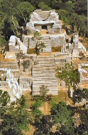
Kinichná
Aerial View
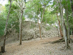
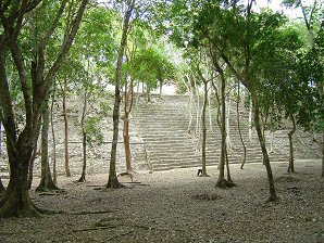
Level B Of Kinichná. Level B Of Kinichná. 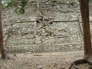
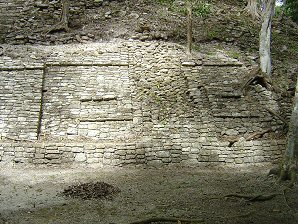
SW Corner Design
Of Level B. SE Corner Design
Of Level B. 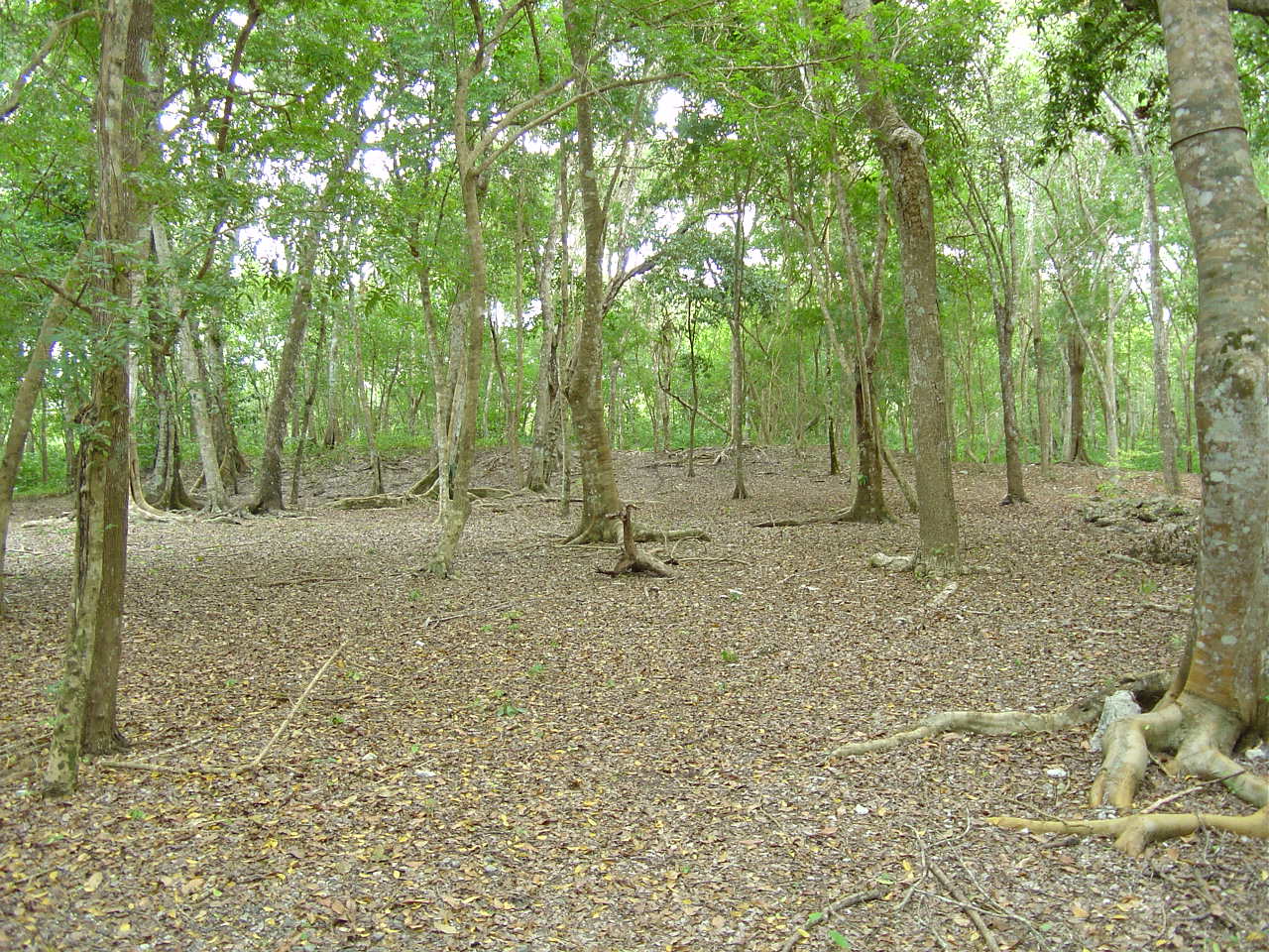
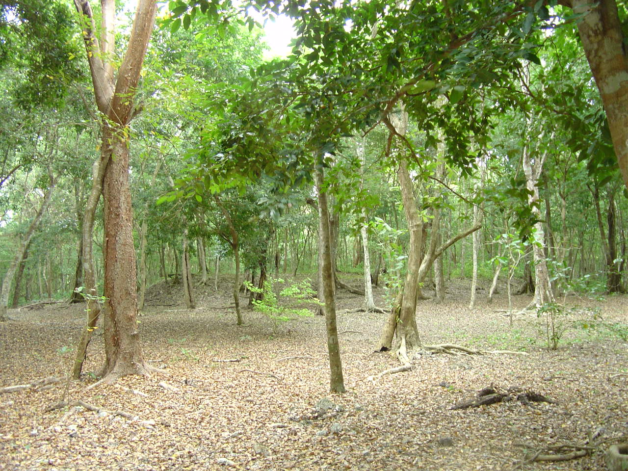
East Structure
In South Plaza. West Structure
In South Plaza. 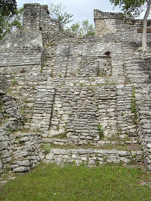
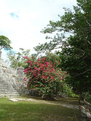
Looking Up & North
From Level C.
At Temples
On Level B. Looking Up & Northeast
From Level C
At Temples On Level B.
From SW Corner
Of Main Steps. 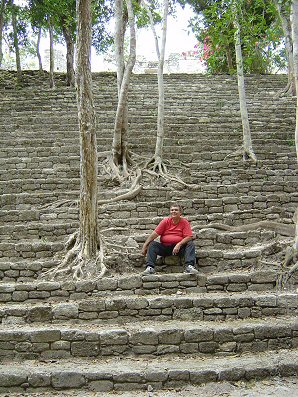
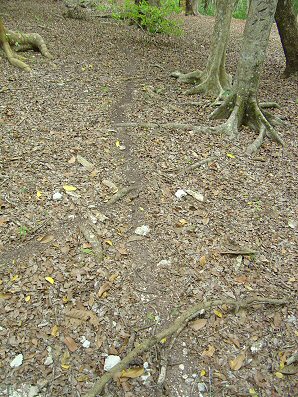
George DeLange
Taking A Break On
Main Steps
Of Level B. George DeLange
Is Watching This
Leaf Cutter Ant Trail. 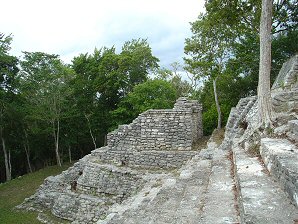
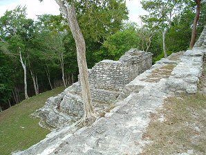
Looking West
From Level B. Looking Southwest
From Level B. 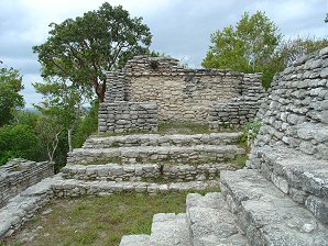
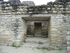
Looking West
From Steps
Of Main Temple
On Top Structure. Looking North
To The Inside Of
The Main Temple
On Top Structure. 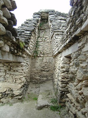
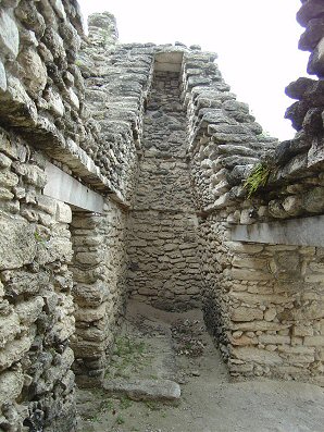
Looking West
From Inside
First Entrance Of
Top Temple Structure. Looking East From Inside
First Entrance Of
Top Temple Structure. 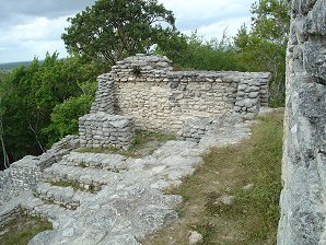
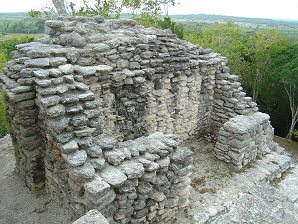
Looking SouthWest
From Outside
First Entrance Of
Top Temple Structure. Looking Southeast
From Outside
First Entrance Of
Top Temple Structure. 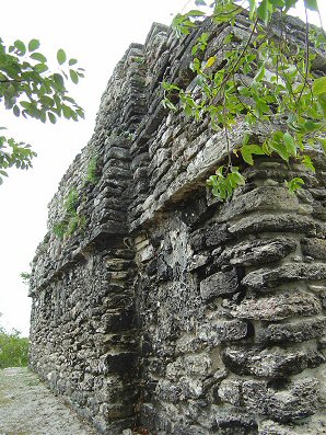
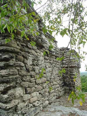
Looking West
From Outside
First Entrance Of
Top Temple Structure. Looking East
From Outside
First Entrance Of
Top Temple Structure.
We Are Proud Of Our SafeSurf Rating!
Click On Any Of The Following Links By Amazon.Com
For Books Or Videos About Touring In Mexico. No Obligation!
Here Are Some Links To The Very Best & Most Popular Items Sold On Amazon.Com
To Learn More! Click The Links Below. No Obligation, Of Course!
Nearby & Rio Bec Region Ruins!
Kinichna, Quintana Roo, a Mayan ruin near the Rio Bec Region. It actually is located closer to Kohunlich so it should be visited if you are already in the area of Kohunlich. You could include Dzibanche in the same visit. We drove on Mexico Highway 186, a paved two-lane road passing through several small Mayan villages. They still had many of the type of houses that the Maya have built for hundreds of years – thatched dwellings with stone or pole walls, raised on a platform. Near the village of Nachi Chon, approximately 50 km west of Chetumal, we turned at the sign pointing to Dzbinche and Kinichna. A deeply potholed one-lane road runs through maize and cane fields to the deserted sites. The Mayan sites of this area were mostly known only to archaeologists until recently and the small villages are unaffected by tourism. There are no services at the sites so be sure to take lots of water and food if desired. Be sure you have plenty of gasolene since the station in Xpuhil is the only place to fill up after leaving Chetumal! We spent our time walking all over the largest structure on site which is a large pyramid structure with many other structures attached to it. At this time there are very few signs that actually point out what you are looking at on the site. The signs there are very unclear in their descriptions. Almost all of our photos were taken at the main structure. They simply show the various parts of the structure.
|
We have links on this page that will connect you with several of the best hotels in Chetumal. We suggest getting a hotel and then letting them arrange either a car or a tour of Chetumal and/or the Quintana Roo Region. If you call their Concierge Services ahead of your arrival, all of this can be pre-arranged for you. We make arrangements this way all the time, when traveling in Mexico. It is safe and it works!!! We have never experienced a problem, doing it this way! The Chetumal International Airport (IATA: CTM, ICAO: MMCM) is an international airport located in Chetumal, Quintana Roo, Mexico. It handles national and international air traffic for the city of Chetumal. It's operated by Aeropuertos y Servicios Auxiliares, a federal government-owned corporation. We wish to mention the "Costa Maya", a newely developed small tourist region in the municipality of Othón P. Blanco, in the state of Quintana Roo, Mexico. This municipality is south of Cancún on the border with Belize. The area is generally undeveloped but has been growing rapidly after the construction of a large pier to accommodate cruise ships that are coming to the area. The Costa Maya includes two small villages - Mahahual and Xcalak and extends physically from Xcalak in the south to the southern border of the Sian Ka'an in the north, a distance of approximately 100 km. Costa Maya's port also has a new and modern tourist shopping mall. The center has a central plaza with saltwater pools and "swim-up" style bars. There are several jewelery stores and many small shops selling ubiquitous souvenir items. It is generally open only to cruise ship passengers. Costa Maya is the closest port to many of the lesser known Mayan ruins in the Yucatan including Chacchoben and Kohunlich. Several of the cruise lines are offering tours into these ruins. These sites are less excavated than the better known pyramids near Cancún. We have placed a link to Priceline.com on this page so you can arrange your flights into and out of Campeche; as well as your hotel, when visiting this area.
|
Click On Any Of The Following Links By Amazon.Com
For Books Or Videos About Touring The Yucatán Peninsula In Mexico. No Obligation!

Kinichná
Aerial View
 |
| Kinichná Aerial View |
|---|
 |  |
| Level B Of Kinichná. | Level B Of Kinichná. |
|---|---|
 |  |
| SW Corner Design Of Level B. | SE Corner Design Of Level B. |
 |  |
| East Structure In South Plaza. | West Structure In South Plaza. |
 |  |
| Looking Up & North From Level C. At Temples On Level B. | Looking Up & Northeast From Level C At Temples On Level B. From SW Corner Of Main Steps. |
 |  |
| George DeLange Taking A Break On Main Steps Of Level B. | George DeLange Is Watching This Leaf Cutter Ant Trail. |
 |  |
| Looking West From Level B. | Looking Southwest From Level B. |
 |  |
| Looking West From Steps Of Main Temple On Top Structure. | Looking North To The Inside Of The Main Temple On Top Structure. |
 |  |
| Looking West From Inside First Entrance Of Top Temple Structure. | Looking East From Inside First Entrance Of Top Temple Structure. |
 |  |
| Looking SouthWest From Outside First Entrance Of Top Temple Structure. | Looking Southeast From Outside First Entrance Of Top Temple Structure. |
 |  |
| Looking West From Outside First Entrance Of Top Temple Structure. | Looking East From Outside First Entrance Of Top Temple Structure. |
We Are Proud Of Our SafeSurf Rating!
Click On Any Of The Following Links By Amazon.Com
For Books Or Videos About Touring In Mexico. No Obligation!
Here Are Some Links To The Very Best & Most Popular Items Sold On Amazon.Com
To Learn More! Click The Links Below. No Obligation, Of Course!
Nearby & Rio Bec Region Ruins!
Here Are Some Links To The Very Best & Most Popular Items Sold On Amazon.Com
To Learn More! Click The Links Below. No Obligation, Of Course!
Nearby & Rio Bec Region Ruins!

