 |
| Click On This Photo For Professional High Quality Peru Tours From Magical Cusco Tours Just Mention delange.org With Code Inka2010 Get A 4% Tour Discount With Any Package Tour Purchase! |
|---|
Pictures, Photos, Images,
Descriptions, Information, & Reviews.
George & Eve DeLange
Google Map To Nazca Lines Peru
View Larger Map
The Nazca Lines are truely one of the world's unresolved mysteries. And a flight over the Nazca lines is a fascinating experience. The Nazca Lines were scratched on the surface of the ground between 500 B.C. and A.D. 500 and they were declared an "Archaeological World Heritage Site" by UNESCO in 1994. While several of the designs represent a variety of giant animals such as a 180m-long lizard, a 90m-long monkey with an extravagantly curled tail or a condor with a 130m wingspan. Most of the lines are simple but perfect triangles, rectangles or straight lines running for several kilometers across the desert, to be best observed by plane. The lines, thousands of them in all, were made by the Nazca and Paracas cultures by clearing darker rocks on the desert surface to expose lighter soil underneath. Scientists still debate why the lines were built. Some of their theories are that they may have served as a calendar, a map of underground water supplies or even as landing strips for alien spaceships. The Nazca Lines are located on the Nazca Desert, a high arid plateau that stretches between the towns of Nazca and Palpa on the pampa (a large flat area of southern Peru). This desolate plain located on the Peruvian coast is made up of the Pampas of San Jose (Jumana), Socos, El Ingenio and a few others in the province of Nasca about 249 miles south of Lima, and 90 miles south of Ica, in the department of Ica, covering an area of approximately 174 square miles. The Pan American Highway runs through part of the Nazca Lines Area. This is made up of sandy desert as well as some of the slopes of the Andes. They total about 300 figures looking like animals, straight lines, and geometric shapes. The markings upon the Nazca Plain are preserved due to it's dry climate, and flat stony ground without sand; which minimizes the effect of the wind at ground level. Thus, with no dust or sand to cover the plain, and little rain or wind to erode it, lines drawn here tend to stay drawn. The small stones which cover the surface of the Nazca Plain contain ferrous oxide. The weather exposure of centuries has given the stones on the surface of the plain, a dark patina. When the small stones are moved or removed, they contrast with the color underneath. In this way the lines show as furrows of a lighter color in contrast to the dark patina of the surrounding stones. The flight over the Nazca lines is highly dependable upon the weather conditions. The flights usely begin early in the morning when the weather is nice. Cloudy or bad weather can result in a couple of hours delay. One it clears again the flights resume. Nazca is a relatively small town of about 30,000 people. One of the best known researchers of the Nazca Lines was Maria Reiche; a German mathematician and archaeologist. She believed the lines were an Astronomical Calendar indicating the direction of stars, planets, and solar solstices. Reiche led a determined effort to discredit theories of extraterrestrial visitors. She argued that the Nazca Indians constructed the Lines some time between 300 BC and AD 800. In support of this possibility, some scientists have put forward ingenious ideas on how the geoglyphs could theoretically have been designed from the ground. One is that they were supervised by observers in hot air ballons Maria Reiche died in 1998 at the age of 95. She is now buried in the arid valley which she loved so much. On the pampa, south of the Nazca Lines, archaeologists have now discovered the lost city of the line-builders, the Cahuachi. It was built nearly two thousand years ago and was mysteriously abandoned 500 years later. In 1975 Aero Condor Peru began flights over the Nazca lines. They used a three-seat Cessna 172, and quickly became the pioneers of this service. Now they use a Cessna Grand Caravan 208B, with a 12-seat capacity. They have more than 30 years of experience and thousands of passengers They do fly overs from 07:00 to 16:30 hours (subject to weather conditions). We were transported from the HOTEL LAS DUNAS to AERÓDROMO and back to HOTEL LAS DUNAS. Our flights over the Nazca and Palpa Lines took approximately 1 hour and 15 minutes. The photos on this page have almost all been reworked to emphasise the figures on the Nasca Plains. However, the lines have not been redrawn or changed. This is necessary due to items such as yellow tinted windows in the aircraft that make photography very difficult. Every attempt has been made to make the figures look true to color. We visited the Nazca Lines on April 11, 2006 at about 11:20 AM and again on April 12, 2006 at about 11:20 AM. Our photos on this page are a combination of our best photos taken during each of those days. We were only able to photograph the best known lines and figures; so that is all that we can show on our page. We also will include a photo of the Candelabra of Paracas; which is nearby, but not included in tours of the Nazca Lines. This page is for information purposes only and while we have made every effort to be accurate, it is the travelers responsibility to make the appropriate choice as to which hotels to use in Peru. We found that when touring Peru, Magical Cusco Tours gave us the best service of all. They even arranged very personal tours based upon our ages and experience. They were there for us whenever we needed them. Click on any of their links on our pages and they will give you a 4% discount for taking their package tours. Mention delange.org. Merchant Code Inka2010 for your discount! We suggest letting Ana Maria handle your tour. Note: The 4% discount applies to package tours only! Discount does not apply to hotel bookings, domestic or international tickets, meals or any other service booked as a single activity.
Magical Cusco Tours also has a culinary tour that you may enjoy.Click Here For: Taste Of Peru.com their culinary tour page. The Nazca Lines are just one of the interesting archaeological sites to visit in this area. You could actually spend several days in this area and not see them all!
We also have links to Priceline.Com on our pages, in case you may prefer to use their services.
|
We have information concerning a possible Izapa - Nazca relationship on this page which comes to us from three different people who have studied these ancient places. We are not saying these researchers collaborated with each other, we are simply saying that we obtained information from their various writings. One is V. Garth Norman who has specialized in the Epigraphy and Archaeoastronomy of Izapa and its monuments for over 40 years. V. Garth Norman holds Graduate Degrees in Ancient Studies and in Archaeology-Anthropology from Brigham Young University. He is affiliated with many research organizations and has participated internationally with numerous professional symposiums, most frequently with the Society for American Archaeology (SAA). He has lectured widely including the National Museum of Anthropology and History in Mexico City on the “Origin of the Maya Calendar at Izapa” (August 17, 2012). He is affiliated with Izapa Cosmos, A.C. in Tapachula, Mexico and The Maya Conservancy (www.themayaconservancy.org) of Mexico & Guatemala. Another is Gilbert de Jong who observed in Nazca the relation between Venus and Regulus, and noticed that about every eight years they both rise heliacally above the horizon, as could be watched on El Fuerte in Bolivia. He noticed many other relationships in Nazca which could show a relationship between Izapa and Nazca. A third is geographer Dr. Vincent Malmström who observed that the ancient Izapa Temple Center, located at 14.8° North Latitude, marks the sun’s zenith passage on August 13th and April 30th, which measures the sacred 260-Day Maya Calendar. The sacred 260-Day Maya Calendar was used throughout Mesoamerica by the ancient Olmec's “Calendar Round” which began at Izapa around 1500 BC. This observation was made possible by the Izapans who observed the sun, moon, star, and Venus cycles that appeared on the eastern horizon primarily on the volcano Tajumulco. Dr. Vincent Malmström observed that from Izapa Stela 9 (sun god rising to heaven) one can see the sun emerging on the mountain on the June 21 Summer Solstice. It is known that in about 500 BC, new Izapa settlers employed the full Calendar Round (365 day “Haab” year) from which the later Maya Long Count calendar (360 day year) was created. It is also known that the entire Izapa Temple Center was organized as an observatory with mounds and monuments aligning to precise cycles of the sun, moon, star, and Venus, the “morning star.” It is fairly well known that the Izapa Temple Center is the birthplace of the ancient 260-Day calendar. It’s location marking the Zenith passages on August 13 and April 30 define it’s importance. The 260-Day count symbolizes the 9 month gestation-creation of a human baby depicted on Stela 10 at Izapa. Also, the Stela 5 Tree of Life carving depicts the ancestral family seated along the base panel. Mayan Leaders say a married man and woman are like the trunk of the Tree. The roots are their ancestors and the branches are their posterity.
The Sun Zenith passage at Izapa is 14.8º North Latitude. The Sun Zenith passage at Nazca, Peru is 14.8º South Latitude, both marking the sacred 260-Day (9 month human gestation) Calendar. At Izapa a Tree of Life is etched upon a stone. At Nazca an image of a Tree of Life is also etched on the Nazca desert floor
It is well known that the Mayan astronomers knew the secret of the Venus risings and settings. Their measurements were within a few seconds of our observations today! Could it be that when they discovered that Nasca was an excellent place to take long time measures, and they then also discovered the secret of the Venus risings and settings? Could it be that they could 'turn back time' and find the position of planets and stars in about 1,359 BC? August 13 (1359 BC) is an important date in the the sacred Mayan calendar. Could this be what the Nasca lines were about? Could the three Nasca circles measured by Gilbert de Jong several years ago refer to that sacred date. This might be the answer on what Nasca really is: an astronomical Mayan influence. It is thought that Izapa could be the landing site of "Father Lehi." Could his descendants have built some of the Nazca Lines, and lived in the older City Of Cahuachi? We would suggest reading the writings of Mr. Gilbert de Jong, V. Garth Norman, and of Dr. Vincent H. Malmström for a more in depth discussion of this subject. Scholars believe the Nazca Lines were created by the Nazca culture between 400 and 650 AD. Scholars believe that Izapa reached its apogee between 600 BCE and 100 CE; several archaeologists have theorized that Izapa may have been settled as early as 1500 BCE, making it as old as the Olmec sites of San Lorenzo Tenochtitlán and La Venta. Izapa remained occupied through the Late Classic period. The time period when the Izapa Tree of Life Stone was made is probably in the Early Classic Period (300-600 A.D.) We have personally noted some of these same similarities, and we also know that the Nazca Lines with their "Tree of Life," and the "Tree of Life" Stone at Izapa could have been made at about the same time. To us, the "Tree of Life" stone at Izapa could have been created first by Lehi or his descendants, and then created by his descendants again at Nazca. We will show some photos that we took of what is thought to be the "Tree of Life" at Nazca. The "Tree of Life" at Nazca is called the "Huarango Tree." It is located very close to the "Observation Tower" that Maria Reiche used. It is just a few feet from the Pan American Highway.
|
In addition to the Nazca Lines; another interesting archaeological sites to visit with smaller, but similar lines is in the United States. They can be seen near Blythe, California.
They are called the Blythe Intaglios or Blythe Geoglyphs.
Here is a link to our Blythe Intaglios or Blythe Geoglyphs Web Page Click Here For Blythe Intaglios or Blythe Geoglyphs Web Page.
|
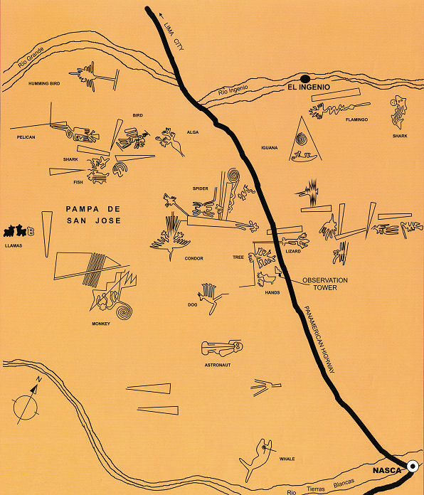 |
| Nazca Lines Map |
|---|
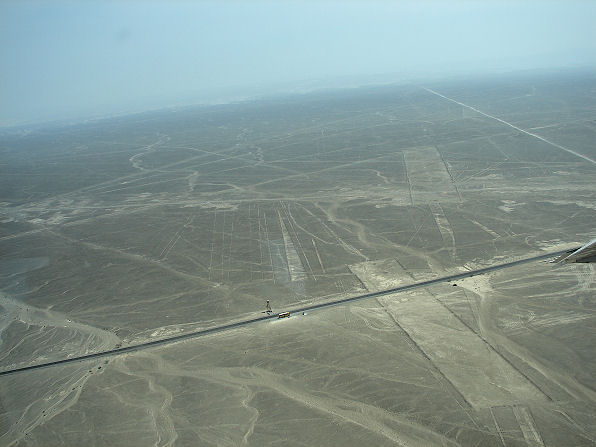 |
| Maria Reiche's Observation Tower. Three Figures Are Close To It And The Pan American Highway Is Also Next To It |
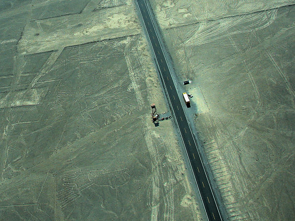 |
| The "Hands" At Bottom Left. The "Tree" A Little Further Up From The "Hands." Then The "Lizard," On Both Sides Of Highway, Near The Top. |
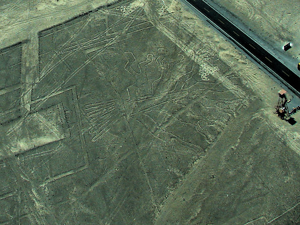 |
| The "Huarango Tree" or "Tree of Life." |
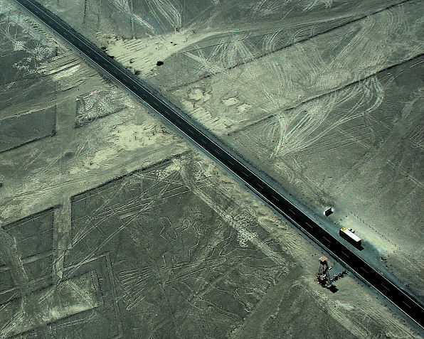 |
| The "Huarango Tree" or "Tree of Life." |
| The "Huarango Tree" or "Tree of Life." |
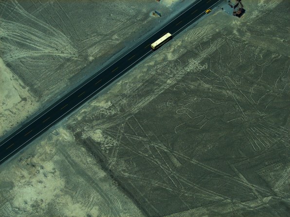 |
| The "Huarango Tree" or "Tree of Life." |
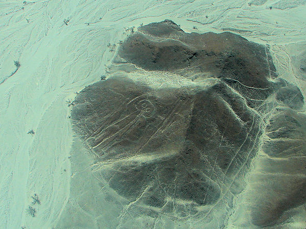 |
| The "Astronaut" (98 feet) |
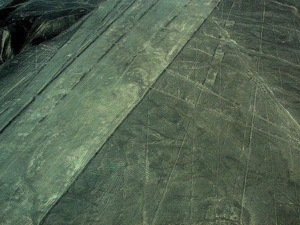 |
| The "Flamingo" Next To The Right Of The Large Trapozoid |
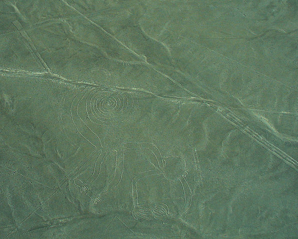 |
| The "Monkey" (92 meters). |
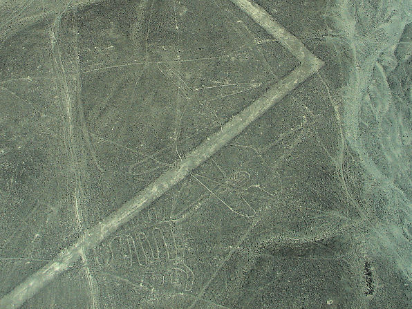 |
| The "Whale" (65 meters) |
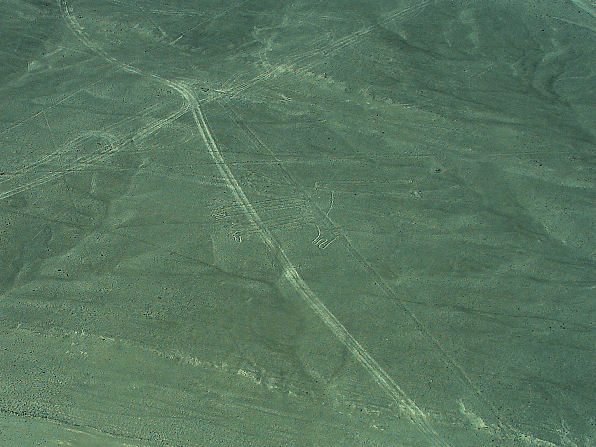 |
| The "Dog" |
 |
| The "Lizard", On Both Sides Of Highway, Near The Top. |
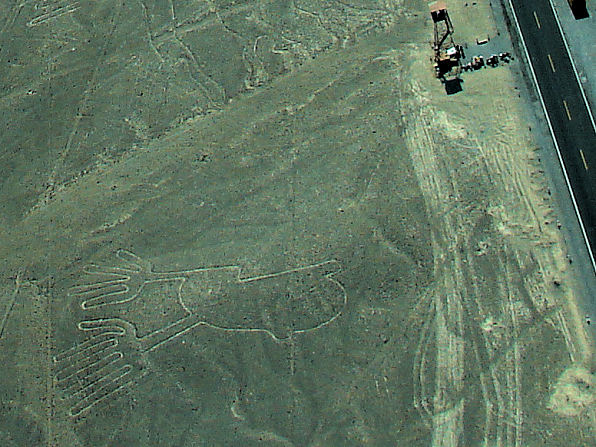 |
| The "Hands" |
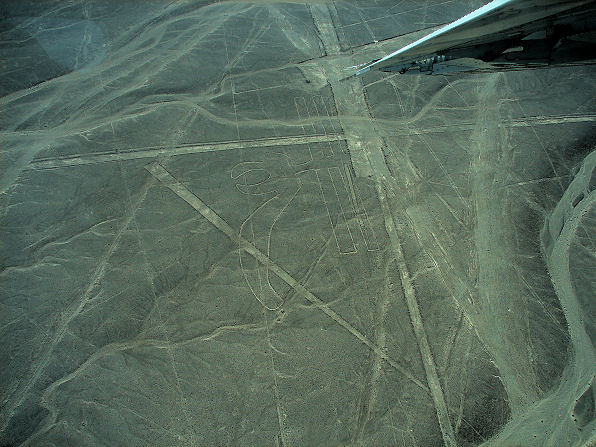 |
| The "Parrot" (200 meters) |
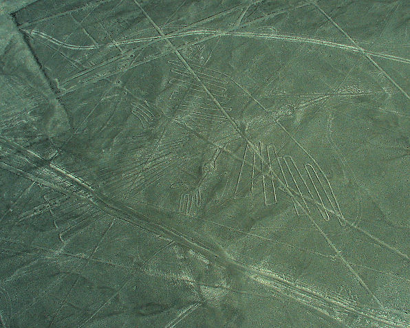 |
| The "Condor" (460 feet) |
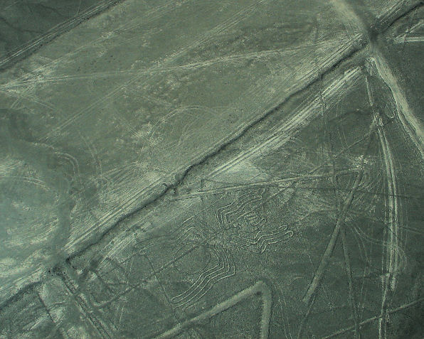 |
| The "Spider" (155 feet) |
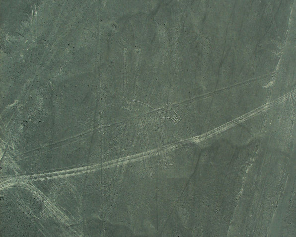 |
| The "Dog" |
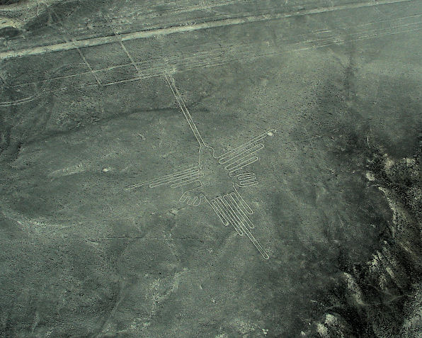 |
| The "Hummingbird" (165 feet) |
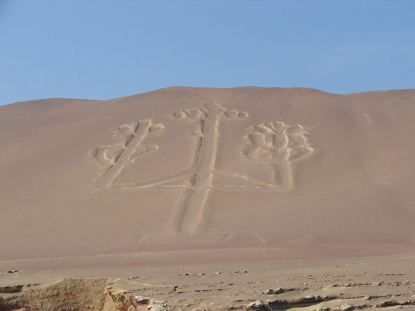 |
| The "Candelabra" Of Paracas |
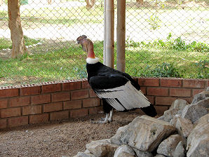 | 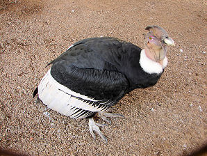 |
| "Pepe" The Condor Was Watching Planes Flying Out Pepe Wants To Go With US | Pepe Lives At The Airport He Was Found Lost As A Baby And Saved From Death |
|---|---|
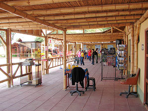 | 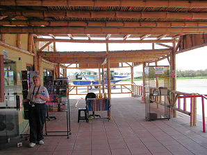 |
| Tourists Waiting For Flights At The Ica Airport | Audrey DeLange Is Ready To Go! |
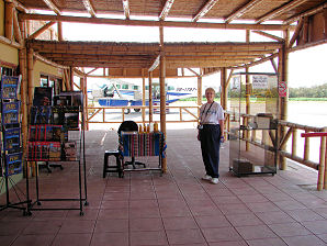 | 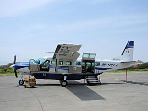 |
| Audrey DeLange Says Hey George, Our Flight Is Ready! | Our Plane Cessna Grand Caravan 208B |
 | 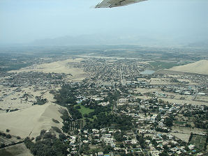 |
| We Are On Our Way! | Hotel Las Dunas Below |
We Are Proud Of Our SafeSurf Rating!

Click On Any Of The Following Links By Amazon.Com
For Books About Hiking Or Touring In Peru.
Some Are Must Have Books - If You Are Going To Peru.
We Also Are Including Some Great Music CD's & DVD's. No Obligation!
Back To Possible
Book Of Mormon Lands
Main Page
Back To Peru Tours Main Page
Back To DeLange Home Page


Book Of Mormon Lands
Main Page


