Arizona
Travels & Tours
Pictures, Photos, Images, & Reviews.
Pleasant Lake
Google Map To Pleasant Lake, Arizona
View Larger Map

Click On Any Of The Following Links By Amazon.Com
For Books, Videos, & Lures For Bass Fishing. No Obligation!
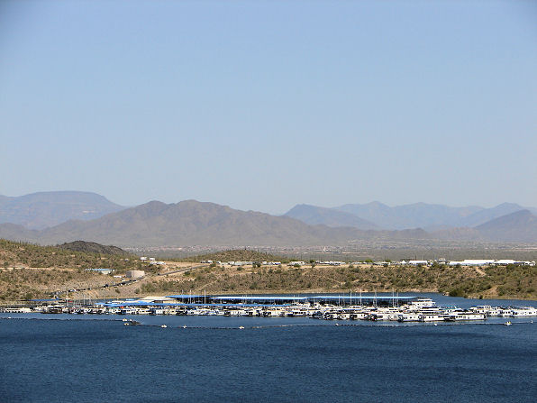 |
| Boats At Pleasant Harbor Marina, Pleasant Lake, Arizona. Photo Taken March 26, 2009. |
|---|
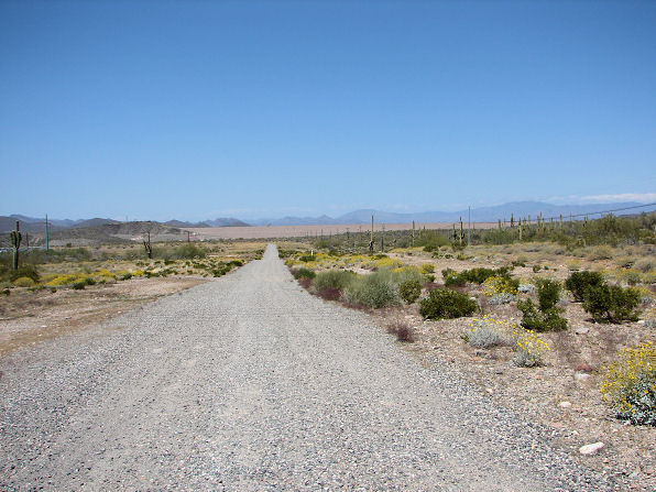 |
| The New Waddell Dam, Viewed From State Route 74 Pleasant Lake, Arizona. Photo. March 26, 2009. |
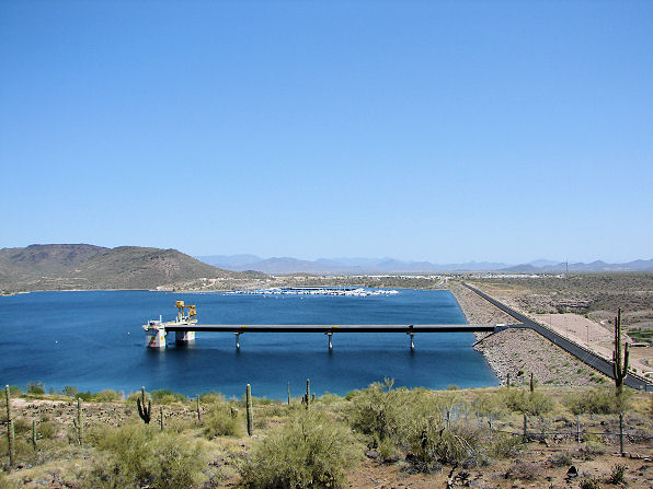 |
| The New Waddell Dam, Pleasant Lake, Arizona. Photo Taken: March 26, 2009. View From Lake Pleasant Park's Visitor's Center |
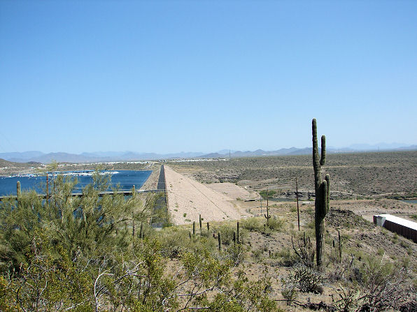 |
| The New Waddell Dam, Pleasant Lake, Arizona. Photo Taken: March 26, 2009. View From Lake Pleasant Park's Visitor's Center |
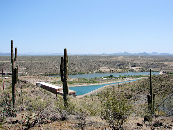 |
| The Camp Dyer Diversion Dam, Showing The Hank Raymond Lake Which Is The Water Storage Area For The Maricopa Water District The Building And Canal In The Foreground Is The Pumping Station For The CAP. It Is Called, The Waddell Pump/Generating Plant Lake Pleasant, Arizona. Photo Taken: March 26, 2009. |
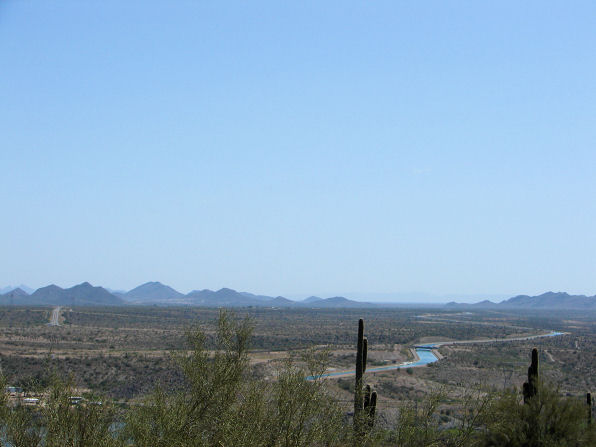 |
| The Water Leaves The Pumping Station And Moves Through The CAP Canal. Lake Pleasant, Arizona. Photo Taken: March 26, 2009. |
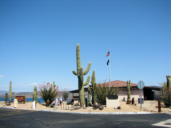 |
| Lake Pleasant Visitor Center, Guests Learn The History Of The Area And Desert Wildlife. They Also Get A Beautiful View Of Lake Pleasant And A Close Look At The New Waddell Dam. Pleasant Lake, Arizona. Photo Taken: March 26, 2009. |
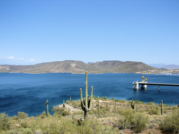 |
| Pleasant Lake And Saguaro Cactus, Arizona. Photo Taken: March 26, 2009. |
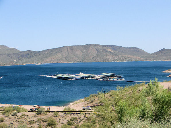 |
| Scorpion Bay, Marina & Yacht Club, Lake Pleasant, Arizona. Photo Taken March 26, 2009. |
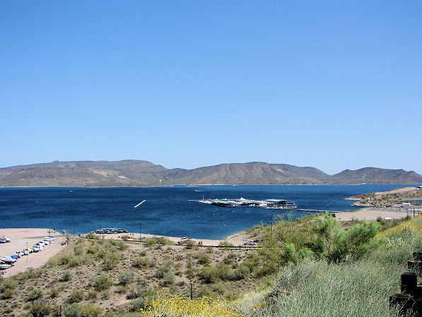 |
| Scorpion Bay, Marina & Yacht Club, Lake Pleasant, Arizona. Photo Taken March 26, 2009. |
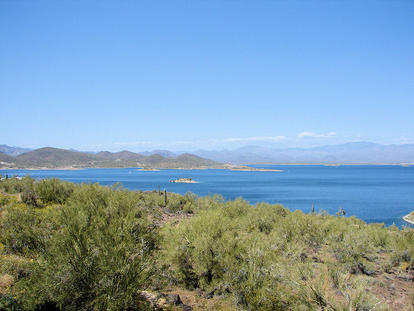 |
| Northern View Of Lake Pleasant, Arizona. Photo Taken March 26, 2009. Weaver & Bradshaw Mountains In Background. |
 | 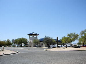 |
| Pleasant Lake Pleasant Harbor Marina Entrance | Pleasant Lake Pleasant Harbor Marina Office |
|---|---|
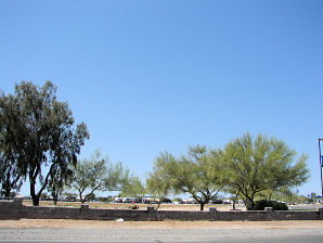 | 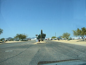 |
| Pleasant Harbor Marina RV Parking, Pleasant Lake | Pleasant Harbor Marina RV Parking, Pleasant Lake |
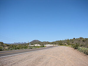 | |
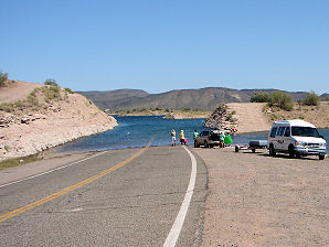
| Nuisance �Quagga� Mussels (Dreissena rostriformis bugensis) Warning Signs At Lake Pleasant | This Is Castle Hot Springs Road Turning Off Of State Route 74 Go North To Both Lake Entrances |
 | 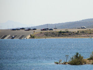 |
| Water Rises & Falls According To Water Needs In Phoenix Area | 10 Lane Boat Ramp Lake Pleasant |
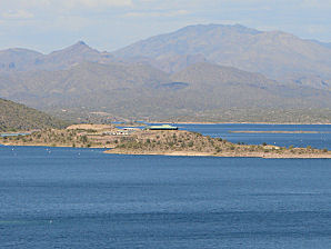 | 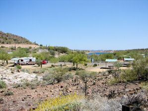 |
| Lake Pleasant Park Headquarters First Aid Station & Heliport | Desert Tortoise Campground Lake Pleasant |
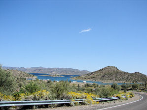 | 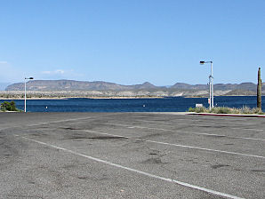 |
| Castle Creek Drive To Four Lane Boat Ramp. | Four Lane Boat Ramp |
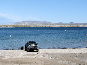 | 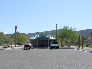 |
| View Along Castle Creek Drive | Castle Creek Drive Rest Rooms |
Lake Pleasant Regional Park:
One of the most scenic water recreation areas in the �Valley of the Sun,� this northwest Valley park is a recreationist�s dream. The park offers many activities, such as camping, boating, fishing, swimming, hiking, picnicking, and wildlife viewing. Lake Pleasant also offers over 140 developed sites for RV and tent camping. At the Lake Pleasant Visitor Center, guests learn about the history of the area and desert wildlife. From the Visitor Center visitors can get a beautiful view of Lake Pleasant and a close look at the New Waddell Dam. A Google Earth Map search marks the center of the New Waddell Dam at 33o 50' 47.13" N 113o 36' 05.55" W. Here is a listing of some of the more popular activities at Lake Pleasant.
Pleasant Harbor:
In Addition: Pleasant Harbor Marina is the largest marina in Arizona offering 4 different moorage options including wet storage, dry storage, stack storage and economy storage. Wet slips are available in 30'-75' sizes with end ties available for larger boats. Both covered and uncovered options are available at the marina. Dry storage is a second option for storing your boat at Pleasant Harbor Marina. Our dry storage yard is paved and secured and comes with unlimited launch/recovery service. Stack storage is an indoor and out of water option for storing your boat. The stack building can accommodate most boats up to 30' in length and also comes with unlimited launch/recovery service. Economy storage is the lowest priced option available at Pleasant Harbor Marina. It is gated and secured and members have 24-hour access into the yard to launch/retrieve their own watercraft.
Camping At Lake Pleasant:
For example, the Roadrunner Campground and Picnic Area has 72 RV sites with water and electrical hookups. It also has covered picnic tables, barbeque grills, restroom, and showers. The Desert Tortoise Campground and Cottonwood Day Use Areas are also open daily from 6 a.m. to 6 p.m. year round. The Desert Tortoise Campground picnic area contains 10 covered tables with grills. The Cottonwood Day Use Picnic Area contains 23 tables with grills and is open from 6 a.m. to 6 p.m. daily. There are no covered ramadas.
Fishing At Lake Pleasant:
A wide variety of sport fishing is available at Lake Pleasant. The fish that are being caught are: largemouth bass, white crappie, white bass, channel catfish, salt water striped bass, bluegill, and tilapia. The salt water species of striped bass were introduced to the lake as the water containing striper fry and eggs is pumped into the lake from the Colorado River through the Central Arizona Project canal. When fishing the lake, anglers take advantage of the fact that the lake is considered to have three fishing zones. One is near the dam and marina, where the opening into the CAP canal is located. Here the water is extremely clear and highly-oxygenated. Second is near the middle of the lake, close to the original, submerged, Waddell Dam. Here the water is clear and deep when the lake is full. Here there are small islands, reefs, and coves. The third area is located at the north end of the lake where there are upstream channels and drainages. Here the water covers a forest of submerged vegetation. It also is shallow, turbid, and nutrient-rich. Another factor which contributes to the good fishing at Lake Pleasant is the fact that the rise and fall of the lake�s waterline enhances the aquatic environment for the fish. During the fall, when CAP water is delivered into Lake Pleasant; the raising water level, covers the seasonal vegetation enriching the lake�s nutrient levels. During the spring, the water levels are held steady to aid the bass spawning. Then in the late spring, the water levels fall as the downstream demand for water increases. This lower level allows exposed shoreline grasses, plants and bushes to re-seed and produce new forage and cover. This cycle is sometimes repeated, which causes the fish to move swiftly back and forth in their search for good food. However, this means that fishermen must always be on their toes trying to keep moving with the fish to the hot fishing spots.
One environmental problem is developing at Lake Pleasant.
|

How To Get To Lake Pleasant Regional Park: From the Phoenix Area; Take I-17 north and exit onto the Carefree Highway (State Route 74) at Exit 223, then head west. The road becomes State Route 74, which is also known as the Lake Pleasant Road. Travel west for about 10.9 miles and turn north on the Pleasant Harbor Road about 1.8 miles to the Pleasant Harbor Marina. Pleasant Harbor Marina is the largest marina in Arizona offering 4 different moorage options including wet storage, dry storage, stack storage and economy storage. To get to the main park entrance continue on as the Lake Pleasant Road past the turnoff to the Marina for about 3.3 miles and take the turn off to the north on the Castle Hot Springs Road. Continue north for about 2.2 miles to the park's main entrance. You will see the entrance buildings about 600 feet east of the turnoff. The main entrance provides access to the Lake Pleasant Park's Visitor's Center, a 10 lane boat ramp, the Desert Tortoise Campgrounds and the Roadrunner Campgrounds. There is a second park entrance to the lake located about 3.1 miles past the main park entrance which is also located on the Castle Hot Springs Road. Stay on the Castle Hot Springs Road going north past the main park entrance for about 3.1 miles, on the east side of Castle Hot Springs Road. Once you go through the entrance, you will trave about 1 mile further, where you'll find access to the 4 lane boat ramp, shoreline camping areas, and the Cottonwood day-use only picnic area which also provides a restroom convenience. NOTE: If you continue past Lake Pleasant; all the way on the Castle Hot Springs Road, you will see some beautiful country, and you will pass by the Castle Hot Springs Resort; where several presidents of the United States, including John F. Kennedy, have stayed! While the road is a public road, the resort is closed to the public at this time. The Castle Hot Springs Road drive is about 29 miles in length, along a very scenic dirt - gravel road, which is passable for 2 - wheel drive vehicles, with high clearance. The road comes out of the wilderness, at State Route 74, about 1.2 miles east of US 60 (Grand Avenue). The other entrance, (or exit depending upon which way you are traveling), to the Castle Hot Springs Road is located 17.2 miles west of the turn off to the main park entrance, also located on State Route 74. It makes for a very nice 1/2 day trip. It can also be done in less than two hours. Be sure to take water with you. Refer to our web page at: Castle Hot Springs for more information. The park is open all year!
Park Fees (NOT PLEASANT HARBOR) at the time of this writing are:
|
History Of Lake Pleasant: Pleasant Dam was completed in 1927 as the Valley's only local water facility to be constructed by private interests. This private interest is known as the Maricopa Water District (MWD). Upon its completion, this dam became the largest multiple arch dam in the world at 76 feet high and 2,160 feet long. It was later renamed, the Waddell Dam. Lake Pleasant was formed by the waters behind Waddell Dam which came from the Agua Fria River; which runs south through a broad Basin from its beginning east of Prescott, Arizona to its confluence with the Gila River, west of Phoenix. Lake Pleasant�s waters were supplied primarily by the Agua Fria River and by Coles Creek, Castle Creek, Humbug Creek, and other drainages. An early settler, King Woolsey gave the river its name. The lake itself was named after Carl Pleasant, the engineer who designed the dam. As the need for more water in Central Arizona increased; the construction of the Central Arizona Project Aqueduct, was started in 1973, to divert water from the Colorado River to Lake Pleasant. Converting Lake Pleasant from an agricultural project, into a storage reservoir for the Central Arizona Project. A new, larger, Waddell Dam was started and then finished in November of 1992. The old Waddell Dam was then partially dismantled and breached before it was covered with waters from the enlarged Lake Pleasant. A 224-foot wide breach opening in the dam was cut into the old dam, making two sections. The breaching of the dam took place on December 4 and December 16, 1992, then the sections were toppled into Lake Pleasant. The breaching created a channel between the two dams which allows the water levels to remain the same in front and in back of the old dam, providing a safe passage for boats. The original dam now lies under about 100 feet of water. The New Waddell Dam increased the size of Lake Pleasant, making it the second - largest body of water in central Arizona. Roosevelt Lake is larger. It now impounds the water, not only from the Agua Fria River system, but also water moved from Lake Havasu by the Central Arizona Project (CAP) canal. The water from this canal now provides most of the water which fills the lake. The Old Beardsley Diversion Dam, which was built during 1895, is located about 1 � miles downstream from Waddell Dam. It is now called the Camp Dyer Diversion Dam. In August of 1992 the New Camp Dyer Diversion Dam was completed. It is about four feet higher than the Old Beardsley Diversion Dam. It diverts lake water into the canals which transport the water into the �Valley of The Sun.� The New Camp Dyer Division Dam creates the Hank Raymond Lake, which serves as the MWD�s regulatory water storage area. It can store a maximum of 400 acre feet of water. The "Waddell Pump/Generating Plant" is located here and it pumps water into Lake Pleasant during the winter and the water flows out of Lake Pleasant during the summer. As the water flows out it, generates electricity for the "Valley Of The Sun." The water is then diverted from the New Camp Dyer Dam into the Beardsley Canal; which is the MWD�s main water transportation system. This concrete - lined canal extends for almost 33 miles. From the Beardsley Canal, there are about 100 miles of laterals, sub-laterals and pipelines which are situated throughout the entire MWD service area.
|
If you are planning to visit Lake Pleasant. And if you are coming from outside of Arizona, you could fly into the Phoenix Sky Harbor International Airport and then rent a car. There are many hotels and motels in the area. We have some links to Priceline.com on this page since they can arrange all of your air flights, hotels and car. In addition, visitors to the lake, may need to purchase some outdoor gear, boating equipment, or fishing gear. We also have some links to Altrec.com on this page since they are a good online source for any outdoor camping gear and clothing that you may need. We of course, appreciate your use of the advertising on our pages, since it helps us to keep our pages active.
|

We Are Proud Of Our SafeSurf Rating!

Click On Any Of The Following Links By Amazon.Com
For Camping Gear. No Obligation!
Click On Any Of The Following Links By Amazon.Com
For Books, Videos, & Lures For Bass Fishing. No Obligation!
| Back To "Valley Of The Sun" Lakes or "Phoenix Area" Lakes Page.
|
| Back To Arizona Tours Page
|
| Back To DeLange Home Page
Images And Text Copyright George & Eve DeLange
|
