Page One.
Teotihuacán.
"An Overview" & The Southern Half.
Featuring The "Quetzalcoatl Quadrangle,"
Also Called, "The Ciudadela."
The "Street Of The Dead," or
"Avenue of the Dead." ( "Calzada de los Muertos" )
The Apartment Compound "Tetitla,"
The "Pyramid Of The Sun,"
And The "Temple Of Quetzalcoatl."
Near San Juan Teotihuacán Municipality, México.
Travel & Tour
Pictures, Photos
Information, Images, & Reviews.
George & Eve DeLange
Google Map To Teotihuacán Archaeological Ruins.
San Juan Teotihuacán Municipality, México.
View Larger Map
We Are Proud Of Our SafeSurf Rating!
Click On Any Of The Following Links By Amazon.Com
For Books & Videos About Teotihuacán. No Obligation!
Teotihuacán: The place where, "Men Became Gods!"
This page is an introduction to the city of Teotihuacán. It contains many photos below; of the main structures that people visit, A site map, and a general description of the site. We will show many details of these structures on our other pages. This page is an overview and introduction to Teotihuacán. Our photos on this page will focus upon the Southern half of Teotihuacán. When you visit Teotihuacán in person, you will usually find it crowded. It is less crowded on days that are not Mexican Holidays. It is easier to photograph in the afternoon, to get proper lighting.
The Principal God:
QUETZALCOATL:
The "Feathered Serpent." The Precious Twin who lifts the sun out of darkness, god of the winds and the breath of life, First Lord of the Toltecs. Lawgiver, civilizer, creator of the calender. Demons tempted Quetzalcoatl constantly to commit murder and human sacrifice, but his love was too great for him to succumb. To atone for great sins, Quetzalcoatl threw himself on a funeral pyre, where his ashes rose to the heavens as a flock of birds carrying his heart to the star Venus. A frieze in the palace at Teotihuacan shows his first entry into the world in the shape of a chrysalis, from which he struggles to emerge as a butterfly, the symbol of perfection. Quetzalcoatl is by far the most compassionate of the Aztec gods -- he only demands one human sacrifice a year. QUETZALCOATL is considered by a few investigators to be synonymous with HUITZILOPOTCHLI. The legends concerning Quetzalcoatl, and Teotihuacán are interesting when we consider the meaning of the word Teotihuacán is "place where gods were born." Here is a condensation of the story from the Florentine Codex. "At Teotihuacan, the gods convened to discuss the next sun; all was is in darkness and the dawn had yet to break. They asked for volunteers...." The ruins of Teotihuacan are found in the Valley of Mexico about 40 km from the ancient city of Tenochtitlan (Mexico City), capital of the Mexica (Aztecs), in the mountains of central Mexico. Ancient Teotihuacán: (pronounced "teh-oh-tee-wa-khan") means "place where gods were born," reflecting the Aztec belief that the gods created the universe here. However Teotihuacán was begun long before the Mexica or (Aztecs) were in existance. A brief history of the late coming Aztecs will follow. Tenochtitlan, Mexico. The Aztecs founded their capital city on an island in Lake Texacoco after seeing an eagle perched on a cactus. Today, the city of canals, grand plazas, and temples is hidden by the modern construction of Mexico City, one of the world's largest cities. The Aztecs believed they were born in the bowels of the earth and entered this world through seven caves. They first settled on Aztlan, a still undiscovered island city that archaeologists believe was somewhere along Mexico's northwest coast. About 1100 A.D., however, the Aztecs left Aztlan and migrated south, settling for short periods in various cities ruled by their neighbors. By 1300 A.D., they had reached the marshy shores of Lake Texacoco in the broad Valley of Mexico. here they found the best land already occupied by more powerful immigrants who had arrived earlier. So they settled on an empty island in the middle of Lake Texacoco, serving as mercenaries for the more powerful tribes in the area for about 50 years. They also learned how to grow food from the wet soils of the lakes region, a difficult task. Eventually, the Aztecs rebelled against their masters, and seized power for themselves. Acting on a tribal prophecy, they began building a city on the island after seeing an eagle perched on a cactus. The city, called Tenochtitlan, soon became the capital of a vast empire that grew strong in the early 1300s. It boasted grand canals, enormous market squares, temples, and it was inhabited and fueled by a wealthy class of priests, warriors, traders, and tax collectors, who directed a highly organized society. More than 300,000 people lived in the city alone. Alliances with neighboring states and wars against enemies brought wealth, power, and, prisoners who could be sacrificed to the gods. Their strongest alliance was commonly called the Tripple Alliance. It was created in 1431 A. D. by the Aztec City of Tenochtitlan, and the non-Aztec cities of Tlacopan, and Texcoco. Tlacopan was a northern kingdom and Texcoco was to the east. The Triple Alliance defeated the eastern kingdoms of Tlaxcala and Huejotzingo, making the Aztecs the dominant rulers of central Mexico. Texcoco, the junior member of the alliance, benefited from Aztec dominance in the region. However, it was one of the first kingdoms to feel the wrath of Cortez and his anti-Aztec allies, as the Spanish conquistador made his scorched-earth march toward Tenochtitlan in 1520. While the history of Teotihuacán has some relationships to the Aztecs, its history is quite different and should not be confused with that of the Aztecs. Teotihuacan arose as a new religious center in the Mexican Highland, around the time of Christ. The place was called Teotihuacan by Nahuatl speakers several centuries after the city's fall, but its original name, the language or languages spoken there, and the ethnic groups who built the city are still unknown. However, there are several theories about who founded the area. Teotihuacán is the largest archaeological city ever to exist on the American continents. During its greatest period, it covered an area of more than 9 square miles with a population of more than 200,000 inhabitants. Some estimates place the population as high as 300,000 people. It was larger than any of the cities in the Old World and it was the most highly urbanized center in the New World. It controlled the activities of hundreds of thousands of people. Teotihuacan is much more ancient than many of the other cities in the area. The dates of its beginnings are given as 150-750 AD; however, its history is said to have begun around 600 B.C. when small groups of farmers developed simple, unplanned settlements. These were the first Teotihuacanos shaping their own culture. When several of these settlements formed the first urban center, perhaps before 100 B.C., construction was begun on the Pyramids of the Sun and the Moon along with a group of other temples and architectural structures. By AD 350, the population increased to 100,000, and the people had began undertaking conquests or commercial incursions South even into modern day Guatemala. Then, Teotihuacán was destroyed in A.D. 750. The center of its cultural influence then passed to the south. The Toltec Empire of about 900-1100 A.D., based in Tula, southern Mexico, ruled much of the Valley of Mexico. Then the Tula were finally expelled by waves of "barbarian" immigrants, tribes of "Chichimecans" from northern Mexico. Then, there is the coming of the Aztecs into the picture: As we have said earlier, one of the Chichimecan tribes, called the Mexica (later the Aztecs), arrived in the area around A.D. 1300. Through clever diplomacy, well-planned marriages and political skill, they formed the Triple Appliance (three major city-states). In about 1428-1431 A. D., this Tripple Alliance had conquered and subjugated most of central Mexico and was only stopped by the arrival of the Spanish in 1519 -1521 A.D. The Aztecs ruled a feudal society and they were renowned for their brutality and organizational skills. Teotihuacan Under the Aztec Empire: After A.D. 750, other people (including the Aztecs) occupied the site of Teotihuacan and built a new city over the ruins of the old. They had many myths and legends about the original creators of the city. Teotihuacan was a vitally important religious and ceremonial center, a link to the ancient past of the Valley of Mexico. Throughout its history, Teotihuacan was a great urban center, filled with fantastic art and culture. Teotihuacan was linked to most of the other great cities of pre-Columbian Mexico, and perhaps even extending up into areas in North America. Features of Teotihuacan: Teotihuacan was meticulously planned in a complex grid pattern: for example every 57 metres there were street intersections. As in many cultures, religion played a crucial role. Temples functioned as the centers of many local "communities" within the city. Foreigners were segregated in a separate section of the metropolis, and the city was divided by wealth, status and occupation. Buildings and ruins spread from one horizon to the other. What we see when we visit is only a small part of the whole. Dozens of ornate facades and temples litter the site. These often have bizzare, beautiful sculptures, as well as brightly painted frescoes of mythical and religious scenes. The Avenue of the Dead (Calzada de los Muertos) is the main axis of the city. It stretches to the north from the Citadel all the way to the Temple of the Moon. It is about 2.5 Km. in length. As you leave the Citadel, turn right and walk north. On the left you’ll see the "Edificios Superpuestos" (superimposed buildings) where excavations have unearthed living quarters below the present level, which were filled in with rubble in order to build the second stage. Rather than being directed exactly north-south, the Avenue of the Dead is aligned to 16º north-west. This was apparently done purposefully to come into alignment with the setting sun on a certain date. The pyramids are some of the oldest structures. No-one really knows the original names or purpose of the pyramids; unlike their Egyptian counterparts, they were apparently not graves for rulers but platforms for temple-structures erected on the flat tops, a pattern followed in the Mississippian cities in the Central U.S.A. The Pyramid of the Sun has over 1,000,000 cubic meters of earth and stone. Unfortunately, over-zealous archaeologists and historians innacurately reconstructed it in 1905-1910 A.D., so its current shape may not be original. In another historical disaster, just like the Egyptian pyramids, the fine coverings of the Teotihuacan pyramids and buildings were removed when the ruins were treated as rock quarries by the Colonial Spanish overlords in their efforts to suppress any part of the native religion.. The "Pyramid Of The Sun" was extensively excavated in the first decade of this twentieth century by Leopordo Batres. Since that time, two tunnels have been excavated into the core of the pyramid, providing more information about its chronology and substructure. Another extensive excavation by INAH, directed by Eduardo Matos Moctezuma in 1992-93, has exposed more of the pyramid complex, especially on its north and east sides. As originally built, the "Pyramid Of The Sun" was approximately 215 m by 215 m at the base, and about 63 m high. It was significantly enlarged at least twice in later periods, resulting in a final size of 225 m along each side. The pyramid was located on the east side of the "Avenue Of The Dead" in the northern half of the city. If the area of monumental construction between the "Pyramid Of The Moon" and the "San Juan River" is regarded as the central zone of the city, the "Pyramid Of The Sun" is located at its middle. In addition to its geographic centrality, the importance of the pyramid is indicated by a cave located under the structure. It is believed by certain scholars that the cave was used for ritual activities, and why the pyramid was constructed where it is today. The "Pyramid Of The Sun" was actually reconstructed as five stepped platforms. However, the fourth platform seems to have been erorneously reconstructed by Batres early this century. The "Pyramid Of The Sun" originally consisted of four stepped platforms, a surmounting temple, and the Adosada platform, which was built over what was originally the principal facade of the "Pyramid Of The Sun." No information about the temple itself is yet available, since, along with the upper-most portion of the pyramid, it has been completely destroyed. In the southern section, The "Ciudadela" and the "Great Compound" stand out as exceptionally large architectural complexes in the city. The Feathered Serpent Pyramid was the principal pyramid of the Ciudadela. Further south of them, unlike in the northern section, the Avenue of the Dead is not well defined by platforms or other architectural units, according to current topography. Further south, beyond the river San Lorenzo, on the southern Avenue of the Dead, several mounds are still visible on surface. The city had no outer defensive walls, however, it is believed that it was not an open city easy for outsiders to attack. The "Feathered Serpent Pyramid,"or "Quetzalcoatl Pyramid" is the third largest pyramid in Teotihuacan. Although significantly smaller in size than both the "Pyramid Of The Sun" and "Pyramid Of The Moon," it is one of the most elaborate monuments in the city. Manuel Gamio's excavations carried out between 1917 and 1922 (Gamio 1922 (1979)) revealed that the principal facade had been covered with carved blocks, including impressive three dimensional sculptures. The excavations by the Proyecto Arqueológico Teotihuacán 1980-82 of the Instituto National de Antropología e Historia confirmed that the facades on all four sides of the pyramid had been decorated with carved stones depicting the motifs discovered earlier by Gamio. The "Feathered Serpent Pyramid" was the principal pyramid at the Ciudadela, one of the largest enclosed precincts in Mesoamerica. Ceramic analyses indicate that both were constructed sometime during the Miccaotli to Early Tlamimilolpa phases (A.D.150-300). However, precise chronological relationships between the pyramid and the Ciudadela remain unknown because of the lack of direct stratigraphic and architectural data. Recent research simply suggests that most of the platform that encloses the Ciudadela may have been built somewhat earlier than the Feathered Serpent Pyramid. The Feathered Serpent Pyramid complex consists of the pyramid (stepped platform), it's surmounting temple, and the Adosada platform which was later built onto the main facade of the pyramid. All four sides of the pyramid had been covered by an elaborate facade of stone carvings which including a series of large sculptural heads. The facades that originally existed on the lateral and rear faces have been almost completely destroyed. Fortunately, the principal (western) facade of the pyramid was covered by the Adosada platform in ancient times, which was therefore uncovered in an excellent condition of preservation. Thanks to these conditions, we know that the Feathered Serpent Pyramid, measuring 65 m on a side (about 4225 m2 at the base), depicted important mythico-religious entities - Feathered Serpents and a form of sacred headdress. The "Adosada Platform" was a later addition constructed over the principal facade of the Feathered Serpent Pyramid sometime in the fourth century A.D. Currently, two structures stand as independent platforms, one from the other, because of extensive removal of the eastern part of the Adosada nucleous by Gamio to expose the western facade adorned with impressive sculptural heads. However, the Adosada had originally been complemental architectural element integrated into the Feathered Serpent Pyramid complex. It is unclear whether the Adosada was surmounted by temple structure of its own. As the size was smaller than the Feathered Serpent Pyramid itself, the Adosada did not completely covered the facade, but left significantly large area of the front side including the upper part of the stairway that led to the top of the pyramid compex. The Adosada was apparently constructed as an enlargement process of the same monument, and the pyramid had presumably been functioning with its temple atop after the Adosada was constructed. However, ritual, political, social implications involved in this new construction have been poorly understood. Ongoing excavations have revealed something of the Teotihuacan culture. According to archaeoastronomer John B. Carlson, the cult of the planet Venus that determined wars and human sacrifices elsewhere in Mesoamerica was prominent at Teotihuacán as well. (Archaeoastronomy is the study of the position of stars and planets in relation to archaeology.) Ceremonial rituals were timed with the appearance of Venus as the morning and evening star. The symbol of Venus at Teotihuacán (as at Cacaxtla, 80km/50 miles away, near Tlaxcala) appears as a star or half star with a full or half circle. (In fact, our independent observations of the paintings at both sites suggest to us that they were painted by the same artist.) Carlson also suggests the possibility that people from Cacaxtla conquered Teotihuacán, since name glyphs of conquered peoples at Cacaxtla show Teotihuacán-like pyramids. Numerous tombs with human remains (many of them either sacrificial inhabitants of the city or perhaps war captives) and objects of jewelry, pottery, and daily life have been uncovered along the foundations of buildings. It appears to some that the primary deity at Teotihuacán may have been a female, called the "Great Goddess" for lack of any known name. Today, what remains are the rough stone structures of the three pyramids and sacrificial altars, and some of the grand houses, all of which were once covered in stucco and painted with brilliant frescoes (mainly in red). The Toltec, who rose in power after the city's decline, were fascinated with Teotihuacán and incorporated its symbols into their own cultural motifs. The Aztec, who followed the Toltec, were fascinated with the Toltec and with the ruins of Teotihuacán; they likewise adopted many of their symbols and motifs. The core of the complex is the so-called “Pyramid of the Sun,” which stands atop the sacred cave of creation, anciently accessible by a tunnel under the pyramid. The pyramid is aligned with the rising of the sun and the appearance of the Pleiades at the spring equinox. Measuring 200 meters square and 66 meters high, the four massive tiers of the pyramid can be climbed by means of a monumental stairway on the west. It was designed for astronomical observations, worship, and sacrifice. The entire structure seems to have symbolized the cosmic mountain of creation, which one ascends in order to gain the presence of the gods. In the sixteenth century an eighteen-foot tall idol—probably similar to the “Atlantes” of Tula—stood in the ruined temple complex at the top. This image was still worshipped by pilgrims but was destroyed by the conquistadors in an attempt to obliterate the Aztec religion. In front of the Pyramid of the Sun, on a roughly north-south axis, runs the three-mile long, forty-yard wide “Avenue of the Dead” (Miccaotli). The entire sacred way is interspersed with half-a-dozen small plazas, and is lined on both sides with dozens of small stepped pyramids, temples, altars and apartment complexes for the priests or other elite groups. The northern part of the Avenue of the Dead ends in the Plaza and Pyramid of the Moon, associated by the Aztecs with the moon and water goddess Chalchiuhtlicue. Although only 46 meters high, it is divided into four massive tiers surmounted by a monumental south-facing stairway. Many of the smaller pyramids and buildings surrounding the Plaza of the Moon contain splendid carvings and fresco murals depicting jaguars, serpents, butterflies, eagles, and ornately attired priests. As with the other temples and pyramids of Teotihuacán, the precise rites and beliefs associated with these structures are unknown. The southern Avenue of the Dead culminates in a structure that the Spanish believed was a “Citadel” (Ciudadela), but which is now thought to have been a market or ceremonial complex. This “Citadel” contains the splendid seven-tiered temple-pyramid of Quetzalcoatl. Built in the second century AD, it is ornamented with numerous representations of the feathered-serpent. Although Quetzalcoatl symbolism is found earlier, many scholars see this site as the first major cult-center devoted to the worship of this god. In subsequent centuries, the Quetzalcoatl temple was buried beneath a larger pyramid; some archaeologists speculate this may represent the overthrow of the Quetzalcoatl cult. By the fourth century AD, the period of monumental building was completed, but rapid military and economic expansion continued apace, with Teotihuacáni merchants and soldiers spreading as far as Kaminaljuyu and Tikal in Guatemala. (Some LDS scholars think that there is a possible correlation between Teotihuacáni militarism in the fourth century and the destruction of the Nephites as described in The Book Of Mormon.) With added trade, tribute, and plunder, the city expanded to a population of roughly 200,000 by the sixth century AD, making it one of the largest cities in the world at the time. The decline of Teotihuacán was as just dramatic as its rise. Although the details are not known, archaeologists suspect that overpopulation and ecological decay, combined with social, economic, political and ideological conflicts, culminated in the massive destruction of the city by about 725 AD; altars and idols were smashed, and the vast ceremonial center was burned. It is unclear if this destruction was caused by internal civil war or by outside invaders, but the results were the same: the city was largely abandoned, leaving only a few squatters farming among the ruins of the once magnificent capital. However, despite its devastation, Teotihuacán never lost its spiritual influence. In later centuries Toltecs and Aztecs made regular pilgrimages there to worship in the ruined temples, copying the art and architectural styles in their own monuments, and giving it the name of the “city of the birth of the gods.” Today hundreds of thousands of visitors from around the world come to stand in awe of the magnificence of this two-thousand-year-old sacred center. We also will have some images on this page about Tetitla; which is a good example of how the vast majority of Teotihuacanos lived. The majority of Teotihuacanos lived in large rectangular single story buildings with stone and adobe walls, plaster or packed earth floors, and flat roofs. They were divided up into multiple apartments that opened onto courtyards that were open to the sky. Today,we would call these places apartment compounds. Archaeologists have only excavated a few of the 2,000+ known apartment compounds, and none have excavated in their entirety. Several are located in the southwestern part of the city are open to visitors, but they are not visited as often as other parts of Teotihuacán. In Tetitla we can see the surviving wall stubs with remnants of painted stucco as well as a small interior courtyard and the remains of columns that once supported the flat roof. All of Teotihuacán's murals constitute a primary source for understanding the city's religion and social organization. Found throughout the city and upon the walls of the apartment compounds such as Tetitla, the paintings and murals, depict a wide range of images centered around two major deities: a female goddess known as the Great Goddess, and a male known as the Storm God (or Tlaloc). The Great Goddess is almost always depicted frontally, with additional motifs pertaining to various forms of agricultural fertility. The Storm God is almost always depicted in profile and is identified by his very distinctive face mask, and with a lightning bolt carried in his left hand. Several animals, including coyotes, owls, and jaguars, are very prominent in these murals. Although red dominates the color schemes; blues, yellows, and greens also appear. The style is flat and linear, and the primary deities often appear in abbreviated versions. Teotihuacán seems to have a lack of a writing system unlike that which can be seen in the Maya realm, or at ruins such as Monte Albán. Audrey and George DeLange have been to Teotihuacán on eight different occasions, Eve DeLange has been there one time, and we are facinated by the different features of the city. Our page will contain photos that have been taken over the years. We do so, because some of the exhibits that were open to the public in past years are no longer open or they have been changed. For example, the vivid colors of the carvings at the Quetzalcoatl Pyramid are no longer easily visable, and the area is no longer as easily accessable to the public as it used to be. Our tour on all of our web pages of Teotihuacán will be starting with the Southern half of Teotihuacán, then the apartment complex known as Tetitla, then to the Northern half, and then to the Museum. Note: there are some good places to eat along the road that works its' way around the ruins of Teotihuacán.
|
The Mexico City International Airport (Spanish: Aeropuerto Internacional de la Ciudad de México or AICM), also called Benito Juárez International Airport (IATA: MEX, ICAO: MMMX) is the major commercial airport that serves Mexico City, the capital of Mexico. It is also Mexico's and Latin America's busiest airport!
There are many very good hotels and motels in the area, and if you need a place to stay; Priceline.com can arrange that for you. In fact, we think they are the best way to do it! We have personally, booked flights, hotels, and vacations, through Priceline.com and we can highly recommend them. Their website is very easy to use! We have some links to Priceline.com on this page, since they can arrange all of your air flights, hotels and car. We of course, appreciate your use of the advertising on our pages, since it helps us to keep our pages active. We also have links on this page, that will connect you with several of the best hotels in Mexico City. Hotels that we have personally used! We could, also suggest getting a hotel, and then letting them arrange for either a car, or a tour of Mexico City. If you call their Concierge Services, ahead of your arrival, all of this can be pre-arranged for you. We have used this method, many times, when traveling in Mexico. We have found it to be safe and it works!!! We have never experienced a problem, doing it this way!
|
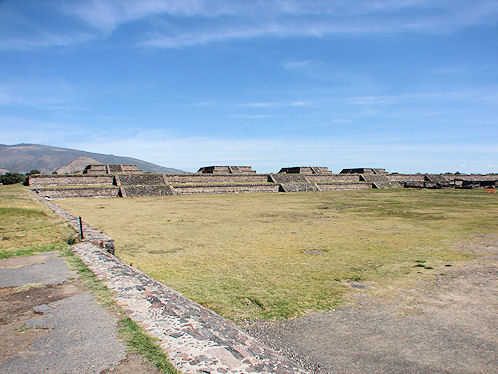 | 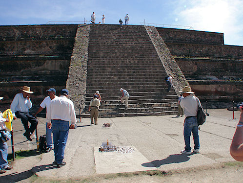 |
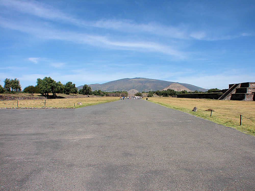
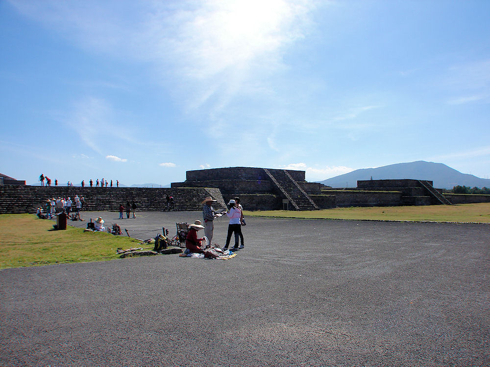
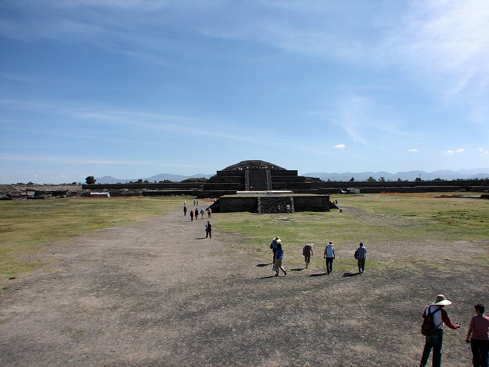
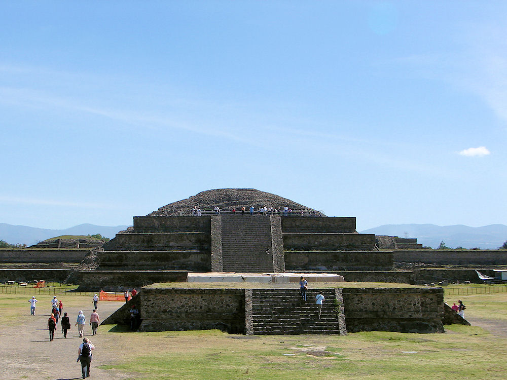
| These Four Photos. Looking North To South. "Quetzalcoatl Quadrangle," Also Called, "The Ciudadela." Teotihuacan Archaeological Ruins. November 21, 2011. | These Four Photos. Looking North To South. The "Adosada Platform." "Quetzalcoatl Quadrangle," Also Called, "The Ciudadela." Teotihuacan Archaeological Ruins. November 21, 2011. |
|---|---|
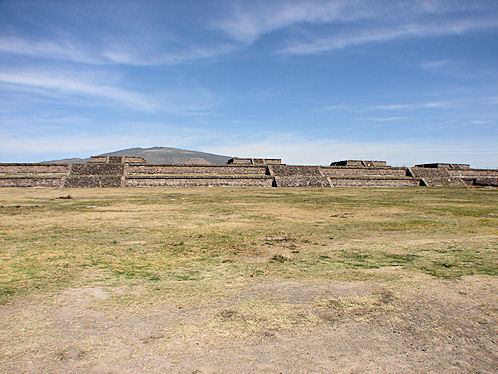 | |
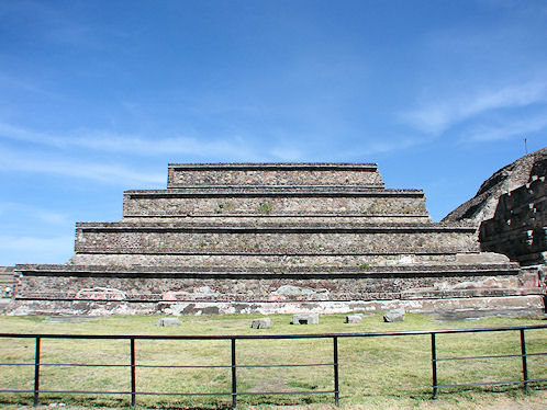
| These Four Photos. Looking North To South. "Quetzalcoatl Quadrangle," Also Called, "The Ciudadela." Teotihuacan Archaeological Ruins. November 21, 2011. | These Four Photos. Looking North To South. "Quetzalcoatl Quadrangle," Also Called, "The Ciudadela." Teotihuacan Archaeological Ruins. November 21, 2011. |
 | 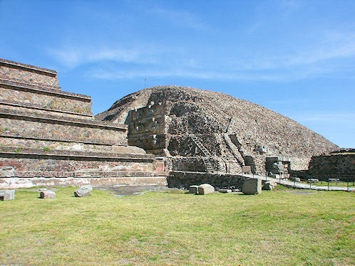 |
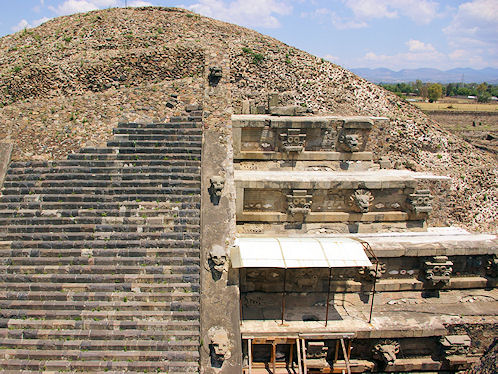
| The "Adosada Platform." In The "Quetzalcoatl Quadrangle," or, "Ciudadela." Teotihuacan Archaeological Ruins. November 21, 2011. | The "Adosada Platform," & "Feathered Serpent Pyramid." In The "Quetzalcoatl Quadrangle," Or, "Ciudadela." Teotihuacan Archaeological Ruins. November 21, 2011. |
 | 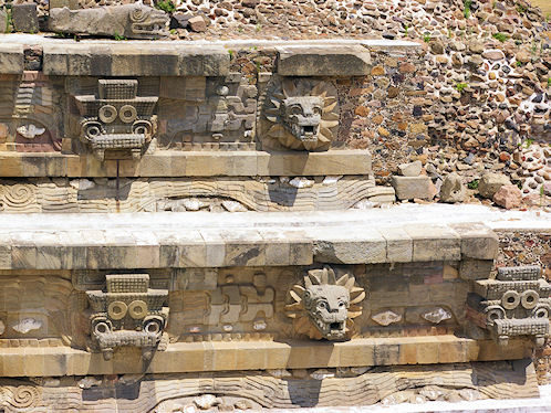 |
| Stone Heads At The "Temple of Quetzalcoatl," Between The "Adosada Platform," & "Temple of Quetzalcoatl." Top Row Example: "Tlaloc" (left) & Feathered Serpent (right). Teotihuacan Archaeological Ruins. Courtesy Of: Wikipedia, the free encyclopedia. | Stone Heads At The "Temple of the Feathered Serpent," Between The "Adosada Platform," & "Feathered Serpent Pyramid." Top Row Example: "Tlaloc" (left) & Feathered Serpent (right). Teotihuacan Archaeological Ruins. Courtesy Of: Wikipedia, the free encyclopedia. |
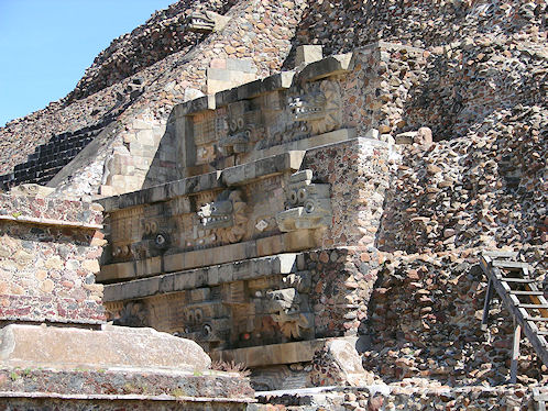 | |
| Stone Heads Between The "Adosada Platform," & "Feathered Serpent Pyramid." Teotihuacan Archaeological Ruins. November 21, 2011. | Stone Heads Between The "Adosada Platform," & "Quetzalcoatl Pyramid." Teotihuacan Archaeological Ruins. November 21, 2011. |
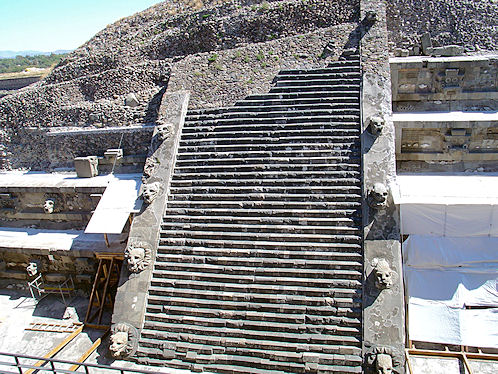 | 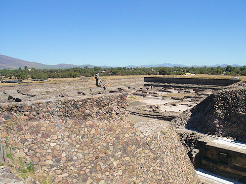 |
| Serpant Staircase & Stone Heads Between The "Adosada Platform," & "Feathered Serpent Pyramid." Teotihuacan Archaeological Ruins. January 17, 2005. | Northeastern Section Of The "Quetzalcoatl Quadrangle" Under Restoration Photo From The "Adosada Platform," Near The "Quetzalcoatl Pyramid." Teotihuacan Archaeological Ruins. January 17, 2005. |
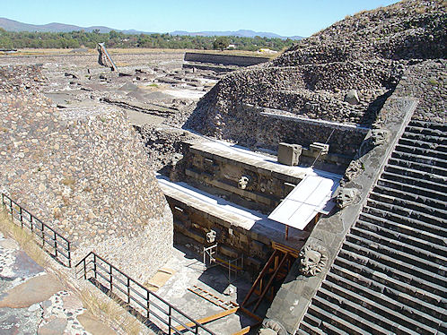 | |
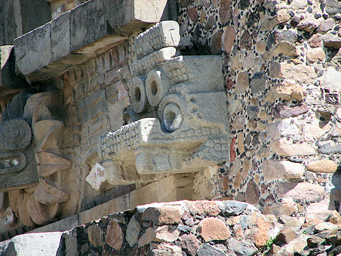
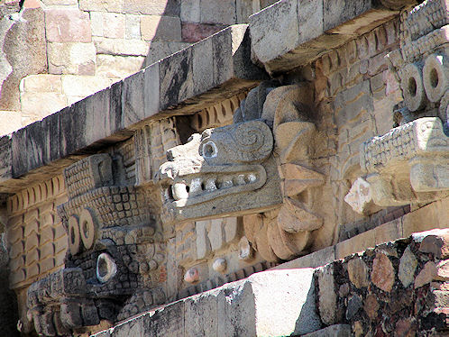
| Left Side (North) Stone Heads Between The "Adosada Platform," & "Feathered Serpent Pyramid." Teotihuacan Archaeological Ruins. January 17, 2005. | Right Side (South) Stone Heads Between The "Adosada Platform," & "Quetzalcoatl Pyramid." Teotihuacan Archaeological Ruins. January 17, 2005. |
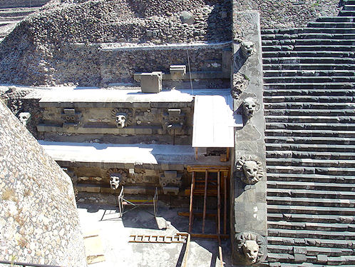 | 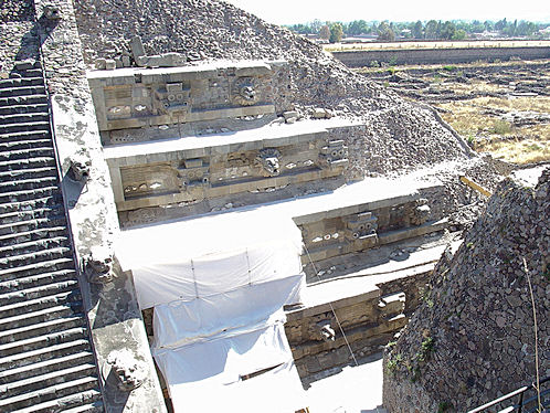 |
| Left Side (North) Stone Heads Between The "Adosada Platform," & "Feathered Serpent Pyramid." Teotihuacan Archaeological Ruins. January 17, 2005. | Right Side (South) Stone Heads Between The "Adosada Platform," & "Quetzalcoatl Pyramid." Teotihuacan Archaeological Ruins. January 17, 2005. |
 |  |
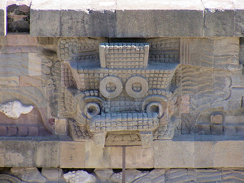
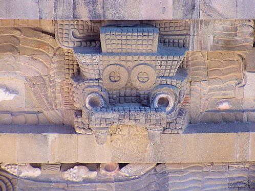
| Tlaloc Stone Head. "Quetzalcoatl Quadrangle," Also Called, "The Ciudadela." Teotihuacan Archaeological Ruins. November 21, 2011. | Quetzalcoatl Stone Head. "Quetzalcoatl Quadrangle," Also Called, "The Ciudadela." Teotihuacan Archaeological Ruins. November 21, 2011. |
 |  |
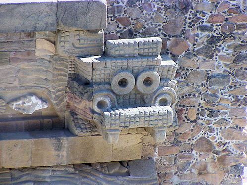
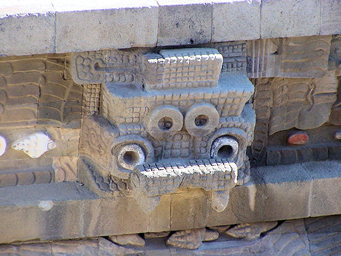
| Tlaloc Stone Head. "Quetzalcoatl Quadrangle," Also Called, "The Ciudadela." Teotihuacan Archaeological Ruins. January 17, 2005. | Tlaloc Stone Head. "Quetzalcoatl Quadrangle," Also Called, "The Ciudadela." Teotihuacan Archaeological Ruins. January 17, 2005. |
 |  |
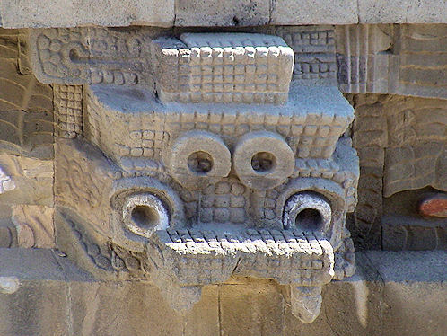
| Tlaloc Stone Head. "Quetzalcoatl Quadrangle," Also Called, "The Ciudadela." Teotihuacan Archaeological Ruins. January 17, 2005. | Tlaloc Stone Head. "Quetzalcoatl Quadrangle," Also Called, "The Ciudadela." Teotihuacan Archaeological Ruins. January 17, 2005. |
 | 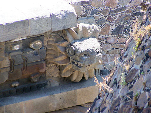 |
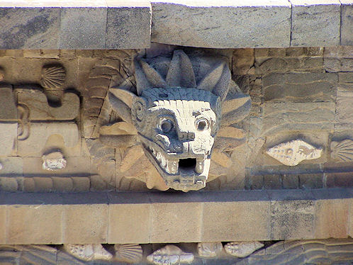
| Tlaloc Stone Head. "Quetzalcoatl Quadrangle," Also Called, "The Ciudadela." Teotihuacan Archaeological Ruins. January 17, 2005. | Quetzalcoatl Stone Head. "Quetzalcoatl Quadrangle," Also Called, "The Ciudadela." Teotihuacan Archaeological Ruins. January 17, 2005. |
 | |
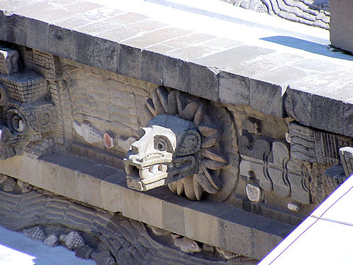
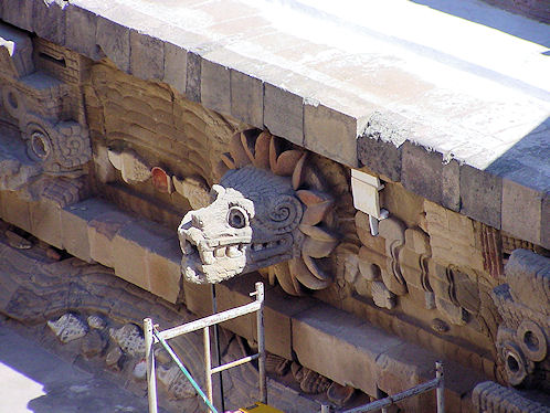
| Quetzalcoatl Stone Head. "Quetzalcoatl Quadrangle," Also Called, "The Ciudadela." Teotihuacan Archaeological Ruins. January 17, 2005. | Quetzalcoatl Stone Head. "Quetzalcoatl Quadrangle," Also Called, "The Ciudadela." Teotihuacan Archaeological Ruins. January 17, 2005. |
 |  |
| Quetzalcoatl Stone Head. "Quetzalcoatl Quadrangle," Also Called, "The Ciudadela." Teotihuacan Archaeological Ruins. January 17, 2005. | Quetzalcoatl Stone Head. "Quetzalcoatl Quadrangle," Also Called, "The Ciudadela." Teotihuacan Archaeological Ruins. January 17, 2005. |
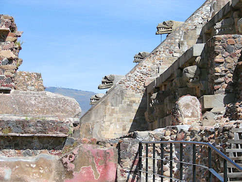 | 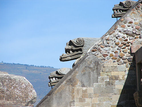 |
| Stone Heads. The "Quetzalcoatl Temple." Stairway. Teotihuacan Archaeological Ruins. November 21, 2011. | Stone Heads. The "Quetzalcoatl Temple." Stairway. Teotihuacan Archaeological Ruins. November 21, 2011. |
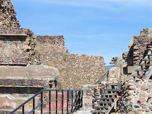 | 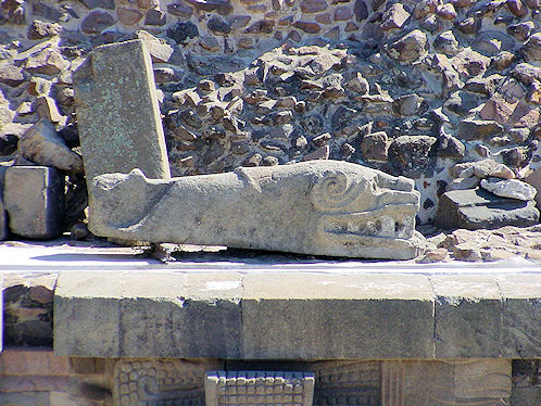 |
| Stone Heads. The "Quetzalcoatl Temple." Stairway. Teotihuacan Archaeological Ruins. November 21, 2011. | Stone Heads. The "Quetzalcoatl Temple" Stairway. Teotihuacan Archaeological Ruins. November 21, 2011. |
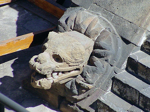 | 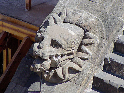 |
| Stone Head One. The "Quetzalcoatl Temple" Stairway. Teotihuacan Archaeological Ruins. January 17, 2005. | Stone Head Two. The "Quetzalcoatl Temple" Stairway. Teotihuacan Archaeological Ruins. January 17, 2005. |
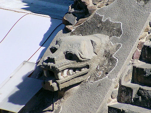 | |
| Stone Head Three. The "Quetzalcoatl Temple" Stairway. Teotihuacan Archaeological Ruins. January 17, 2005. | Stone Head Four. The "Quetzalcoatl Temple" Stairway. Teotihuacan Archaeological Ruins. January 17, 2005. |
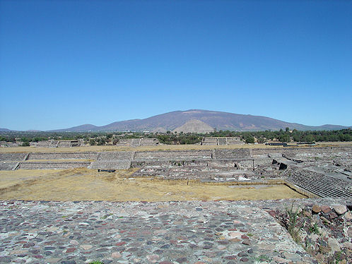 | 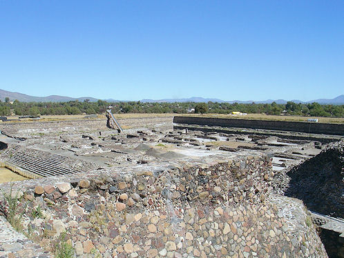 |
| Northern Section Of The "Quetzalcoatl Quadrangle" Under Restoration Photo From The "Adosada Platform," Near The "Quetzalcoatl Pyramid." Teotihuacan Archaeological Ruins. January 17, 2005. | Northeastern Section Of The "Quetzalcoatl Quadrangle" Under Restoration Photo From The "Adosada Platform," Near The "Quetzalcoatl Pyramid." Teotihuacan Archaeological Ruins. January 17, 2005. |
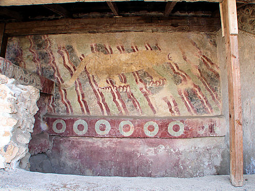 | 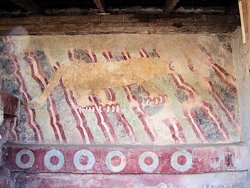 |
| "Puma Mural." Near The Street Of The Dead Across The Court Yard, South Of The Pyramid Of The Moon. Teotihuacan Archaeological Ruins. November 21, 2011. | "Puma Mural." George's Favorite. Near The Street Of The Dead Across The Court Yard, South Of The Pyramid Of The Moon. Teotihuacan Archaeological Ruins. November 21, 2011. |
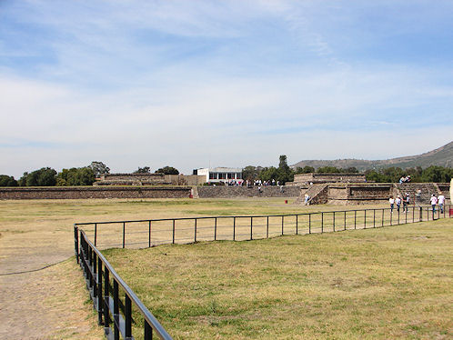 | 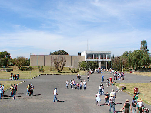 |
| Cafe West Of The "Quetzalcoatl Quadrangle," Also Called, "The Ciudadela." Teotihuacan Archaeological Ruins. November 21, 2011. | Cafe West Of The "Quetzalcoatl Quadrangle," Also Called, "The Ciudadela." Teotihuacan Archaeological Ruins. November 21, 2011. |
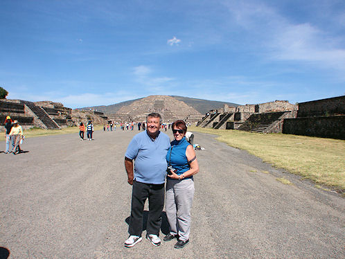 | 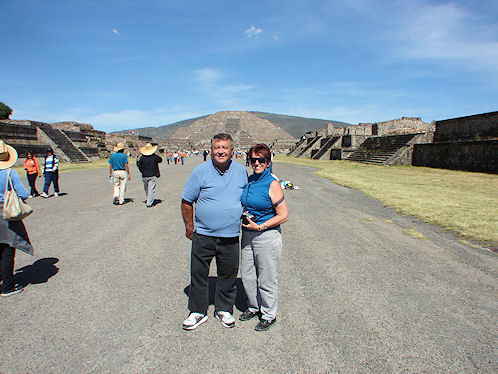 |
| George & Eve DeLange On The "Avenue of the Dead." Temple Of The Moon Is North, In The Background. Teotihuacan Archaeological Ruins. November 21, 2011. | George & Eve DeLange On The "Calzada de los Muertos." Temple Of The Moon Is North, In The Background. Teotihuacan Archaeological Ruins. November 21, 2011. |
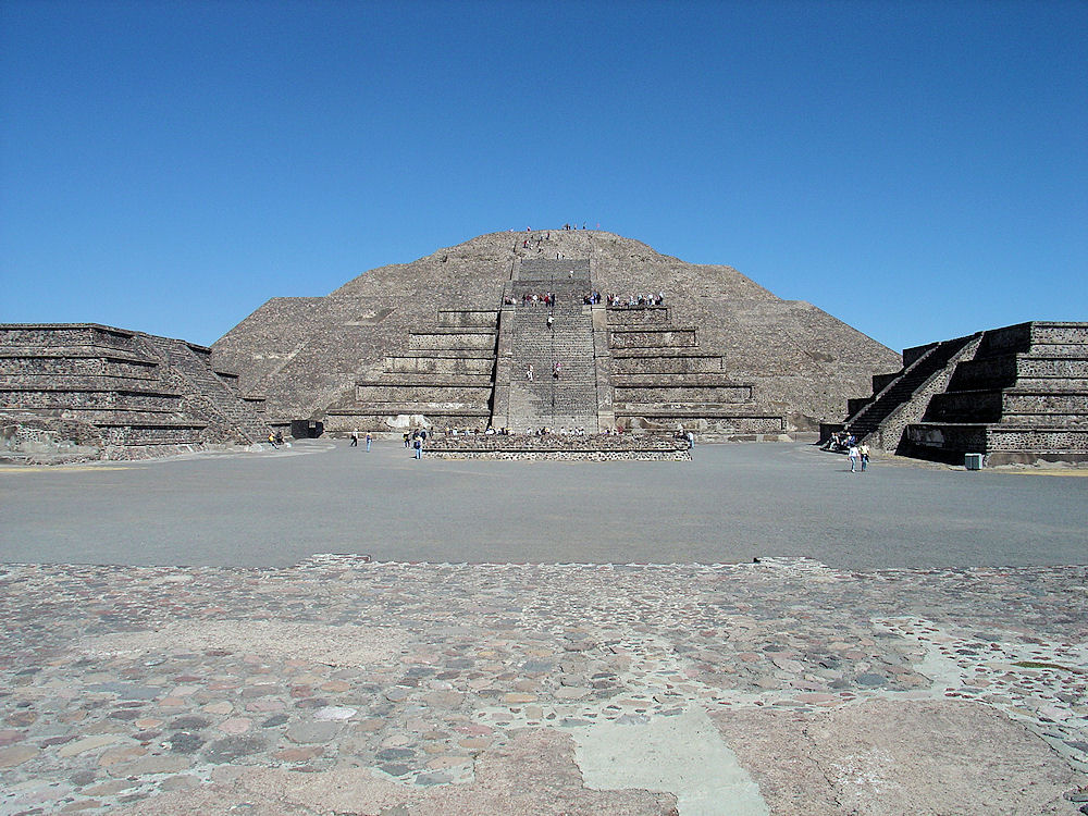 |
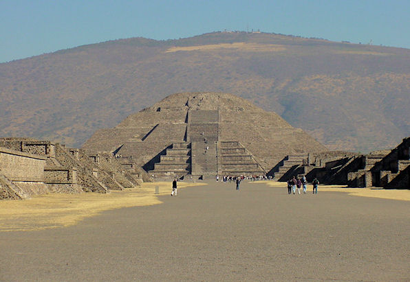
| Teotihuacán: Looking North Toward The "Pyramid Of The Moon." And Parts Of The "Plaza Of The Moon." January 17, 2005. |
|---|
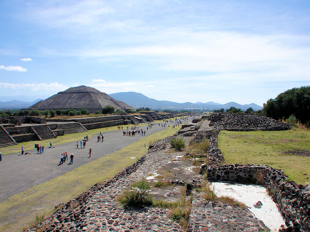 |
| Teotihuacán: Looking Southeast Toward The "Pyramid Of The Sun." Along The "Street Of The Dead." or "Avenue of the Dead" (Calzada de los Muertos) (a translation from its Nahuatl name Miccoatli), November 21, 2011. |
|---|
 |
| Site Map of Teotihuacán: "Where Men Became Gods!" |
|---|
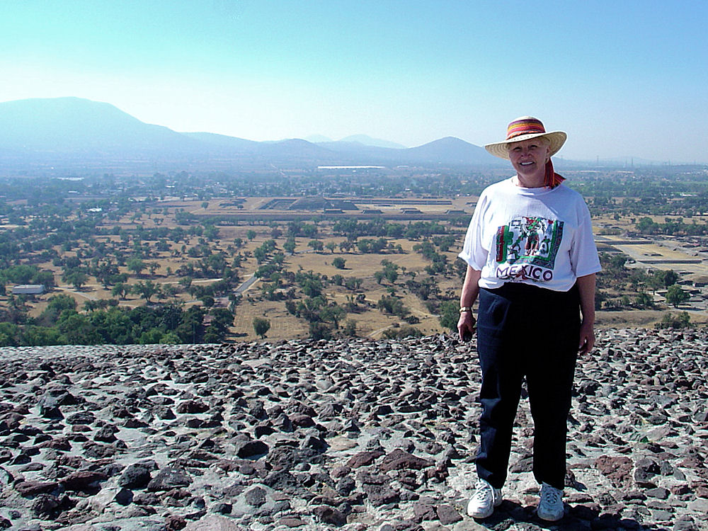 |
| Audrey DeLange Says, "Behind Me Is The "Quetzalcoatl Quadrangle," "Sometimes Called The "Citadel" Or "Ciudadela" Photo Taken From The Top Of The "Pyramid of The Sun", Looking South. January 17, 2005. |
|---|
| South Side "Pyramid Of The Sun" Teotihuacán. |
|---|
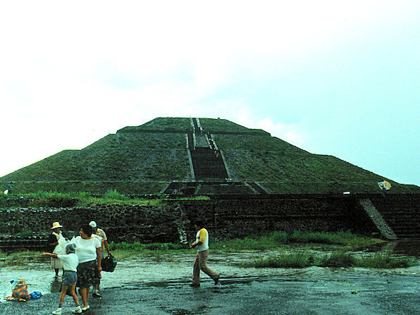 |
| West Side "Pyramid Of The Sun". Teotihuacán After A Rain In August 1988. |
|---|
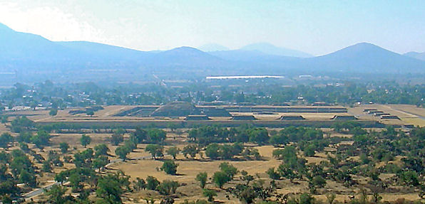 |
| The "Quetzalcoatl Quadrangle," Looking South. |
|---|
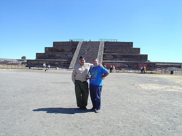 |
| Teotihuacán: At The Front Of The "Adosada Platform," & "Temple of Quetzalcoatl." Hector Rugerio Coria & George DeLange, Amigo's. |
|---|
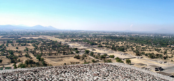 |
| "Street Of The Dead", Looking SouthWest. |
|---|
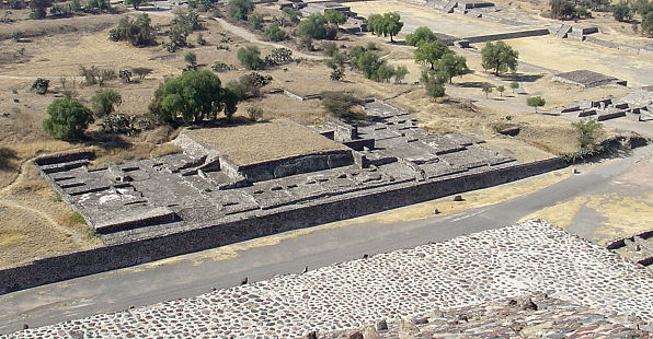 |
| "House Of The Priests", Looking SouthWest From Top Of The "Pyramid Of The Sun." |
|---|
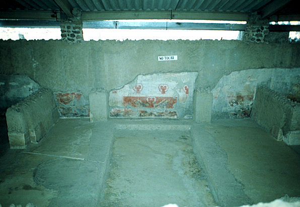 | 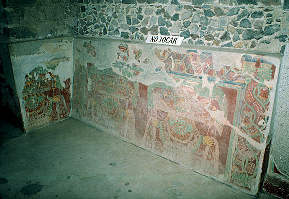 |
| Mural Walls "Tetitla" At Teotihuacán: "Where Men Became Gods!" | Mural Walls "Tetitla" At Teotihuacán: "Where Men Became Gods!" |
|---|---|
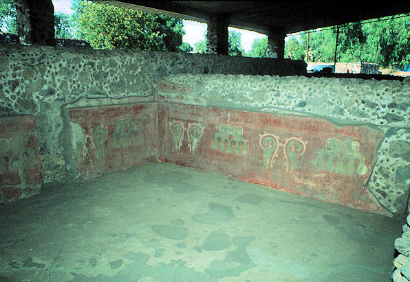 | 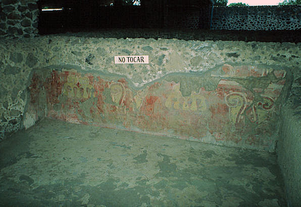 |
| Mural Walls "Tetitla" At Teotihuacán: "Where Men Became Gods!" | Mural Walls "Tetitla" At Teotihuacán: "Where Men Became Gods!" |
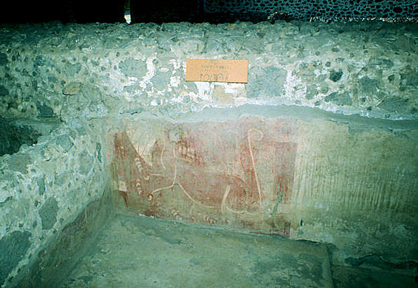 | 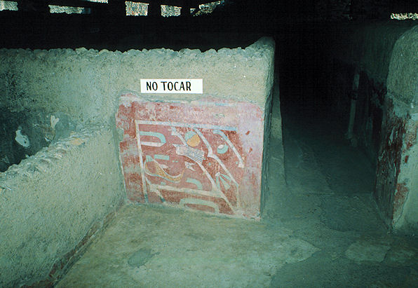 |
| Mural Walls "Tetitla" At Teotihuacán: "Where Men Became Gods!" | Mural Walls "Tetitla" At Teotihuacán: "Where Men Became Gods!" |
 |  |
| "Piramide Charlie's" At Teotihuacán: "Where Men Became Gods!" Highly Rated Place To Eat Audrey, Noel, Laurine, Unknown Mariachi, & George DeLange We Were There In 1988. | "Cerro Gordo" & "Pyramid Of The Moon." At Teotihuacán: "Where Men Became Gods!" |
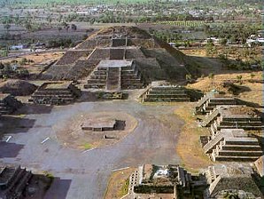 | |
| Street Of The Dead Court yard Pyramid Of The Moon. | Court yard Pyramid Of The Moon Pyramid Is North End Of Complex. |
|---|---|
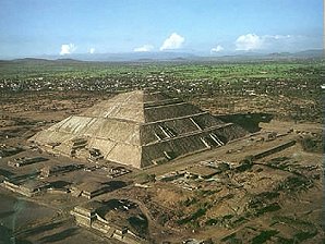 | 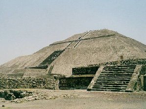 |
| Pyramid Of The Sun Worlds Third Largest Pyramid Street Of Dead Bottom Left. | Pyramid Of The Sun Faces West This Is West Side. |
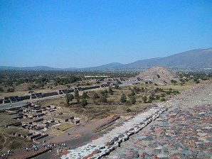 | 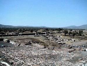 |
| Sunken Ruins Botttom Left Pyramid Of The Moon Taken From Pyramid Of The Sun. | Sunken Ruins Taken From Pyramid Of The Sun Street Of The Dead Background. |
 | 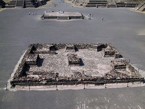 |
| Pyramid Of The Sun Plaza At Side (West) Of Pyramid Of The Sun. | Pyramid Of The Moon Plaza In Front (South) Of Pyramid Of The Moon. |
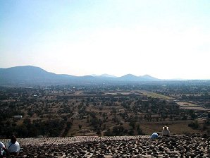 | 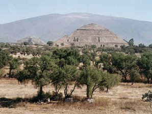 |
| Far Distance View Southern Section With Ciudadela The Great Compound Feathered Serpent Pyramid Seen From Pyramid Of The Sun. | Pyramid Of The Sun Seen From The Ciudadela And The Great Compound. |
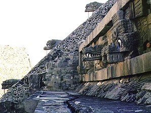 | 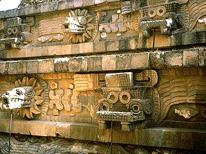 |
| The Great Compound Feathered Serpent Pyramid. | The Great Compound Feathered Serpent Pyramid. |
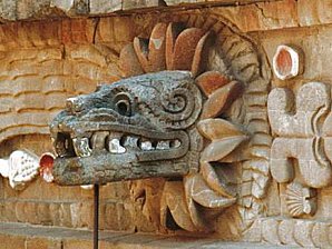 | 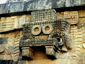 |
| QUETZALCOATL "The Feathered Serpent." | Serpent. |
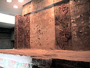 | 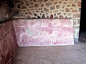 |
| Inscriptions Under Temple Of Feathered Conches. | Murals From Palace Of The Jaguars. |
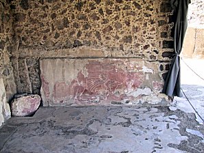 | 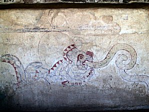 |
| Murals Palace Of The Jaguars. | Murals Palace Of The Jaguars. |
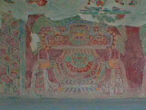 | 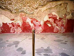 |
| Murals From Tepantitla Complex. | Murals From Tepantitla Complex. |
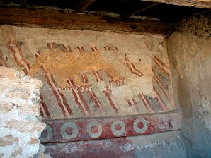 | |
| The Jaguar Panel Near Street Of The Dead Across Court South Of Pyramid Of Moon. | George's Favorite Near Street Of The Dead Across Court South Of Pyramid Of Moon. |
We Are Proud Of Our SafeSurf Rating!
We Are Proud Of Our SafeSurf Rating!
Click On Any Of The Following Links By Amazon.Com
For Books & Videos About Teotihuacán. No Obligation!
Here Are Some Links To The Very Best & Most Popular Items Sold On Amazon.Com
To Learn More! Click The Links Below. No Obligation, Of Course!
Other Teotihuacán Pages!


